
Mato Grosso is one of the states of Brazil, the third largest by area, located in the Central-West region. The state has 1.66% of the Brazilian population and is responsible for 1.9% of the Brazilian GDP.

The Juruena River is a 1,240 km (770 mi) long river in west-central Brazil, in the state of Mato Grosso.

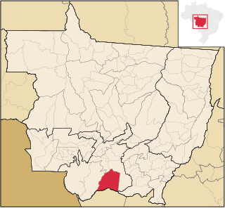
Nobres is a city in the state of Mato Grosso, Brazil. It is located approximately 140 kilometers from Cuiabá on the south slopes of the Serra Azul.
The Pantanal Matogrossense National Park is a national park in the state of Mato Grosso at the border to Mato Grosso do Sul, Brazil.
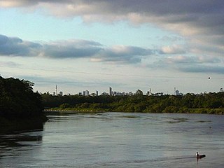
The Cuiabá River is a Brazilian river in the western state of Mato Grosso that flows in the Río de la Plata Basin. It is a tributary of the São Lourenço River.

The Aguapeí River is a river of Mato Grosso state in western Brazil. It is a tributary of the Jauru River, which in turn is a tributary of the Paraguay River.
The Caçanje River, also called the Cassange River, is a river of Mato Grosso state in western Brazil. It is a tributary of the Cuiabá River.

The São Lourenço River is a tributary of the Paraguay River within the Pantanal, an alluvial plain that spans portions of Brazil, Bolivia and Paraguay. The São Lourenço river basin lies in the Mato Grosso state of Brazil.
Barão de Melgaço is a municipality in the state of Mato Grosso in the Central-West Region of Brazil.

Poconé is a municipality in the state of Mato Grosso in the Central-West Region of Brazil. The Bento Gomes River passes by here the village in a few kilometers.
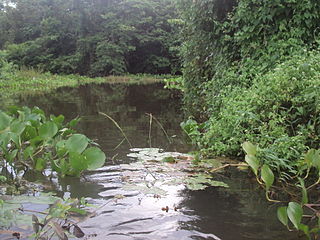
Águas do Cuiabá Ecological Station, formerly the Águas do Cuiabá State Park, is an ecological station in the state of Mato Grosso, Brazil, a fully protected conservation unit in the cerrado biome. There was controversy about the acquisition of land to expand the unit's area when it was made an ecological station.
The Rio da Casca Ecological Station is an ecological station in the state of Mato Grosso, Brazil. It protects a partly deforested area of savanna.
The Águas Quentes State Park is a state park in the state of Mato Grosso, Brazil
The Massairo Okamura State Park is a state park in the city of Cuiabá, capital of Mato Grosso, Brazil. It preserves an area of typical cerrado forest in a densely urbanised area.
The Encontro das Águas State Park is a state park in the state of Mato Grosso, Brazil. It covers an area of the pantanal rich in watercourses.

The Piquirí River is a river of Mato Grosso state in western Brazil. It is a tributary of the São Lourenço River.
The Serra de Santa Bárbara State Park is a state park in the state of Mato Grosso, Brazil. It preserves a unique environment where the Amazon rainforest, pantanal and cerrado meet, and holds many endemic or endangered species.
The Alegre River is a river in the state of Mato Grosso, Brazil.
The Guirá State Park is a State park in the state of Mato Grosso, Brazil.
The Zé Bolo Flô State Park, formerly the José Inácio da Silva State Park is a State park in the city of Cuiabá, capital of the state of Mato Grosso, Brazil.
