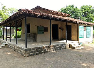
Gadchiroli district is an administrative district in Maharashtra, India. The city of Gadchiroli is the administrative headquarters of the district.

Chandrapur district is a district in the Nagpur Division in the Indian state of Maharashtra. Chandrapur was the largest district in India until the Gadchiroli and Sironcha tehsils were separated as Gadchiroli district in 1981. In 2011, the district population was 2,204,307.

Gyalshing District or Geyzing District is a district of the Indian state of Sikkim. Its headquarter is Geyzing, also known as Gyalshing. The district is a favourite with trekkers due to the high elevations. Other important towns include Pelling and Yuksom. Local people also call it as Pallo-Sikkim and Sano-Sikkim commonly.

Gondia district is an administrative district in the state of Maharashtra in India. The district headquarter is located at Gondia. The district occupies an area of 5,234 km2 (2,021 sq mi) and has a population of 1,322,507 of which 11.95% were urban. The district is part of Nagpur Division. There are 8 Talukas in Gondia District. Gondia Airport is second airport in Vidharbha region and serves city of Gondia.
Tisri is a community development block that forms an administrative division in the Khori Mahuwa subdivision of the Giridih district in the Indian state of Jharkhand.

Wardha District is in the state of Maharashtra in western India. This district is a part of Nagpur Division. The city of Wardha is the administrative headquarter of the district. Hinganghat, Pulgaon, Arvi and Wardha are the major cities in the District. The District had a population of 1,300,774, of which 26.28% were urban as of 2011.
Gadchiroli is a city and a municipal council in Gadchiroli district in the state of Maharashtra, central India. It is located on eastern side of Maharashtra, and is the administrative headquarters of the district. Gadchiroli is called a lung of Maharashtra as it has almost 35% of this district has forest cover. The main river flowing through city is the Wainganga River. The landscape is lush and green during the monsoon season which is prone to flooding. Gadchiroli is known for its forests. Teak is grown commercially and bamboos are used for various crafts.

Bhamragad is a Village and a taluka and a district sub-division in Gadchiroli district in the Indian state of Maharashtra.

Kannavam is a Village in Thalassery Taluk in Kannur District of Kerala State, India. It comes under Chittaripparamba Panchayat. It is located 37 km (23 mi) south east of District headquarters Kannur, 13 km (8.1 mi) east of Kuthuparamba and 466 km (290 mi) from State capital Thiruvananthapuram
Sironcha is a town and municipal council in Gadchiroli district of Maharashtra state in India. It connected with NH-63.
Sarde is an Indian village in the Tehsil of Uran of the Raigad District of the Indian state of Maharashtra.
Simaria is a community development block that forms an administrative division in the Simaria subdivision of the Chatra district, Jharkhand state, India.
Tati Jhariya is a community development block that forms an administrative division in the Hazaribagh Sadar subdivision of the Hazaribagh district in the Indian state of Jharkhand.
Dhanwar is a community development block that forms an administrative division in the Khori Mahuwa subdivision of the Giridih district in the Indian state of Jharkhand.
Domchanch is a community development block that forms an administrative division in the Koderma subdivision of the Koderma district, Jharkhand state, India.
Borio is a community development block that forms an administrative division in the Sahibganj subdivision of the Sahibganj district, Jharkhand state, India.
Barhait is a community development block that forms an administrative division in the Sahibganj subdivision of the Sahibganj district, Jharkhand state, India.
Taljhari is a community development block that forms an administrative division in the Rajmahal subdivision of the Sahibganj district, Jharkhand state, India.
Pathna is a community development block that forms an administrative division in the Rajmahal subdivision of the Sahibganj district, Jharkhand state, India.


