
The Brecon Beacons, or Bannau Brycheiniog is a mountainous region and national park in Wales. The name 'Brecon Beacons' was originally applied only to the mountain range south of Brecon, now also known as the Central Beacons. The range includes South Wales' highest mountain, Pen y Fan, its twin summit Corn Du, and Craig Gwaun Taf, which are the three highest peaks in the range.

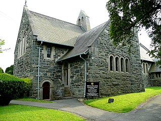
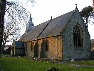
Llansantffraed (Llansantffraed-juxta-Usk) is a parish in the community of Talybont-on-Usk in Powys, Wales, near Brecon. The benefice of Llansantffraed with Llanrhystud and Llanddeiniol falls within the Diocese of St Davids in the Church in Wales.

Waun Fach is, with a summit height of 811 metres (2,661 ft), the highest mountain in the Black Mountains in south-eastern Wales. It is one of the three Marilyns over 600 m that make up the range, the others being Black Mountain and Mynydd Troed. To the north Rhos Fawr and the Radnor Forest can be seen. It is the third highest mountain in Britain south of Snowdonia. It is situated at the head of the Grwyne Fechan valley, above and to the west of the Grwyne Fawr reservoir. It has an undistinguished rounded summit. The nearby tops on the ridge, Pen Trumau and Pen y Gadair Fawr, although lower, are very much more recognisable.
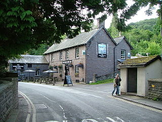
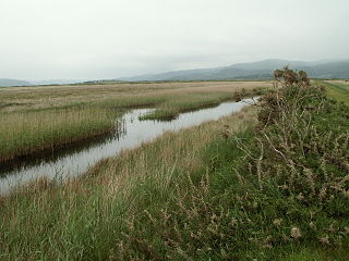
Talybont-on-Usk is a village and community in Powys, Wales, in the historic county of Brecknockshire. It lies on both the Caerfanell river and the Monmouthshire and Brecon Canal, about 1 mile (1.6 km) from the River Usk. In 2001, it had a population of 743, reducing to 719 at the 2011 census. The community includes the settlements of Llansantffraed, Scethrog, Aber Village, and Pencelli.
Talybont, is a small village to the southeast of the city of Bangor in Gwynedd, north Wales, in the community of Llanllechid, and next to Llandygai. It had a population of 465 as of 2011.

Tal-y-bont is a village north of the town of Barmouth in north Wales.

Penisa'r-waun is a small village which is located 4 miles to the east of Caernarfon and a mile to the northeast of Llanrug on the A4547 in Gwynedd, north-west Wales.
Waun-gron Park railway station serves the Fairwater area of Cardiff, Wales. Passenger services are currently operated by Transport for Wales.

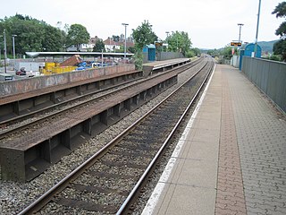
Talybont railway station serves the villages of Tal-y-bont and Llanddwywe in Gwynedd, Wales. The station is an unstaffed halt on the Cambrian Coast Railway with passenger services to Harlech, Porthmadog, Pwllheli, Barmouth, Machynlleth and Shrewsbury. Most trains call only on request.
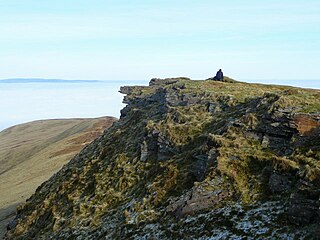
Fan y Big is a subsidiary summit of Waun Rydd in the Brecon Beacons National Park, in southern Powys, Wales. It is 716.6 m (2,351 ft) high and is often hiked as part of the Horseshoe Walk, a traverse of the four main peaks in the Brecon Beacons.

Waun Rydd is a mountain in the Brecon Beacons National Park, in southern Powys, Wales. Its height is 769 m (2,523 ft) and it tops a large boggy plateau rising to the east of Pen y Fan.

Bwlch y Ddwyallt is the name commonly applied to the high point of the plateau of Gwaun Cerrig Llwydion in the eastern part of the Brecon Beacons in south Wales. It is a top of Waun Rydd.
The Afon Leri is a river in Ceredigion, Wales. It rises at Llyn Craig-y-Pistyll and is joined at Talybont by Afon Ceulan before passing behind Borth to its mouth in the Dyfi estuary at Ynyslas.

Aber Village or Aber Clydach is a hamlet within the Brecon Beacons National Park in Powys, Wales. It is centred on the minor road which runs south from Talybont-on-Usk up the Caerfanell valley known as Glyn Collwn across the Brecon Beacons to Pontsticill and Merthyr Tydfil. Aber Clydach lies within the community of Talybont-on-Usk about 1.5 km to the south of the village of Talybont and 0.5 km to the north of the dam of Talybont Reservoir.
Gwernaffield, also known as Gwernaffield-y-Waun, is a village and electoral ward in Flintshire, Wales. It lies about three miles west of Mold on the eastern side of the Clwydian Range. The village is part of the community of Gwernaffield with Pantymwyn, which has an area of 7.53 km2 and is bordered by the River Alyn on three sides. The community includes the neighbouring village of Pantymwyn and had a population of 1,851 at the time of the 2001 census, increasing to 1,942 at the 2011 census. The name of the village comes from gwern, feld and gwaun. Gwernaffield, which adjoins Pantymwyn, Itself had a population of around 900.

Talybont-on-Usk railway station was a station in Talybont-on-Usk, Powys, Wales. The station was opened in 1863 and closed in 1962.

Waun Mawn is the site of a possible dismantled Neolithic stone circle in the Preseli Hills of Pembrokeshire, Wales. The diameter of the postulated circle is estimated to be 110 m (360 ft), the third largest diameter for a British stone circle.

The Rhos-Rydd Shield, or Rhyd y Gors is a large copper-alloy Yetholm-type shield from the Bronze Age, found in Rhos-Rydd or Rhyd y Gors, near Blaenplwyf, Wales. It is currently held in the British Museum in London. It is completely flat, 667 mm across, and 0.7 mm thick, weighing 1929 grams. It dates from the 12th to the 10th century BC.

