Related Research Articles
Saharanpur is a city and a municipal corporation in Uttar Pradesh, India. It is also the administrative headquarters of Saharanpur district.

The Northern Railway (NR) is one of the 17 Railway zones of India and the northernmost zone of the Indian Railways. It is headquartered at Baroda House in New Delhi.

The National Capital Region is a planning region centred upon the National Capital Territory (NCT) of Delhi in India. It encompasses Delhi and several districts surrounding it from the states of Haryana, Uttar Pradesh, and Rajasthan. The NCR and the associated National Capital Region Planning Board (NCRPB) were created in 1985 to plan the development of the region and to evolve harmonized policies for the control of land-uses and development of infrastructure in the region. Prominent cities of NCR include Delhi, Faridabad, Ghaziabad, Gurgaon and Noida.
Gangoh is a town and a municipal board in Saharanpur district in the state of Uttar Pradesh, India. It lies about 40 km south-west of Saharanpur city. Other nearby towns are Karnal, Haryana, which is about 35 km south-west of Gangoh; Yamunanagar, Haryana, about 50 km to the north-west; and Shamli, Uttar Pradesh, about 50 km to the south. The town lies about 150 km north-east of the national capital, Delhi.
Sarsawa is a town at the border of Haryana and a municipal board in Saharanpur district in the Indian state of Uttar Pradesh.
Himachal Pradesh, although railways and airways serve very limited transport needs, the road network of the state serves the transport needs of the people. Although, the geography of Himachal presents considerable challenge to the development of transport infrastructure, it has the highest road density among all the Hill States of India. Himachal also has 3 airports, 2 narrow gauge rail tracks and couple of other under-construction broad gauge railway tracks, but roads remain the main mode of transport.

Joya is a nagar panchayat located along highway NH-24 in Amroha district in the Western Uttar Pradesh. It is predominantly a milk producing city. Joya was a gram panchayat before 1988. The late Abrar Hussain was the first chairman of Joya in 1988.
Delhi, a major metropolitan region of India, is connected to various parts of country through several national highways and expressways. All the highways and expressways from Delhi lead to Haryana or Uttar Pradesh and continue from there.

National Highway 44 is a major north–south National Highway in India and is the longest in the country.

Western Uttar Pradesh is a region in India that comprises the western districts of Uttar Pradesh state, including the areas of Rohilkhand and those where Hindi, Urdu and Braj are spoken; it is in the region of Western Uttar Pradesh that Hindi-Urdu originated. The region has some demographic, economic and cultural patterns that are distinct from other parts of Uttar Pradesh, and more closely resemble those of Haryana and Rajasthan states. The largest city of the region is Ghaziabad, while the second-largest city, Agra, is a major tourist destination.

The Uttar Pradesh Expressways Industrial Development Authority (UPEIDA) is an authority set up in 2007 by the Government of Uttar Pradesh to develop expressway projects in the state. The headquarters of UPEIDA is located at Paryatan Bhawan in Gomti Nagar, Lucknow.

Shamli is a district in the Indian state of Uttar Pradesh. This district was carved out from Muzaffarnagar District on 28 September 2011 as Prabudh Nagar and renamed Shamli in July 2012. Shamli is the headquarters of the district. Shamli is located along the Delhi-Saharanpur-Dehradun Expressway, Ambala-Shamli Expressway, Gorakhpur-Shamli Expressway, Delhi–Saharanpur, Meerut-Karnal and Panipat-Khatima Highways.

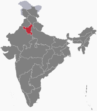
The following outline is provided as an overview of and topical guide to Haryana.
Civil Aviation Department, Haryana is a Ministry and department of the Government of Haryana in India.

Delhi–Amritsar–Katra Expressway is an approved 670 km (420 mi) long, 4-lane wide controlled-access expressway, which will connect Bahadurgarh border near Delhi with Katra in Jammu and Kashmir via Haryana and Punjab. It will have a spur section which will connect Nakodar with Sri Guru Ram Das Ji International Airport located in Raja Sansi, Amritsar. The 397.7 km (247.1 mi) long Delhi–Katra Expressway is National Expressway 5(NE-5) and 99 km (62 mi) long Nakodar-Amritsar Expressway is National Expressway 5A(NE-5A). Once completed, it will reduce the current Delhi-Katra distance from 727 km (452 mi) to 588 km (365 mi) and the time travel will be reduced from 14 hours to 6 hours, and Delhi-Amritsar distance to 405 km (252 mi) and from the time travel will be reduced from 8 hours to only 4 hours.

Rail transport in the state of Haryana, India, is conducted by five rail divisions in three zones: the North Western Railway zone, Northern Railway zone, and North Central Railway zone. The Diamond Quadrilateral high-speed rail network, Eastern Dedicated Freight Corridor, and Western Dedicated Freight Corridor pass through Haryana.
The Delhi–Mumbai Expressway is a 1,350 km long, 8-lane wide under-construction access-controlled expressway connecting India's national capital New Delhi to its financial capital Mumbai. The foundation stone for the project was laid by union minister of Road Transport & Highways Nitin Gadkari in the presence of Sushma Swaraj and Arun Jaitley on 8 March 2019 and it was inaugurated by Prime Minister Narendra Modi. The total project value including the land acquisition cost is around ₹1,00,000 crores . It is expected to be completed by October 2025.
The Trans-Haryana Expressway or the Ambala–Narnaul Expressway (NH-152D) is a 227-km long, 6-lane wide greenfield access-controlled expressway, connecting the cities of Ambala and Narnaul in the state of Haryana. The expressway connects Gangheri village in Kurukshetra district with Surana village on Narnaul Bypass (NH-148B) in Mahendragarh district. It passes via Kaul, Pundri, Pillu khera, Julana, Kalanaur, Charkhi Dadri and Kanina. It will reduce the distance from Chandigarh to Delhi, Narnaul, and Jaipur, thus decongesting NH-44 and NH-48.
The Delhi–Saharanpur–Dehradun Expressway, also known as National Highway 709B (NH 709B), is an under-construction, 210 kilometres (130 mi) long, 12/6 lane access-controlled expressway, which will connect Delhi, the national capital of India, with Dehradun, the capital of the Indian state of Uttarakhand. It will pass through the states of Delhi, Uttar Pradesh and Uttarakhand, and will pass through the cities of Baghpat, Baraut, Shamli and Saharanpur. The National Highway 307 (NH-307) is also apart of Delhi Dehradun Expressway.
References
- ↑ "Montecarlo Wins Shamli – Ambala Expressway's Package 3". The Metro Rail Guy. 2022-07-15. Retrieved 2023-11-08.
- ↑ "Work on Ambala Shamli Expressway started this is how Rajasthan will be connected to Haryana UP and Punjab |Ambala Shamli Expressway : अंबाला-शामली एक्सप्रेसवे का काम शुरू, हरियाणा पंजाब और UP से ऐसे जुड़ेगा राजस्थान | Hindi News, जयपुर".