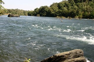
Dandeli is a taluk in Uttara Kannada district of Karnataka, India, in the Malenadu region.

Literacy in India is a key for social-economic progress. The 2011 census, indicated a 2001–2011 literacy growth of 97.2%, which is slower than the growth seen during the previous decade. An old analytical 1990 study estimated that it would take until 2060 for India to achieve universal literacy at then-current rate of progress.
Arambakkam is a village in the Tiruvallur district of Tamil Nadu, India. It is located in the Gummidipoondi taluk.
Surajpura is a village in the Bhopal district of Madhya Pradesh, India. It is located in the Berasia tehsil.
Bhatni is a village in the Bhopal district of Madhya Pradesh, India. It is located in the Berasia tehsil.
Bhainsana is a village in the Bhopal district of Madhya Pradesh, India. It is located in the Berasia tehsil.
Mengra is a village in the Bhopal district of Madhya Pradesh, India. It is located in the Berasia tehsil.
Bhaupura is a village in the Bhopal district of Madhya Pradesh, India. It is located in the Berasia tehsil.
Kalapipal is a village in the Bhopal district of Madhya Pradesh, India. It is located in the Berasia tehsil.
Danderi is a village in the Bhopal district of Madhya Pradesh, India. It is located in the Berasia tehsil.
Kalayanpura is a village in the Bhopal district of Madhya Pradesh, India. It is located in the Berasia tehsil.
Damila is a village in the Bhopal district of Madhya Pradesh, India. It is located in the Berasia tehsil.
Parsora is a village in the Bhopal district of Madhya Pradesh, India. It is located in the Berasia tehsil.
Shukla is a village in the Bhopal district of Madhya Pradesh, India. It is located in the Berasia tehsil.
Charpahari is a village in the Bhopal district of Madhya Pradesh, India. It is located in the Berasia tehsil.
Borpura is a village in the Bhopal district of Madhya Pradesh, India. It is located in the Berasia tehsil.
Langarpur is a village in the Bhopal district of Madhya Pradesh, India. It is located in the Berasia tehsil.
Undrai is a village in the Bhopal district of Madhya Pradesh, India. It is located in the Berasia tehsil.
Sukaliya is a village in the Bhopal district of Madhya Pradesh, India. It is located in the Berasia tehsil.

