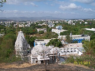
Narpad is a village in the Palghar district of Maharashtra, India. It is located in the Dahanu taluka.
Kalamdevi is a village in the Palghar district of Maharashtra, India. It is located in the Dahanu taluka.
Bendgaon is a village in the Palghar district of Maharashtra, India. It is located in the Dahanu taluka.
Junnarpada is a village in the Palghar district of Maharashtra, India. It is located in the Dahanu taluka.

Kosbad is a village in the Palghar district of Maharashtra, India. It is located in the Dahanu taluka.
Bodgaon is a village in the Palghar district of Maharashtra, India. It is located in the Dahanu taluka.
Bramhanwadi is a village in the Palghar district of Maharashtra, India. It is located in the Dahanu taluka.
Talothe is a village in the Palghar district of Maharashtra, India. It is located in the Dahanu taluka.
Pardi is a village in the Palghar district of Maharashtra, India. It is located in the Dahanu taluka.
Shensari is a village in the Palghar district of Maharashtra, India. It is located in the Dahanu taluka.
Dharampur is a village in the Palghar district of Maharashtra, India. It is in the Dahanu taluka.
Karanjvira is a village in the Palghar district of Maharashtra, India. It is located in the Dahanu taluka.
Naruli is a village in the Palghar district of Maharashtra, India. It is located in the Dahanu taluka.
Pokharan is a village in the Palghar district of Maharashtra, India. It is located in the Dahanu taluka.
Tawa is a village in the Palghar district of Maharashtra, India. It is located in the Dahanu taluka.
Chandranagar is a village in the Palghar district of Maharashtra, India. It is located in the Dahanu taluka.
Khambale is a village in the Palghar district of Maharashtra, India. It is located in the Dahanu taluka.
Kosesari is a village in the Palghar district of Maharashtra, India. It is located in the Dahanu taluka. It is in rural part of Palghar, and it is one of the 173 villages of Dahanu Block of Palghar district.
Pimpalshet Budruk is a village in the Palghar district of Maharashtra, India. It is located in the Dahanu taluka.
Vittalnagar is a village in the Palghar district of Maharashtra, India. It is located in the Vikramgad taluka.


