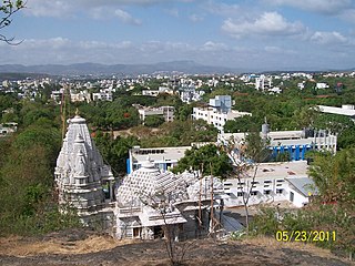
Khunavade is a village in the Palghar district of Maharashtra, India. It is located in the Dahanu taluka.
Bendgaon is a village in the Palghar district of Maharashtra, India. It is located in the Dahanu taluka.

Kosbad is a village in the Palghar district of Maharashtra, India. It is located in the Dahanu taluka.
Dhamanagaon is a village in the Palghar district of Maharashtra, India. It is located in the Dahanu taluka.
Dehane is a village in the Palghar district of Maharashtra, India. It is located in the Dahanu taluka.
Ghadane is a village in the Palghar district of Maharashtra, India. It is located in the Dahanu taluka.
Bodgaon is a village in the Palghar district of Maharashtra, India. It is located in the Dahanu taluka.
Bramhanwadi is a village in the Palghar district of Maharashtra, India. It is located in the Dahanu taluka.
Dharampur is a village in the Palghar district of Maharashtra, India. It is in the Dahanu taluka.
Bandhghar is a village in the Palghar district of Maharashtra, India. It is located in the Dahanu taluka.
Dhumket is a village in the Palghar district of Maharashtra, India. It is located in the Dahanu taluka.
Bharad is a village in the Palghar district of Maharashtra, India. It is located in the Dahanu taluka.
Ambiste is a village in the Palghar district of Maharashtra, India. It is located in the Dahanu taluka.
Dabhon is a village in the Palghar district of Maharashtra, India. It is located in the Dahanu taluka.
Nikane is a village in the Palghar district of Maharashtra, India. It is located in the Dahanu taluka.
Chandranagar is a village in the Palghar district of Maharashtra, India. It is located in the Dahanu taluka.
Kolavali is a village in the Palghar district of Maharashtra, India. It is located in the Dahanu taluka.
Chandigaon is a village in the Palghar district of Maharashtra, India. It is located in the Dahanu taluka.
Kosesari is a village in the Palghar district of Maharashtra, India. It is located in the Dahanu taluka. It is in rural part of Palghar, and it is one of the 173 villages of Dahanu Block of Palghar district.
Vittalnagar is a village in the Palghar district of Maharashtra, India. It is located in the Vikramgad taluka.


