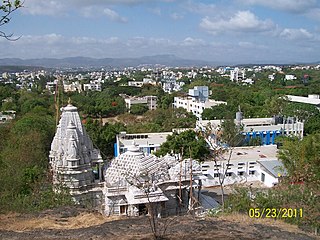
Peth Umri is a city and a municipal council in Nanded district in the Indian state of Maharashtra.It belongs to Bhokar Assembly constituency which was won by Ashok Shankarrao Chavan of Indian national congress in the last assembly elections
Bhoom is a town with a municipal council in Osmanabad district, Maharashtra, India, and it is the headquarters of Bhoom tahsil. Bhoom municipal corporation is established in 1948. Bhoom is a small town situated in a valley of the Banashankar hill ranges of Sahyadri. It is situated on the banks of the River Banaganga, which eventually flows into the Bhima. In 1717, Sambhaji II of Kolhapur gave Bhoom as jagir to Shrimant Senakhaskhel Yashwantrao Thorat (a chief and military leader of his troops) for his bravery. In 19th century Bhoom was under Nizam territory during the British raj in India. However it was independently ruled by the ' Thorat ' royal family. Shrimant Vijaysinh Amarsinh Thorat is the present head of Bhoom. He was the President of Bhoom Municipal Council from 1991 -2006.
Peth or Peint is the smallest tehsil of Nashik subdivision of Nashik district in Maharashtra, India. It belongs to Northern Maharashtra region. It belongs to Nashik Division. Peth is a Taluka headquarter. It is located 54 km to the West of Nashik District headquarters. It is also called as Peint. Pin code of Peth is 422208 and postal head office is Peth.
Peth Vadgaon is a city and education hub in Kolhapur district in the Indian state of Maharashtra. It is governed by a municipal council.
Khunavade is a village in the Palghar district of Maharashtra, India. It is located in the Dahanu taluka.

Kosbad is a village in the Palghar district of Maharashtra, India. It is located in the Dahanu taluka.
Dehane is a village in the Palghar district of Maharashtra, India. It is located in the Dahanu taluka.
Rampur is a village in the Palghar district of Maharashtra, India. It is located in the Dahanu taluka. It lies along the Maharashtra State Highway 73.
Varkhande is a village in the Palghar district of Maharashtra, India. It is located in the Dahanu taluka.
Ghadane is a village in the Palghar district of Maharashtra, India. It is located in the Dahanu taluka.
Bodgaon is a village in the Palghar district of Maharashtra, India. It is located in the Dahanu taluka.
Shelti is a village in the Palghar district of Maharashtra, India. It is located in the Dahanu taluka.
Naruli is a village in the Palghar district of Maharashtra, India. It is located in the Dahanu taluka.
Tadiyale is a village in the Palghar district of Maharashtra, India. It is located in the Dahanu taluka, on the shore of Arabian Sea.
Vaghadi is a village in the Palghar district of Maharashtra, India. It is located in the Dahanu taluka.
Dhumket is a village in the Palghar district of Maharashtra, India. It is located in the Dahanu taluka.
Chandranagar is a village in the Palghar district of Maharashtra, India. It is located in the Dahanu taluka.
Khambale is a village in the Palghar district of Maharashtra, India. It is located in the Dahanu taluka.
Kosesari is a village in the Palghar district of Maharashtra, India. It is located in the Dahanu taluka. It is in rural part of Palghar, and it is one of the 173 villages of Dahanu Block of Palghar district.
Vittalnagar is a village in the Palghar district of Maharashtra, India. It is located in the Vikramgad taluka.


