Sangli is a metropolitan town and the headquarters of Sangli District in Maharashtra, in south-western India. It has earned the nickname "Turmeric City of India" for being the hub of the Asia's largest production and trade of this spice. Sangli is situated on the banks of river Krishna and houses many sugar factories. A significant city in South-Western India, it lies 376 km from Mumbai, 230 km from Pune and 638 km from Bangalore. The city has a significant healthcare hub, including its twin City Miraj. Sangli-Miraj combined has more than 1000+ Hospitals and Clinics. Sangli is known as Turmeric city for its global turmeric trade as well grapes, raisins, jaggery and the most significant number of sugar factories in India, with district area having has more than 30 sugar factories.The Sangli region boasts the largest raisin market in Asia. Sangli-Miraj-Kupwad municipal corporation (SMKMC) along with its Urban Agglomeration consisting satellite towns of Madhavnagar & Budhgaon is 93rd biggest in India.
Ratnagiri is a port city on the Arabian Sea coast in Ratnagiri District in southwestern Maharashtra, India. The district is part of Konkan division of Maharashtra. The city is known for the Hapus or Alphonso mangoes. Ratnagiri is the birthplace of Indian independence activist Lokmanya Tilak. Thibaw, the last king of Burma, alongside his consort Supayalat and two infant daughters were exiled to a two-storied brick mansion in Ratnagiri. The building is now known as Thibaw Palace. This place has many villages like Karla, Rajiwada, Mirkarwada, etc.
Sindhudurg district is an administrative district of the Konkan division in India, which was carved out of the erstwhile Ratnagiri district. The district headquarters are located at Oros. The district occupies an area of approximately 5,207 km2 and has a population of 849,651, of which 12.59% were urban. As of 2011, it is the least populous district of Maharashtra.
Kudal is a census town in Sindhudurg district, Maharashtra, India. It is situated on River Karli in southwest Maharashtara. Kudal is the fourth largest town in Sindhudurg after Sawantwadi, Malvan and Kankavli. As of 2011, the population is 16,015. Kudal supports one MIDC area in the Konkan division. The Kudal railway station is located on the Konkan Railway route and connects the town with Mumbai metro situated in the Bombay, Baroda and Central India Railway of the north, and Mangalore on the south. It is a major stop for the Konkan Railway. The Deccan Odyssey train also stops in Kudal. National Highway 66 passes through Kudal. Apart from that, it also has two bus stations, a new one and old one. The old one is situated in market while the new one is just adjacent to the NH-66. Kudal is situated in centre of the Sindhudurg district and also considered one of the fastest-growing towns in the Konkan region. The Desai's were the original rulers of Kudal, who were tributaries of the Bijapur Sultanate, later the Marathas and then under the British.
Sawantwadi, is a city located in Sawantwadi Taluka, in the state of Maharashtra in Konkan region which is in the mid-western coast of India.
Sawantwadi is a taluka in the Sindhudurg district in the Indian state of Maharashtra. The taluka headquarters is Sawantwadi which has a municipal council, which is a local civic body. Sawantwadi was formerly the capital of the Kingdom of Sawantwadi, ruled by the Sawant Bhonsle dynasty
Ajara is a census town and the headquarters of Ajara Taluka in the Kolhapur district of Maharashtra, India. It is a developing city with a Nagar Panchayat.
Gadhinglaj ([ɡəɖᵊɦiŋɡləd͡z]) is a city in India in the Kolhapur district in the southwest corner of the state of Maharashtra, India. It is located on the banks of the river Hiranyakeshi. It is the Taluka (Tehsil) headquarters of Gadhinglaj Taluka and a subdivision headquarters of the Gadhinglaj Subdivision of the Kolhapur District. It is governed by a municipal council. The rapidly growing city is the third largest in the Kolhapur District, with population of more than 50,000. Places to visit include Samagad fort, temples and beautiful weather.

Asoli is a small village in Taluka Vengurla and district Sindhudurg of Maharashtra, India.
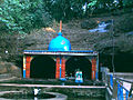
Nrusinhawadi commonly known as Narsobawadi or Narsobachi Wadi is a small town in Shirol Tahasil in Kolhapur district, Maharashtra. Narsobawadi gets its name from the presence of 'Shri Nrusinha Saraswati', the Purna Avatar of Lord Dattatreya.
Kadgaon is a town situated Gadhinglaj Taluka of Kolhapur district situated in the southwest corner of the state of Maharashtra, India. Kadgaon is about 4 km from Gadhinglaj, 79 km from Kolhapur. Kadgaon is situated on MH SH 134 and is about 15 km from National Highway 48 (NH48). It is managed by Town Council. It is in the phase of transforming from a small town to a bustling city. It is the second-largest city after Gadhinglaj in Gadhinglaj Taluka also second largest city in Gadhinglaj sub division which Include talukas of Gadhinglaj, Ajra, Bhudargad, Chandgad. As of 2012 it has a population of about 20,851. Kadgaon has amenities that are of the level of Municipal Council in India. Kadgaon has developed as an industrial hub in recent years. It has a strong agricultural sector and is known for its sugarcane, jaggery and red chili production. It is well connected to all of Kolhapur and Maharashtra. It has a very excellent civic amenities. Like in most of the case in the Maharashtra the primary Language spoken is Marathi with 20,851 speaking as their primary Language.
Mahagaon is a town in Gadhinglaj Taluka, Kolhapur district, situated in the southwest corner of the state of Maharashtra, India, on the banks of the Hiranyakeshi river. It is about 10 kilometres (6.2 mi) south of Gadhinglaj and 14 kilometres (8.7 mi) from the city of Kadgaon. It is managed by a town council. In 2011, it had a population of about 20,108.

Gadhinglaj is a taluka in Maharashtra. The city of Gadhinglaj is the taluka headquarters and Gadhinglaj subdivision headquarters as well. As of 2011, the taluka had a population of 874,015, of which 35% were urban. Languages spoken in this area are Marathi, Kannada, Hindi and English also. But the most-spoken language is Marathi, as Marathi is a state language.
Haladi is a Town in Gadhinglaj Taluka Kolhapur district situated in the southwest corner of state Maharashtra, India. Harali is situated on banks of Hiranyakeshi river originated from the Great Amboli Ghats is about 7 km from Gadhinglaj towards south and 12 km from the second largest city Kadgaon in Gadhinglaj Taluka and just 2 km from Mahagaon,Gadhinglaj. It is managed by Town Council.In 2011 it has a population of about 9,856. Harali is the eight largest city and town in Gadhinglaj Taluka. Shri Appasaheb Nalawade Gadhinglaj Taluka Sahakari Sakhar Karkhana is situated in the town.
Maharashtra State Highway 134, commonly referred to as MH SH 134, is a normal state highway that runs south through Kolhapur district and Sindhudurg district in the state of Maharashtra, India. This state highway touches the cities of Sankeshwar-Gadhinglaj-Kadgaon-Ajra-Amboli and then proceeds from Maharashtra-Karnataka state border from East-West towards Sawantvadi in Sindhudurg. It covers a distance of over 110 km.

The Hiranyakeshi river is a left-bank tributary of the Ghataprabha River originating in the Western Ghats in the Sindhudurg district of Maharashtra.
Medhewadi is a village in Ajara taluka, one of the southernmost talukas of Kolhapur District of the Indian state of Maharashtra. It is situated on the banks of Hiranyakeshi river.
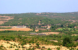
Majare Karve is a small village/hamlet in Chandgad taluka in Kolhapur District of Maharashtra, India. It has own Panchayath with more than 1500 population. Situated on central point From Belguam and District office Chandgad on Belguam-Savantwadi highway. It belongs to Desh or Paschim Maharashtra region. It belongs to Pune Division.
Manohargad-Mansantoshgad Fort are two adjacent forts located on the same hill but separated by a saddle. This fort is situated at Shivapur, Tal - Kudal. The forts are 33 km from Sawantwadi and the same distance from Kudal Sindhudurg district of Maharashtra. The forts are situated on the hill north of the base village Shivapur.The fort is located in the proximity of the Amboli hill station.
Warana River is a river that flows through the Warana river valley of Sangli and Kolhapur districts in the western Indian state of Maharashtra. It is an important tributary of the Krishna River.