
Bengo is a province of Angola. Its capital is Caxito. It has an area of 31,371 square kilometres, and its population as of the 2014 Census was 356,641. The province was created in 1980 by dividing the original province of Luanda into Bengo and a new smaller province of Luanda.

Ambriz is a village and municipality in Bengo Province, Angola. It is located 127 km from the town of Caxito. It borders the municipality of N'zeto, Zaire Province, to the north and the municipality of Dande to the south.

Marcos Ignacio "Nacho" Ambriz Espinoza is a Mexican professional manager and former footballer. He is the current head coach of Liga MX club Santos Laguna.
Xangongo Airport is an airport near Xangongo, Angola. It was built by the Cubans in 1988 as a forward air base during the last campaign against apartheid South Africa in the Angolan Civil War.
Cabinda Airport is an airport serving Cabinda, a city in the Cabinda Province, an exclave of Angola.
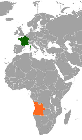
Relations between France and Angola have not always been cordial, due to the former French government's policy of supporting militant separatists in Angola's Cabinda Province. The international Angolagate scandal embarrassed both governments, by exposing corruption and illicit arms deals. Following French President Nicolas Sarkozy's visit in 2008, relations have improved.
Benguela Airport is an airport serving Benguela, the capital city of Benguela Province in Angola.
Lucapa Airport is an airport serving Lucapa, the capital of the Lunda Norte Province in northeastern Angola.
Bela Vista is a town and commune in the municipality of Ambriz, province of Bengo, Angola. As of 2014, the commune had a population of 4,346 people over an area of 1,620 square kilometres (630 sq mi).
Tabi is a town and commune in the municipality of Ambriz, province of Bengo, Angola. As of 2014, the commune had a population of 5,382 people over an area of 1,240 square kilometres (480 sq mi).
Porto Amboim Airport is an airport serving Porto Amboim, a coastal city in Cuanza Sul Province, Angola.
Sumbe Airport is an airport serving the city of Sumbe in Cuanza Sul Province, Angola.
Uíge/Carmona Airport is a public use airport on the west side of Uíge, the capital of Uíge Province in Angola.
Luau Airport is an airport serving Luau, a municipality in the Moxico Province of Angola. It is near the border between Angola and the Democratic Republic of the Congo.
Cafunfo Airport is an airport serving Cafunfo, in Lunda Norte Province, Angola.
Cangamba Airport is an airport serving Cangamba in Moxico Province, Angola.
N'zeto Airport is an airport serving N'zeto, a town in Zaire Province, Angola. The runway is 2.5 kilometres (1.6 mi) south of the town, along the Atlantic coast.
Waku Kungo Airport is an airport serving Waku-Kungo in Cuanza Sul Province, Angola. The runway is 6.5 kilometres (4.0 mi) south of Waku-Kungo, near the village of Cela.
Futebol Clube M'patu a Ponta is an Angolan sports club from the village of Ambriz, in Bengo province. The team currently plays in the Gira Angola.
Luau International Airport is an airport serving Luau, a municipality in the Moxico Province of Angola. It is 6.5 kilometres (4.0 mi) west of the city, and may replace the Villa Teixeira de Sousa Airport, an unpaved airstrip that is within the city.
