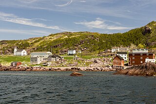
Bonavista is a town on the Bonavista Peninsula, Newfoundland in the Canadian province of Newfoundland and Labrador. Unlike many Newfoundland coastal settlements, Bonavista was built on an open plain, not in a steep cove, and thus had room to expand to its current area of 31.5 km2 (12.2 sq mi). Bonavista is located approximately 300 km by road from the provincial capital of St. John's.

Grates Cove is a local service district and designated place in the Canadian province of Newfoundland and Labrador. It is the most northerly community on the Avalon Peninsula, located on the tip of the Bay de Verde Peninsula on the island of Newfoundland. Called "the Grates" by John Guy as early as 1612, the origin of the name is unknown.

Open Hall-Red Cliffe is a local service district and designated place in the Canadian province of Newfoundland and Labrador.

Sandy Cove is a town located on the Eastport Peninsula in Newfoundland and Labrador, Canada. It is located on Newman Sound, which is part of Bonavista Bay. It had a population of 120 in the 2021 census.
Templeman is a community of New-Wes-Valley in Newfoundland, Canada, located on the north side of Bonavista Bay just south of Cape Freels and north of Wesleyville. Templeman has a shallow and rocky harbour, and can only accommodate small boats.
Upper Amherst Cove, is a local service district and designated place in the Canadian province of Newfoundland and Labrador.
Maberly is a tiny coastal hamlet at the end of route 238-II on the Bonavista Peninsula on the island of Newfoundland with a permanent year-round population of about 20. In the 1921 census, there were 83 inhabitants. It has long been associated with nearby Elliston, being about 3 km from Elliston Centre by road, and was officially annexed by that town in the 1960s. Driving from Elliston Centre to Maberly, you pass through Sandy Cove and the Neck.
Dover is a small incorporated fishing and lumbering village located in a small cove at the head of Freshwater Bay, Bonavista Bay, Newfoundland, Canada. Settled in the early 1890s it was originally known as Shoal Bay, presumably from its many shallow coves and inlets in the area. From the 1950s to the 1970 Shoal Bay was referred to as Wellington , whereas the local residents called it Dover.
The Bonavista Peninsula is a large peninsula on the east coast of the island of Newfoundland in the Canadian province of Newfoundland and Labrador. It consists of 50 incorporated towns/unincorporated communities which have a population of 12,176 as of the 2016 Canadian Census. Bonavista is the largest population centre on the peninsula.
Musgrave Harbour is a town and designated place in the Canadian province of Newfoundland and Labrador.
Brookfield is a Canadian community located on the northeast coast of the island of Newfoundland in the province of Newfoundland and Labrador.
Cape Freels is one of the communities that comprise an area on the northeast coast of the Island of Newfoundland, called Bonavista North, in the province of Newfoundland and Labrador, Canada. These communities have a shared history in that they were settled by people from England, predominantly from the West Country - Dorset, Devon, Somerset and Hampshire.
Plate Cove East is a small community located in Bonavista Bay, Newfoundland and Labrador. It is part of the federal electoral riding of Bonavista—Gander—Grand Falls—Windsor. It was officially a town from 1960 until 2004. In 1966 it had a population of 237. In 2011 there were 89 inhabitants.

St. Brendan's is a town in the Canadian province of Newfoundland and Labrador, situated in Shoal Cove on Cottel Island in Bonavista Bay. Other settlements on the island include Shalloway Cove, Haywards Cove, and Dock Cove. The town had a population of 125 in the Canada 2021 Census. St. Brendan's is inaccessible by road and is served by a daily ferry service from Burnside.
Knight's Cove is a village located southwest of Bonavista and west of Catalina on the island of Newfoundland in the Canadian province of Newfoundland and Labrador. The first postmistress was Mrs. Elizabeth Walsh in 1952. It had a population of 161 in 1951.
Bayly's Cove was on Bonavista Bay and had a population of 900 in 1911.

Trinity East, Newfoundland and Labrador is a designated place in the Canadian province of Newfoundland and Labrador. It is southwest of Catalina on the Bonavista Peninsula.
Canning's Cove is a local service district and designated place in the Canadian province of Newfoundland and Labrador. It is on Bonavista Bay.

Birchy Cove is a local service district and designated place in the Canadian province of Newfoundland and Labrador.

Division No. 1, Subdivision G is an unorganized subdivision on the Avalon Peninsula in Newfoundland and Labrador, Canada. It is in Division 1 and contains the unincorporated communities of Baccalieu Island, Besom Cove, Bradley's Cove, Burnt Point, Caplin Cove, Daniel's Cove, Grates Cove, Gull Island, Job's Cove, Kingston, Long Beach, Lower Island Cove, Low Point, Northern Bay, Ochre Pit Cove, Red Head Cove, Riverhead, Smooth Cove and Western Bay.


