The Western Peripheral Expressway (WPE) or Kundli–Manesar–Palwal Expressway, is an operational 6-lane, 135.6 km (84.3 mi)-long Expressway in the Haryana state of India. Along with the Eastern Peripheral Expressway, the Western Peripheral Expressway is expected to divert more than 50,000 heavy vehicles away from Delhi, which will help to maintain good air quality in Delhi. Western Peripheral Expressway along with Eastern Peripheral Expressway completes the largest Ring Road around Delhi. There are 10 tolled entries and exits, from north to south - Kundli, Kharkhoda, Bahadurgarh, Badli, Fartukhnagar, Panchgaon, Manesar, Taoru, Sohna & Palwal. Toll rate notified in December 2018 is INR1.35 per km for cars, INR2.18 per km for light motor vehicles, INR4.98 per km for trucks and buses, and two wheelers are not permitted on the expressway.

Expressways are the highest class of roads in India. As of July 2023, India has a total length of 4,719 km (2,932 mi) of expressways. These are controlled-access highways where entrance and exits are controlled by the use of cloverleaf or trumpet or grade separated interchanges that are incorporated into the design of the expressway and designed for maximum speed of 120 km/h, whereas National highways are flyover access or controlled-access highway, where entrance and exit is through the side of the flyover, at each intersection of highway with road, flyovers are provided to bypass the city/town/village traffic and these highways are designed for speed of 100 km/h. Some roads are not access-controlled expressways, but are still named as expressways, such as the Biju Expressway, these are actually state highways which are not declared by central government as an Expressway, hence not an Expressway or National Highway. Mumbai–Pune Expressway is the first 6-lane operational expressway in India started in 2002. Expressways follow standards set by Indian Roads Congress and Bureau of Indian Standards.
The Eastern Peripheral Expressway (EPE) or Kundli–Ghaziabad–Palwal Expressway is a 135 km (84 mi) long, 6-lane wide expressway passing through the states of Haryana and Uttar Pradesh in India. The expressway starts from the Western Peripheral Expressway at Kundli, Sonipat, passing through Baghpat, Ghaziabad and Noida districts in UP and Faridabad district in Haryana before rejoining the Western Peripheral Expressway near Dholagarh, Palwal. Eastern Peripheral Expressway along with Western Peripheral Expressway completes the largest Ring Road around Delhi. The Eastern Peripheral Expressway was declared as National Expressway 2 (NE-2) in March 2006.
Ludhiana-Bhatinda-Ajmer Expressway, consisting of 2 separate Ludhiana-Bhatinda Expressway and Bhatinda-Ajmer Expressway projects on the "Ludhiana–Ajmer Economic Corridor (EC-8)", is 6-lane access-controlled under-construction express national highway project by the NHAI which will connect Pathankot via Ludhiana to Bhatinda and Ajmer. The movement of goods will be facilitated, via Ajmer, from northern states to ports at western coast such as Kandla port.

The Bangalore–Chennai Expressway, or National Expressway 7 (NE-7), is an under construction 258 km (160 mi) long, 4-lane wide access-controlled expressway between the cities of Bangalore, the capital of Karnataka and Chennai, the capital of Tamil Nadu. It will run from Hoskote in Bangalore Metropolitan Region Development Authority to Sriperumbudur in Chennai Metropolitan Area. It is planned to allow vehicles to reach 120 km/h (75 mph). This expressway was designated as a National Expressway on 1 January 2021. The total project value is ₹ 17,930 crore. It will be completed by March 2024.
Northern Peripheral Road or NH 248-BB, commonly known as Dwarka Expressway is a 27.6 km (17.1 mi) long, under construction, 8-lane, elevated grade separated expressway connecting Dwarka in Delhi to Kherki Daula Toll Plaza, Gurgaon in Haryana. The expressway will take off from km 20 of NH 48 at Shiv Murti in Mahipalpur in Delhi and terminate at km 40 of NH 48 near Kherki Daula Toll Plaza in Gurgaon in Haryana. The NPR has been planned as an alternate road link between Delhi and Gurgaon, and is expected to ease the traffic situation on the Delhi-Gurgaon Expressway. The expressway was initially planned to be 18 km (11 mi) long and was expected to open by 2012 but land acquisition issues delayed the project.
The Ring Road is a 150 kilometre, 6-lane ring road encircling the city of Jaipur, Rajasthan, India. It is built by Jaipur Development Authority (JDA). The expressway is designed for speeds up to 120 km/h. Construction of the Ring Road around Jaipur was conceived by PWD in December 2000 on BOT basis. In Phase I & II, a road with a length of 47 km will be constructed in the south of Jaipur, connecting Ajmer Road, Tonk Road and Agra Road. In Phase III, a road with a length of 97.75 km will be constructed in the northern part of Jaipur and will connect Agra Road, Delhi Road, Sikar Road and Ajmer Road.
East-West Industrial Corridor Highway of Arunachal Pradesh, a 2-lane and 966.78 km long including existing 274.20 km Pasighat-Manmao route, is a proposed highway across lower foothills of Arunachal Pradesh state in India from Bhairabkunda in Assam at tri-junction of Bhutan-Assam-Arunachal Pradesh in west to Kanubari tri-junction of Nagaland-Assam-Arunachal Pradesh in east.

Delhi–Amritsar–Katra Expressway is an approved 670 km (420 mi) long, 4-lane wide controlled-access expressway, which will connect Bahadurgarh border near Delhi with Katra in Jammu and Kashmir via Haryana and Punjab. It will have a spur section which will connect Nakodar with Sri Guru Ram Dass Jee International Airport located in Raja Sansi, Amritsar. The 397.7 km (247.1 mi) long Delhi–Nakodar–Katra section is National Expressway 5(NE-5) and 99 km (62 mi) long Amritsar–Nakodar section is National Expressway 5A(NE-5A). Once completed, it will reduce the current Delhi-Katra distance from 727 km (452 mi) to 588 km (365 mi) and the time travel will be reduced from 14 hours to 6 hours, and Delhi-Amritsar distance to 405 km (252 mi) and from the time travel will be reduced from 8 hours to only 4 hours.
The Delhi–Mumbai Expressway is a 1,350 km long, 8-lane wide under-construction access-controlled expressway connecting India's national capital New Delhi with its financial capital Mumbai. Foundation stone of the project was laid by union minister Nitin Gadkari in presence of Sushma Swaraj and Arun Jaitley on 8 March 2019. The total project value including the land acquisition cost is around ₹1,00,000 crores. An additional 31 km long spur will also be constructed by the NHAI from Noida International Airport in Jewar to Sector-65, Faridabad on this expressway.
The Samruddhi Mahamarg or Nagpur-Mumbai Expressway and Maharashtra Expressway-2 (ME-2), is a partially opened 6-lane wide, 701-km long access-controlled expressway in Maharashtra, India. It is amongst the country's longest greenfield road projects, which will connect the two capital cities of the state, its capital, Mumbai, and its third-largest and vice-capital city, Nagpur. The project is being led by the state infrastructure arm Maharashtra State Road Development Corporation (MSRDC), and is designed under the Engineering, Procurement and Construction (EPC) model.
The Trans–Haryana Expressway or the Ambala–Narnaul Expressway (NH-152D) is a 227-km long, 6-lane wide greenfield access-controlled expressway, connecting the cities of Ambala and Narnaul in the state of Haryana. The expressway connects Gangheri village in Kurukshetra district with Surana village on Narnaul Bypass (NH-148B) in Mahendragarh district. It passes via Kaul, Pundri, Assandh, Dhatrath, Kalanaur, Charkhi Dadri and Kanina. It will reduce the distance from Chandigarh to Delhi, Narnaul, and Jaipur, thus decongesting NH-44 and NH-48.
National Highway 352W, commonly referred to as Gurgaon-Pataudi Road or NH 352W is a national highway in India. It is a spur road of National Highway 352 from Narwana to Rewari, which itself is a spur road of National Highway 52. NH 352W traverses only one state, the state of Haryana in India.
The Outer Ring Road is a under construction 93-kilometre-long (58 mi) 6 lane access-controlled expressway ring road encircling the city of Kanpur, Uttar Pradesh, India. It will start from Mandhana on Kanpur Aligarh Highway and will pass through Kanpur Jhansi/Agra Highway at Sachendi, Hamirpur Road near Ramaipur, Allahabad Highway at Maharajpur, from there it will cross Ganga river near Chakeri Airport and reach Unnao district where it will connect Raebareli Highway and under construction Kanpur Lucknow Expressway further it will pass through Kanpur Lucknow Highway and Trans Ganga City and will again enter Kanpur district by crossing Ganga river between Ganga Bairaj and Bithoor and end at Mandhana forming a circle.
Amritsar–Jamnagar Expressway (NH-754) is an under-construction 1,257 km long, 6-lane wide expressway in the north-western part of India. The expressway will reduce the distance between Amritsar and Jamnagar from earlier 1,430 km to 1,316 km and the time travel from 26 hours to only 13 hours. It is a part of the Bharatmala and Amritsar–Jamnagar Economic Corridor (EC-3). It will pass through four states of Punjab, Haryana, Rajasthan and Gujarat.
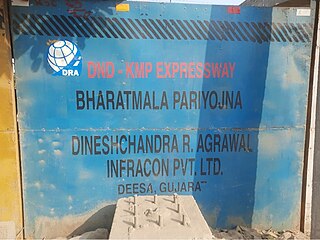
DND–Faridabad–KMP Expressway or NH-148NA is an under-construction 59 km long, 6-lane wide access-controlled expressway in Delhi NCR, India. It will connect the junction of DND Flyway and Ring Road at Maharani Bagh in Delhi with KMP Expressway at Khalilpur, Nuh district in Haryana. Initially it was a separate expressway, but now it is a part of Delhi–Mumbai Expressway project. This expressway will have an additional 31 km long spur link from Sector-65, Faridabad bypass to Jewar Airport.
Raipur–Visakhapatnam Expressway (NH-130CD), part of Raipur–Visakhapatnam Economic Corridor (EC-15), is an under-construction, six-lane, 464 km (288 mi) long access-controlled greenfield expressway, which will pass through the states of Chhattisgarh, Odisha and Andhra Pradesh in central and east-central India. At present, from Durg, it runs between NH-30 and NH-130C till Boriguma, then runs east of NH-26 till Sunabeda and then west of NH-26 till Visakhapatnam after terminating with NH-16 at Vizianagaram. Along the new route, it will connect Raipur by starting at Abhanpur in Raipur district with the cities of Dhamtari, Kanker, Kondagaon, Koraput, and Sabbavaram before terminating at Visakhapatnam Port.
Varanasi–Kolkata Expressway, also known as Varanasi–Ranchi–Kolkata Expressway, is an approved 610 km (380 mi) long, six-lane, greenfield access-controlled expressway, which will connect the holy city of Varanasi in Uttar Pradesh with the capital of West Bengal, Kolkata, through the capital of Jharkhand, Ranchi. It will run almost parallel with the Grand Trunk Road or the Asian Highway 1, and will pass through four states–Uttar Pradesh, Bihar, Jharkhand and West Bengal. The expressway is a part of Bharatmala Pariyojana, and it will reduce both travel time and distance, from 12-14 hours to only 6-7 hours, and from 690 km (430 mi) to 610 km (380 mi). It will start from Chandauli district in Uttar Pradesh, and will terminate near Uluberia, Howrah district, West Bengal.
Gorakhpur–Siliguri Expressway is an approved 519 km (322 mi) long, four-lane access-controlled greenfield expressway, which will connect the city of Gorakhpur in Uttar Pradesh with the city of Siliguri in West Bengal, India. It will run almost parallel to the India–Nepal border, and will pass through three states–Uttar Pradesh, Bihar and West Bengal. The expressway is a part of Bharatmala Pariyojana, and it will reduce both travel time and distance, from 14-15 hours only 8-9 hours, and from 640 km (400 mi) to 519 km (322 mi). As it will pass through close to the India–Nepal border, the project is of strategic importance for the country, as it will also benefit Nepal. It will be built at a cost of ₹ 32,000 crore, and will be completed by 2025, which was earlier scheduled at 2028/29. In the future, it will be extended to the capital of Assam and the largest city of Northeast India, Guwahati.
Surat–Chennai Expressway is an under-construction, 1,271 km (790 mi) long, four- to six-lane access-controlled expressway, which will connect the second largest city of Gujarat, Surat, with the capital of Tamil Nadu, Chennai, in India. It will pass through six states: Gujarat, Maharashtra, Karnataka, Telangana, Andhra Pradesh and Tamil Nadu. It will be operated and maintained by the National Highways Authority of India (NHAI), and will reduce both travel time and distance from around 35 hours to around 28 hours, and from approximately 1,570 km (980 mi) to 1,271 km (790 mi). It will be built at a cost of ₹ 45,000 crore (~US$5.5 billion), which was earlier slated at ₹ 50,000 crore. It will be the second longest expressway in India, after the Delhi–Mumbai Expressway.