Pechora is a town in the Komi Republic, Russia, located on the Pechora River, west of and near the northern Ural Mountains. The area of the town is 28.9 square kilometres (11.2 sq mi). Population: 43,105 (2010 Census); 48,700 (2002 Census); 64,746 (1989 Soviet census).

Koshekhablsky District is an administrative and a municipal district (raion), one of the seven in the Republic of Adygea, Russia. It is located in the east of the republic and borders with Kurganinsky District of Krasnodar Krai in the north and northeast, Labinsky District of Krasnodar Krai in the east, Mostovsky District of Krasnodar Krai in the south, Giaginsky District in the west, and with Shovgenovsky District in the northwest. The area of the district is 606.7 square kilometers (234.2 sq mi). Its administrative center is the rural locality of Koshekhabl. As of the 2010 Census, the total population of the district was 30,422, with the population of Koshekhabl accounting for 23.8% of that number.

Maykopsky District is an administrative and a municipal district (raion), one of the seven in the Republic of Adygea, Russia. It is located in the south of the republic and borders Giaginsky District in the north, Mostovsky District of Krasnodar Krai in the east, the territory of the City of Sochi in Krasnodar Krai in the south, Apsheronsky District of Krasnodar Krai in the west and southwest, and with Belorechensky District of Krasnodar Krai in the northwest. The area of the district is 3,667.43 square kilometers (1,416.00 sq mi). Its administrative center is the rural locality of Tulsky. As of the 2010 Census, the total population of the district was 58,439, with the population of Tulsky accounting for 18.4% of that number.

Takhtamukaysky District is an administrative and a municipal district (raion), one of the seven in the Republic of Adygea, Russia. It is located in the west of the republic and borders with Krasnoarmeysky District of Krasnodar Krai and with the territory of the City of Krasnodar in the north, Teuchezhsky District in the east, the territory of the Town of Goryachy Klyuch of Krasnodar Krai in the south, and with Seversky District of Krasnodar Krai in the south and west. The area of the district is 463.6 square kilometers (179.0 sq mi). Its administrative center is the rural locality of Takhtamukay. At the 2010 Census, the total population of the district was 69,662, with the population of Takhtamukay accounting for 7.5% of that number.
Eveno-Bytantaysky National District is an administrative and municipal district, one of the thirty-four in the Sakha Republic, Russia. The area of the district is 52,300 square kilometers (20,200 sq mi). Its administrative center is the rural locality of Batagay-Alyta. As of the 2010 Census, the total population of the district was 2,867, with the population of Batagay-Alyta accounting for 63.9% of that number.
Alsheyevsky District is an administrative and municipal district (raion), one of the fifty-four in the Republic of Bashkortostan, Russia. It is located in the west of the republic. The area of the district is 2,415 square kilometers (932 sq mi). Its administrative center is the rural locality of Rayevsky. As of the 2010 Census, the total population of the district was 43,647, with the population of Rayevsky accounting for 44.8% of that number.
Iglinsky District is an administrative and municipal district (raion), one of the fifty-four in the Republic of Bashkortostan, Russia. It is located in the east of the republic and borders with Nurimanovsky District in the north, Chelyabinsk Oblast in the east, Arkhangelsky District in the south, Karmaskalinsky District in the southwest, Ufimsky District in the west, and with Blagoveshchensky District in the northwest. The area of the district is 2,450 square kilometers (950 sq mi). Its administrative center is the rural locality of Iglino. As of the 2010 Census, the total population of the district was 49,675, with the population of Iglino accounting for 33.8% of that number.

Karaidelsky District is an administrative and municipal district (raion), one of the fifty-four in the Republic of Bashkortostan, Russia. It is located in the north of the republic and borders with Askinsky District in the north, Duvansky District in the east, Nurimanovsky and Blagoveshchensky Districts in the south, Mishkinsky District in the southwest, and with Baltachevsky District in the west. The area of the district is 3,786 square kilometers (1,462 sq mi). Its administrative center is the rural locality of Karaidel. As of the 2010 Census, the total population of the district was 27,945, with the population of Karaidel accounting for 21.4% of that number.

Karmaskalinsky District is an administrative and municipal district (raion), one of the fifty-four in the Republic of Bashkortostan, Russia. It is located in the center of the republic and borders with Ufimsky and Iglinsky Districts in the north, Arkhangelsky District in the east, Gafuriysky District in the southeast, Aurgazinsky District in the south, Alsheyevsky District in the southwest, and with Chishminsky District in the west. The area of the district is 1,750 square kilometers (680 sq mi). Its administrative center is the rural locality of Karmaskaly. As of the 2010 Census, the total population of the district was 51,504, with the population of Karmaskaly accounting for 16.6% of that number.

Miyakinsky District is an administrative and municipal district (raion), one of the fifty-four in the Republic of Bashkortostan, Russia. It is located in the west of the republic and borders with Alsheyevsky District in the north, Sterlitamaksky District in the east, Sterlibashevsky District in the east and south, Orenburg Oblast in the southwest, and with Bizhbulyaksky District in the west. The area of the district is 2,051.28 square kilometers (792.00 sq mi). Its administrative center is the rural locality of Kirgiz-Miyaki. As of the 2010 Census, the total population of the district was 28,224, with the population of Kirgiz-Miyaki accounting for 26.5% of that number.

Yermekeyevsky District is an administrative and municipal district (raion), one of the fifty-four in the Republic of Bashkortostan, Russia. It is located in the west of the republic and borders with Tuymazinsky District in the north, Belebeyevsky District in the east, Bizhbulyaksky District in the southeast, and with Orenburg Oblast and the Republic of Tatarstan in the west. The area of the district is 1,437 square kilometers (555 sq mi). Its administrative center is the rural locality of Yermekeyevo. As of the 2010 Census, the total population of the district was 17,162, with the population of Yermekeyevo accounting for 22.9% of that number.
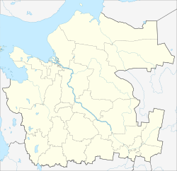
Chitinsky District is an administrative district (raion), one of the thirty-one in Zabaykalsky Krai, Russia. It is located in the west of the krai, and borders with Karymsky District in the east, Duldurginsky District in the south, and with Khiloksky District in the west. The area of the district is 16,100 square kilometers (6,200 sq mi). Its administrative center is the city of Chita. Population : 64,642 (2010 Census); 62,221 ; 62,366 (1989 Soviet census).

Petrovsk-Zabaykalsky District is an administrative district (raion), one of the thirty-one in Zabaykalsky Krai, Russia. It is located in the southwest of the krai, and borders Khiloksky District in the east, Krasnochikoysky District in the south, and Bichursky District, Kizhinginsky District, Mukhorshibirsky District, Zaigrayevsky District of the Republic of Buryatia in the west and north. The area of the district is 8,700 square kilometers (3,400 sq mi). Its administrative center is the town of Petrovsk-Zabaykalsky. As of the 2010 Census, the total population of the district was 37,900, with the population of the administrative center accounting for 48.9% of that number.

Ulyotovsky District is an administrative district (raion), one of the thirty-one in Zabaykalsky Krai, Russia. It is located in the southwest of the krai, and borders with Khiloksky District in the north, Duldurginsky District in the east, Kyrinsky District in the south, and with Krasnochikoysky District in the west. The area of the district is 16,000 square kilometers (6,200 sq mi). Its administrative center is the rural locality of Ulyoty. Population: 18,946 (2010 Census); 21,337 ; 34,669 (1989 Soviet census). The population of Ulyoty accounts for 32.0% of the district's total population.

Aginsky District is an administrative district (raion) Agin-Buryat Okrug of Zabaykalsky Krai, Russia, one of the thirty-one in the krai. It is located in the south of the krai, and borders with Karymsky District in the north, Mogoytuysky District in the east, Ononsky District in the south, and with Duldurginsky District in the west. The area of the district is 6,300 square kilometers (2,400 sq mi). Its administrative center is the urban locality of Aginskoye. Population: 34,354 (2010 Census); 29,511 ; 32,835 (1989 Soviet census). The population of Aginskoye accounts for 45.4% of the district's total population.