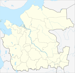
Gavrilovsky, Gavrilovskaya, or Gavrilovskoye is the name of several rural localities in Russia.
Bolshoy Khaluy is a rural locality in Oshevenskoye Rural Settlement of Kargopolsky District, Arkhangelsk Oblast, Russia. The population was 14 as of 2010.
Krominskaya is a rural locality in Oshevenskoye Rural Settlement of Kargopolsky District, Arkhangelsk Oblast, Russia. The population was 8 as of 2010.
Lodygino is a rural locality in Pavlovskoye Rural Settlement of Kargopolsky District, Arkhangelsk Oblast, Russia. The population was 16 as of 2010.
Nikiforovo is a rural locality in Ukhotskoye Rural Settlement of Kargopolsky District, Arkhangelsk Oblast, Russia. The population was 46 as of 2010.
Podzyshevskaya is a rural locality in Oshevenskoye Rural Settlement of Kargopolsky District, Arkhangelsk Oblast, Russia. The population was 4 as of 2010.
Krasnaya Gorka is a rural locality in Pinezhskoye Rural Settlement of Pinezhsky District, Arkhangelsk Oblast, Russia. The population was 30 as of 2010.
Mezhdurechensky is a rural locality in Mezhdurechenskoye Rural Settlement of Pinezhsky District, Arkhangelsk Oblast, Russia. The population was 1,981 as of 2010. There are 12 streets.
Novolavela is a rural locality and the administrative center of Lavelskoye Rural Settlement of Pinezhsky District, Arkhangelsk Oblast, Russia. The population was 1,024 as of 2010. There are 19 streets.
Chakola is a rural locality in Pirinemskoye Rural Settlement of Pinezhsky District, Arkhangelsk Oblast, Russia. The population was 98 as of 2010. There are 2 streets.
Konyovo is a rural locality and the administrative center of Konyovskoye Rural Settlement of Plesetsky District, Arkhangelsk Oblast, Russia. The population was 2,838 as of 2010. There are 23 streets.
Lipakovo is a rural locality in Fedovskoye Rural Settlement of Plesetsky District, Arkhangelsk Oblast, Russia. The population was 356 as of 2010. There are 9 streets.
Lomovoye is a rural locality in Samodedskoye Rural Settlement of Plesetsky District, Arkhangelsk Oblast, Russia. The population was 425 as of 2010. There are 12 streets.
Luzhma is a rural locality in Fedovskoye Rural Settlement of Plesetsky District, Arkhangelsk Oblast, Russia. The population was 72 as of 2010. There are 6 streets.
Malinovka is a rural locality in Obozerskoye Urban Settlement of Plesetsky District, Arkhangelsk Oblast, Russia. The population was 122 as of 2010. There are 2 streets.
Matnema is a rural locality in Tarasovskoye Rural Settlement of Plesetsky District, Arkhangelsk Oblast, Russia. The population was 15 as of 2010.
Pervomaysky is a rural locality in Obozerskoye Rural Settlement of Plesetsky District, Arkhangelsk Oblast, Russia. The population was 123 as of 2010.
Fedovo is a rural locality and the administrative center of Fedovskoye Rural Settlement of Plesetsky District, Arkhangelsk Oblast, Russia. The population was 464 as of 2010. There are 10 streets.
Talagi is a rural locality and the administrative center of Talazhskoye Rural Settlement of Primorsky District, Arkhangelsk Oblast, Russia. The population was 1,829 as of 2010.
Gavrilovskaya is a rural locality in Spasskoye Rural Settlement, Tarnogsky District, Vologda Oblast, Russia. The population was 24 as of 2002.

