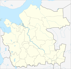
Belaya Kalitva is a town and the administrative center of Belokalitvinsky District in Rostov Oblast, Russia. Population: 43,651 (2010 Census); 47,347 (2002 Census); 47,803 (1989 Soviet census).
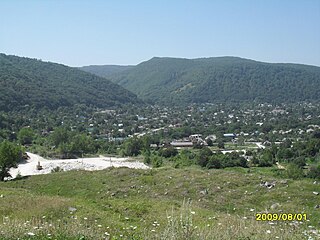
Kamennomostsky, also known as Khadzhokh (Хаджо́х) is a rural locality in Maykopsky District of the Republic of Adygea, Russia, located on the Belaya River 40 kilometers (25 mi) south of Maykop. Population: 7,213 (2010 Census); 7,580 (2002 Census); 8,292 (1989 Soviet census).

Belaya Kholunitsa is a town and the administrative center of Belokholunitsky District in Kirov Oblast, Russia, located on the river Belaya Kholunitsa, 82 kilometers (51 mi) northeast of Kirov, the administrative center of the oblast. Population: 11,232 (2010 Census); 11,975 (2002 Census); 13,367 (1989 Soviet census).
Bely, Belaya, or Beloye, literally meaning "white", is the name of several inhabited localities in Russia.

Abyysky District is an administrative and municipal district, one of the thirty-four in the Sakha Republic, Russia. It is located in the north of the republic around the Indigirka River and borders with Allaikhovsky District in the north, Srednekolymsky District in the east, Verkhnekolymsky District in the southeast, Momsky District in the south, and with Ust-Yansky District in the west. The area of the district is 69,400 square kilometers (26,800 sq mi). Its administrative center is the urban locality of Belaya Gora. As of the 2010 Census, the total population of the district was 4,425, with the population of Belaya Gora accounting for 50.7% of that number.

Ust-Belaya is a rural locality in Anadyrsky District of Chukotka Autonomous Okrug, Russia, located at the confluence of the Anadyr and the Belaya Rivers. Population: 856 (2010 Census); Municipally, the settlement is subordinated to Anadyrsky Municipal District and incorporated as Ust-Belaya Rural Settlement.

Beloglinsky District is an administrative district (raion), one of the thirty-eight in Krasnodar Krai, Russia. As a municipal division, it is incorporated as Beloglinsky Municipal District. It is located in the east of the krai. The area of the district is 1,470 square kilometers (570 sq mi). Its administrative center is the rural locality of of Belaya Glina. Population: 31,296 (2010 Census); 33,477 (2002 Census); 33,459 (1989 Soviet census). The population of Belaya Glina accounts for 55.3% of the district's total population.

Belaya Gora is an urban locality and the administrative center of Abyysky District in the Sakha Republic, Russia, located on the right bank of the Indigirka River, approximately 20 kilometers (12 mi) downstream of its confluence with its tributary the Uyandina, opposite the village of Suturuokha. At the 2010 Census, its population was 2,245.
Dakhovskaya is a rural locality and the administrative center of Kuzhorskoye Rural Settlement of Maykopsky District, Russia. The population was 1363 as of 2018. There are 41 streets.
Ilyinsky is a rural locality in Udelno-Duvaneysky Selsoviet, Blagoveshchensky District, Bashkortostan, Russia. The population was 5 as of 2010. There are 4 streets.

Udelno-Duvaney is a rural locality and the administrative centre of Udelno-Duvaneysky Selsoviet, Blagoveshchensky District, Bashkortostan, Russia. The population was 1,079 as of 2010. There are 27 streets.
Yablochny is a rural locality in Udelno-Duvaneysky Selsoviet, Blagoveshchensky District, Bashkortostan, Russia. The population was 12 as of 2010. There are 2 streets.
Yasheltau is a rural locality in Skvorchikhinsky Selsoviet, Ishimbaysky District, Bashkortostan, Russia. The population was 9 as of 2010. There are 2 streets.
Timoshinskaya is a rural locality in Kargopolsky District, Arkhangelsk Oblast, Russia. The population was 7 as of 2012. There are 2 streets.
Belaya Ramen is a rural locality in Paustovskoye Rural Settlement, Vyaznikovsky District, Vladimir Oblast, Russia. The population was 12 as of 2010.
Bazki is a rural locality in Bobrovskoye Rural Settlement, Serafimovichsky District, Volgograd Oblast, Russia. The population was 280 as of 2010. There are 7 streets.
Belaya is a rural locality in Opokskoye Rural Settlement, Velikoustyugsky District, Vologda Oblast, Russia. The population was 52 as of 2002.
Belaya Gorka 1-ya is a rural locality in Sukhodonetskoye Rural Settlement, Bogucharsky District, Voronezh Oblast, Russia. The population was 169 as of 2010. There are 5 streets.