Andytown, Florida

Last updated
Aerial photograph of Andytown, Fla. in 1957 Andytown-FL.jpg
Aerial photograph of Andytown, Fla. in 1957
Aerial photo of the interchange (looking north) US 27 Aerial at I-75 (30658946990).jpg
Aerial photo of the interchange (looking north)
Andytown sign displayed at Andy's Lounge and Package in Davie, Florida AndytownSign.jpg
Andytown sign displayed at Andy's Lounge and Package in Davie, Florida
A tribute to Andytown, Florida; this is inscribed on the top of the Interstate 75 (eastbound) bridge abutment spanning U.S. Route 27. Andytown1946-1979.jpg
A tribute to Andytown, Florida; this is inscribed on the top of the Interstate 75 (eastbound) bridge abutment spanning U.S. Route 27.

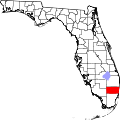
Andytown was a town located in Broward County, Florida, United States at the intersection of U.S. 27 and I-75. It was demolished in 1979 in order to allow for the expansion of the Alligator Alley portion of Interstate 75. Andytown can be found on maps from the 1970s , aerial maps of Florida (and even 1980s, as it was years before they were updated). It remains today on some online map services. MSN's Maps service, for instance, returns a map for a search of Andytown. Google Maps similarly includes a place marker for it. Andytown was at the intersection of US 27 and State Road 84.

Contents

Back when SR-84 (also known as "Alligator Alley") and US-27 were each two-lane roads, the intersection was controlled by a simple traffic light. At the southeast corner of that intersection, there was a gas station with a convenience store, restaurant, bar, motel and a trailer where the Andytown pioneers (the Tsanos family of Kosta "Gus"/ Andy's nephew, his wife Litsa and daughter Sophia Tsanos) lived until 1972. Gus and Litsa ( also Greek immigrants) worked at Andytown since 1964. Litsa's brother John Theodore ran the gas station. [1] The restaurant was a very popular stopping point- attracting tourists, locals, hunters, some celebrities, truckers, farmers, state troopers, air boats- especially for people who ventured into or returned from the Everglades.

Andytown was named after Andreas D. Poulos. [1] A Greek immigrant from the small village of Kostana of Epirus, Greece (area of Thesprotia near the Albanian border- at that time part of Ottoman Greece). Poulos immigrated to the United States in the early 1900s through Ellis Island as young Greek boy, later became a proud US citizen and moved to Florida previously having lived in Philadelphia. Poulos, a charismatic optimist and a unique visionary (always in a smart suit, smile and bow tie) who loved Florida and the Everglades, bought the business (later named Andytown) in 1946 after stopping for a drink and making the owner of the truck stop an on the spot offer for the building and land. This is an immigrant's dream of owning his own town. Poulos, understood the potential of the area before the developers, before the Department of Transportation made their infrastructure plans. [1] [2] After Poulos died in 1972, his nephew Kosta "Gus" and wife Litsa Tsanos proudly inherited Andytown and continued to work there. [2]

Andytown did not have electricity service until 1953. [1] As of 1954, it did not have any telephones; the nearest telephone was located 15 miles (24 km) away. There was no nearby hospital, or police station or school. The Tsanos family would travel to 441 to get proper drinking water. Alligators, snakes, and other wildlife were part of the daily atmosphere. There was nothing but Florida pine lining State Road 84 along the canal. An area at the time that was rural Florida only with a few farms, trailer parks, orange groves between it and University Drive (which at that time were mostly cow or horse pastures). [1] Andytown was an important oasis for travelers marked by Cuban palms, a welcoming spirit, interesting characters, lively bartenders, the occasional alligator in the parking lot and a fine juke box.

The 1960s TV adventure series The Everglades was partially filmed in Andytown.

In 1967, the Florida state government took the land for its future use in transportation projects by Eminent Domain. Kosta "Gus" struggled to keep Andytown in a legal battle after Andy's death because of the personal pride attached to Andy's pioneering spirit and what it meant to his family, but ultimately the Dept of Transportation won out. [2] In 1979, the state announced it would be demolishing the buildings in Andytown in order to build entrance and exit ramps at the intersection of I-75 and US-27. Gus and Litsa threw a big party with the locals to say good bye to Andytown. [2] The building was demolished in November 1979. [2]
Further remains of Andytown are located west of US-27 on Griffin Road; across the street from the cemetery is an FPL substation, named the Andytown Substation. Additionally, in nearby Davie, a bar called Legendary Andy's Lounge and Package displayed an old Andytown sign over their door- had the original Andytown liquor license which was the 83rd license in Florida. The lounge- located on State Road 84 and Flamingo Road (East of Andytown) was an homage to Andy Poulos. "Gus"/Kosta (Andy's nephew) owned and ran until his death in 2005 - Sophia, his daughter also owned/ ran Legendary Andy's Lounge until 2010. Sophia Tsanos is the last of the original pioneers of Andytown and has given interviews about her personal experiences and is in possession of photos, clippings and memorabilia. [3] Legendary Andy's Lounge was a continuation of Andytown in spirit, proudly remembering the history of the area and those like Andy Poulos pioneering West Broward near the Florida Everglades. The bar Legendary Andy's Lounge also became a local favorite but was later ( around 2015) demolished by the landlord /Cumberland Farms to make way for a Cumberland Farms super station.

Nearby areas

Jomo City was located about 1,000 feet (300 m) away from Andytown, on the west side of U.S. 27. [1] Jomo City had a gas station and a restaurant and nothing else. [1]

Rebel City was located about 12 miles (19 km) west of Andytown and consisted of a two-room cabin. [4] It was built for people with airboats who enjoyed exploring the Everglades on the weekends. [4]

Flamingo Gardens on Flamingo Road.

See also

Related Research Articles

<span class="mw-page-title-main">Pembroke Pines, Florida</span> City in Broward County, Florida, United States

Pembroke Pines is a city in southern Broward County, Florida, United States. The city is located 22 miles (35 km) north of Miami. It is a suburb of and the fourth-most populous city in the Miami metropolitan area. The population of Pembroke Pines was 171,178 at the 2020 census.

<span class="mw-page-title-main">Flamingo, Monroe County, Florida</span> Place in Florida, United States

Flamingo is the southernmost headquarters of Everglades National Park, in Monroe County, Florida, United States. Flamingo is one of the two end points of the 99-mile (159-km) Wilderness Waterway, and the southern end of the only road through the park from Florida City. It began as a small coastal settlement on the eastern end of Cape Sable on the southern tip of the Florida peninsula, facing Florida Bay. The actual town of Flamingo was located approximately 4+12 miles west of the current Flamingo campground area. All that remains of the former town are a few remnants of building foundations, and it is considered a ghost town.

<span class="mw-page-title-main">Everglades National Park</span> National park in Florida, United States

Everglades National Park is a national park of the United States that protects the southern twenty percent of the original Everglades in Florida. The park is the largest tropical wilderness in the United States and the largest wilderness of any kind east of the Mississippi River. An average of one million people visit the park each year. Everglades is the third-largest national park in the contiguous United States after Death Valley and Yellowstone. UNESCO declared the Everglades & Dry Tortugas Biosphere Reserve in 1976 and listed the park as a World Heritage Site in 1979, and the Ramsar Convention included the park on its list of Wetlands of International Importance in 1987. Everglades is one of only three locations in the world to appear on all three lists.

Hacienda Village is a defunct town located in central Broward County, Florida in the United States. It possessed both a police and fire department as well as various other municipal agencies, yet still relied heavily on Broward County for many services. It was disincorporated in 1984 and was subsequently absorbed into the nearby town of Davie, Florida.

The Tamiami Trail is the southernmost 284 miles (457 km) of U.S. Highway 41 (US 41) from State Road 60 (SR 60) in Tampa to US 1 in Miami. A portion of the road also has the hidden designation of State Road 90 (SR 90).

<span class="mw-page-title-main">Interstate 595 (Florida)</span> Interstate highway in Broward County, Florida

Interstate 595 (I-595), also known as the Port Everglades Expressway and unsigned FloridaState Road 862, is a 12.86-mile (20.70 km) auxiliary Interstate Highway that connects I-75 and Alligator Alley in the west with Florida's Turnpike, I-95, Fort Lauderdale–Hollywood International Airport, U.S. Highway 1, and SR A1A before terminating at Port Everglades in the east. The Interstate route was conceived in 1969 and planned as an Interstate starting in 1974. Construction began in 1984, with the expressway opening in stages in the late 1980s, with completion in 1991. The reversible tolled express lanes opened in 2014.

<span class="mw-page-title-main">Florida State Road 9336</span> State highway in Miami-Dade County, Florida, United States

State Road 9336, also known in parts as the Ingraham Highway, Tower Road and West Palm Drive, is an 8.75-mile-long (14.08 km) two- to four-lane road in Miami-Dade County, in the U.S. state of Florida. The route is the only signed four-digit state road in Florida. The route connects US 1, and the Homestead Extension of Florida's Turnpike by proxy, in Florida City with the Everglades National Park, acting as the park's primary mode of entry. The road continues on from its western terminus at the national park's entrance as Main Park Road for another 39.3 miles (63.2 km), providing access to many of the park's facilities and the ghost town of Flamingo, in Monroe County, at its western end.

<span class="mw-page-title-main">Loxahatchee National Wildlife Refuge</span> United States National Wildlife Refuge in Florida

The Arthur R. Marshall Loxahatchee National Wildlife Refuge is a 145,188-acre (587.55 km2) wildlife sanctuary is located west of Boynton Beach, in Palm Beach County, Florida. It is also known as Water Conservation Area 1 (WCA-1). It includes the most northern remnant of the historic Everglades wetland ecosystem.

<span class="mw-page-title-main">Flamingo Gardens</span> Botanical garden and wildlife sanctuary in Davie, Florida, U.S.

Flamingo Gardens is a 60-acre (24 ha) botanical garden and wildlife sanctuary, located just west of Fort Lauderdale, Florida and north of Miami at 3750 South Flamingo Road, Davie, Florida, United States. It is open to the public for a fee.

<span class="mw-page-title-main">Big Cypress National Preserve</span> Over 729,000 acres in Florida (US) managed by the National Park Service

Big Cypress National Preserve is a United States National Preserve located in South Florida, about 45 miles west of Miami on the Atlantic coastal plain. The 720,000-acre (2,900 km2) Big Cypress, along with Big Thicket National Preserve in Texas, became the first national preserves in the United States National Park System when they were established on October 11, 1974. In 2008, Florida film producer Elam Stoltzfus featured the preserve in a PBS documentary.

<span class="mw-page-title-main">Florida State Road 29</span> Highway in Florida

State Road 29 is a state highway that runs north–south through Southwest Florida. It begins in Carnestown and runs north to a point just south of Palmdale. A rural road, it runs mostly through uninhabited farmland in its northern half, and along wetlands in its southern half. The route previously continued south of Carnestown to Everglades City and Chokoloskee, which has since become County Road 29.

<span class="mw-page-title-main">Florida State Road 823</span> State highway in Florida, United States

Florida State Road 823 (SR 823) is a 20.6-mile (33.2 km) long state highway in the U.S. state of Florida. The road runs from U.S. Route 27 in Hialeah to Interstate 595 and SR 84 in Davie. The section in Miami-Dade County, through Hialeah and Miami Lakes, is known as Red Road. In Broward County, the road turns northwest and merges into Flamingo Road, until its terminus in Davie, though the road continues without designation into Sunrise.

<span class="mw-page-title-main">Sawgrass Mills</span> Shopping mall in Florida, United States

Sawgrass Mills is a shopping mall in Sunrise, Florida, owned by Simon Property Group. With 2,370,610 square feet (220,237 m2) of retail selling space, it is the eleventh largest mall in the United States, the largest single story outlet mall in the U.S., the largest shopping mall in Broward County, the second largest mall in Florida and the Miami metropolitan area after the Aventura Mall, and the third largest shopping mall in the southeastern United States. With over 21 million annual visitors, Sawgrass Mills is one of the most visited attractions in the state of Florida.

<span class="mw-page-title-main">Florida State Road 84</span> Highway in Florida

State Road 84 is a highway in the U.S. state of Florida originally extending from Tamiami Trail in Naples to U.S. Route 1 in Fort Lauderdale. The road consists of two noncontiguous pieces––in Collier County as Davis Boulevard and in Broward County as Marina Mile Boulevard and highway frontage roads.

<span class="mw-page-title-main">Florida State Road 820</span> State highway in Florida, United States

State Road 820, locally known as Pines Boulevard and Hollywood Boulevard, is a 19.956-mile-long (32.116 km) divided east–west highway serving southern Broward County, Florida. Its western terminus is an intersection with U.S. Highway 27 in Pembroke Pines, Florida; and its eastern terminus is a trumpet interchange with State Road A1A in Hollywood, Florida. SR 820 is the southernmost of three roads in Broward County that connects US 27 and A1A, the others being Sheridan Street and Griffin Road. SR 820 also serves as the latitudinal baseline for the street grid that incorporates Hollywood, Pembroke Pines, Miramar, West Park, and Pembroke Park.

<span class="mw-page-title-main">Griffin Road</span> Highway in Broward County, Florida, US

Griffin Road is a boulevard extending 18.2 miles (29.3 km) in Broward County, mostly designated State Road 818 (SR 818). It begins at Orange Drive in Southwest Ranches and continues east to Federal Highway (US 1) in Dania Beach. The westernmost 7.5 miles (12.1 km) of Griffin Road are designated as County Road 818 (CR 818).

<span class="mw-page-title-main">Carnestown, Florida</span> Unincorporated area in Florida

Carnestown is an uninhabited unincorporated area in Collier County, Florida, United States, located at the intersection of United States Route 41 and State Road 29. The area is named for Juliet Gordon Carnes (1884-1971), whom Barron Collier, the county's namesake, married in 1907.

<span class="mw-page-title-main">Miles City, Florida</span> Unincorporated community in Florida

Miles City is an unincorporated community in Collier County, Florida, United States, located near the intersection of the Alligator Alley portion of Interstate 75 and State Road 29. The community is part of the Naples–Marco Island Metropolitan Statistical Area. The name came from Miles Collier (1914-1954), son of area land owner Barron Collier.

<span class="mw-page-title-main">Interstate 75 in Florida</span> Highway in Florida

Interstate 75 (I-75) is a part of the Interstate Highway System that runs from the Hialeah–Miami Lakes border, a few miles northwest of Miami, to Sault Ste. Marie in the Upper Peninsula of Michigan. I-75 begins its national northward journey near Miami, running along the western parts of the Miami metropolitan area before traveling westward across Alligator Alley, resuming its northward direction in Naples, running along Florida's Gulf Coast, and passing the cities of Fort Myers, Punta Gorda, Venice, and Sarasota. The freeway passes through the Tampa Bay area before turning inward toward Ocala, Gainesville, and Lake City before leaving the state and entering Georgia. I-75 runs for 471 miles (758 km) in Florida, making it the longest Interstate in the state and also the longest in any state east of the Mississippi River. The Interstate's speed limit is 70 mph (110 km/h) for its entire length in Florida.

References

  1. 1 2 3 4 5 6 7 Rockefeller, Al (April 18, 1954). "Troubled Motorists Find Haven At Andytown". Fort Lauderdale News. p. 3-B.
  2. 1 2 3 4 5 Hicks, John (September 23, 1979). "Andy's". The Orlando Sentinel. p. 12.
  3. Sophia Tsanos
  4. 1 2 Jones, Duane (October 3, 1954). "Rebel City a Haven in Glades for Airboatmen". The Miami Herald. p. 5-BR.

26°08′45″N80°26′30″W / 26.14583°N 80.44167°W / 26.14583; -80.44167