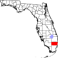
Roosevelt Gardens, Florida

Last updated

Roosevelt Gardens, Florida
CDP
Coordinates: 26°8′28″N80°10′49″W / 26.14111°N 80.18028°W / 26.14111; -80.18028
Country Flag of the United States.svg  United States
State Flag of Florida.svg  Florida
County   Broward
Area
[1]
  Total0.32 sq mi (0.83 km2)
  Land0.32 sq mi (0.83 km2)
  Water0.00 sq mi (0.00 km2)
Population
 (2020)
  Total2,749
  Density8,537.27/sq mi (3,292.94/km2)
Time zone UTC-5 (Eastern (EST))
  Summer (DST) UTC-4 (EDT)
ZIP code
33311 [2]
Area code(s) 754 and 954
FIPS code 12-61807 [3]

Roosevelt Gardens is a census-designated place (CDP) in Broward County, Florida, United States. The population was 2,749 at the 2020 census.

Contents

Geography

Roosevelt Gardens is located at 26°8′28″N80°10′49″W / 26.14111°N 80.18028°W / 26.14111; -80.18028 (26.141213, -80.180268). [4]

According to the United States Census Bureau, the CDP has a total area of 0.8 km2 (0.3 mi²), all land.

Demographics

Historical population
CensusPop.Note
2000 1,923
2010 2,45627.7%
2020 2,74911.9%
U.S. Decennial Census [5]

2020 census

Roosevelt Gardens racial composition
(Hispanics excluded from racial categories)
(NH = Non-Hispanic) [6]
RaceNumberPercentage
White (NH)541.96%
Black or African American (NH)2,42388.14%
Native American or Alaska Native (NH)160.58%
Asian (NH)30.11%
Pacific Islander or Native Hawaiian (NH)10.04%
Some other race (NH)200.73%
Two or more races/Multiracial (NH)531.93%
Hispanic or Latino (any race)1796.51%
Total2,749100.00%

As of the 2020 United States census, there were 2,749 people, 808 households, and 418 families residing in the CDP. [7]

2010 census

Roosevelt Gardens Demographics
2010 Census Roosevelt GardensBroward CountyFlorida
Total population2,4561,748,06618,801,310
Population, percent change, 2000 to 2010+27.7%+7.7%+17.6%
Population density7,442.4/sq mi1,444.9/sq mi350.6/sq mi
White or Caucasian (including White Hispanic)2.2%63.1%75.0%
(Non-Hispanic White or Caucasian)1.3%43.5%57.9%
Black or African-American 95.8%26.7%16.0%
Hispanic or Latino (of any race) 2.0%25.1%22.5%
Asian 0.0%3.2%2.4%
Native American or Native Alaskan 0.1%0.3%0.4%
Pacific Islander or Native Hawaiian 0.0%0.1%0.1%
Two or more races (Multiracial) 0.7%2.9%2.5%
Some Other Race 0.0%3.7%3.6%

As of the 2010 United States census, there were 2,749 people, 808 households, and 418 families residing in the CDP. [8]

2000 census

At the 2000 census there were 1,923 people, 661 households, and 427 families living in the CDP. The population density was 2,320.2/km2 (6,068.2/mi²). There were 733 housing units at an average density of 884.4/km2 (2,313.0/mi²). The racial makeup of the CDP was 1.04% White, 97.66% African American, 0.16% Native American, 0.21% from other races, and 0.94% from two or more races. Hispanic or Latino of any race were 0.31%. [3]

In 2000, of the 661 households 30.7% had children under the age of 18 living with them, 23.4% were married couples living together, 34.5% had a female householder with no husband present, and 35.4% were non-families. 28.1% of households were one person, and 6.4% were one person aged 65 or older. The average household size was 2.91, and the average family size was 3.61.

In 2000, the age distribution was 33.0% under the age of 18, 9.6% from 18 to 24, 27.9% from 25 to 44, 19.7% from 45 to 64, and 9.8% 65 or older. The median age was 31 years. For every 100 females, there were 88.7 males. For every 100 females age 18 and over, there were 84.0 males.

In 2000, the median household income was $17,423, and the median family income was $20,536. Males had a median income of $16,760 versus $22,796 for females. The per capita income for the CDP was $9,559. About 31.4% of families and 33.2% of the population were below the poverty line, including 47.1% of those under age 18 and 33.3% of those age 65 or over.

As of 2000, English was the first language for 100% of the population. [9]

Related Research Articles

Boulevard Gardens is a census-designated place (CDP) in Broward County, Florida, United States. The population was 1,457 at the 2020 census.

<span class="mw-page-title-main">Broadview Park, Florida</span> CDP in Florida, United States

Broadview Park is a census-designated place (CDP) in Broward County, Florida, United States. The population was 7,670 at the 2020 census.

Franklin Park is a census-designated place (CDP) in Broward County, Florida, United States. The population was 1,025 at the 2020 census.

Hillsboro Pines is a census-designated place (CDP) in Broward County, Florida, United States. The population was 496 at the 2020 census.

Hillsboro Ranches was a census-designated place (CDP) in Broward County, Florida, United States in 2000. The population was 47 at the 2000 census. Hillsboro Ranches was not designated a CDP in the 2010 census. As of 2018, Hillsboro Ranches remains an unincorporated neighborhood, part of the Broward Municipal Services District, Northern County.

<span class="mw-page-title-main">Washington Park, Florida</span> CDP in Florida, United States

Washington Park is a census-designated place (CDP) in Broward County, Florida, United States. Its population was 1,948 at the 2020 census.

<span class="mw-page-title-main">Coral Terrace, Florida</span> Census-designated place in Florida

Coral Terrace is a suburban unincorporated community and census-designated place (CDP) in Miami-Dade County, Florida, United States. It is part of the Miami metropolitan area of South Florida. The population was 23,142 at the 2020 census, down from 24,376 in 2010.

<span class="mw-page-title-main">Golden Glades, Florida</span> Census-designated place in Florida

Golden Glades is a census-designated place (CDP) in Miami-Dade County, Florida, United States. It is part of the Miami metropolitan area of South Florida. The population was 32,499 at the 2020 US census.

<span class="mw-page-title-main">Homestead Base, Florida</span> Census-designated place in Florida

Homestead Base is a census-designated place (CDP) in Miami-Dade County, Florida, United States. The CDP comprises the extent of Homestead Air Reserve Base plus some surrounding land. It is part of the Miami metropolitan area of South Florida. The population was 999 at the 2020 census.

<span class="mw-page-title-main">Ives Estates, Florida</span> Census-designated place in Florida

Ives Estates is a census-designated place (CDP) in Miami-Dade County, Florida. It is part of the Miami metropolitan area of South Florida. The population was 25,005 at the 2020 census, up from 19,525 in 2010.

<span class="mw-page-title-main">Kendall West, Florida</span> Census-designated place in Florida

Kendall West is a census-designated place and unincorporated community in Miami-Dade County, Florida, west of the Florida Turnpike. It is located in the Miami metropolitan area of South Florida. The population was 36,536 at the 2020 census.

<span class="mw-page-title-main">Leisure City, Florida</span> Census-designated place in Florida

Leisure City is an unincorporated community and census-designated place (CDP) in Miami-Dade County, Florida, United States, that includes the smaller, older community of Modello in its northwestern section. The CDP is most notable for the Coral Castle Museum, located in the Modello area. It is located in the Miami metropolitan area of South Florida. The population was 26,324 at the 2020 census, up from 22,655 in 2010.

<span class="mw-page-title-main">Palmetto Estates, Florida</span> Census-designated place in Florida

Palmetto Estates is an unincorporated area and census-designated place (CDP) in Miami-Dade County, Florida, United States. It is part of the Miami metropolitan area of South Florida. The population was 13,498 at the 2020 census.

<span class="mw-page-title-main">Sunset, Florida</span> Census-designated place in Florida

Sunset is a census-designated place (CDP) in Miami-Dade County, Florida, United States. It is part of the Miami metropolitan area of South Florida. The population was 15,912 at the 2020 census. The U.S. Postal Service uses the ZIP Codes of 33173 and 33183 for Sunset.

<span class="mw-page-title-main">The Crossings, Florida</span> CDP in Florida

The Crossings is a census-designated place (CDP) and suburb of Miami in Miami-Dade County, Florida, United States. It is part of the Miami metropolitan area of South Florida. The CDP includes the neighborhoods of The Crossings, Devon Aire, and Calusa. The population was 23,276 at the 2020 census.

<span class="mw-page-title-main">The Hammocks, Florida</span> Census-designated place in Florida

The Hammocks is a planned community and census-designated place in Miami-Dade County, Florida, United States. It is part of the Miami metropolitan area of South Florida. The population was 59,480 at the 2020 census, up from 51,003 in 2010.

<span class="mw-page-title-main">Three Lakes, Florida</span> Census-designated place in Florida

Three Lakes is a census-designated place (CDP) and planned community in Miami-Dade County, Florida, United States. It is part of the Miami metropolitan area of South Florida. The population was 16,540 at the 2020 census, up from 15,047 in 2010.

<span class="mw-page-title-main">Virginia Gardens, Florida</span> Village in Florida

Virginia Gardens is a village in Miami-Dade County, Florida, United States. The village is a part of the Miami metropolitan area of South Florida. According to the U.S. Census Bureau, the village had a population of 2,364 in 2020.

<span class="mw-page-title-main">Westview, Florida</span> Census-designated place in Florida

Westview is a census-designated place (CDP) in Miami-Dade County, Florida, United States. It is part of the Miami metropolitan area of South Florida. The population was 9,923 at the 2020 census.

<span class="mw-page-title-main">South Miami Heights, Florida</span> Census-designated place in Florida

South Miami Heights is a census-designated place (CDP), originally known as Eureka, in Miami-Dade County, Florida. It is part of the Miami metropolitan area of South Florida. The population was 36,770 as of the 2020 census.

References

  1. "2020 U.S. Gazetteer Files". United States Census Bureau. Retrieved October 31, 2021.
  2. "Roosevelt Gardens FL ZIP Code". zipdatamaps.com. 2023. Retrieved February 17, 2023.
  3. 1 2 "U.S. Census website". United States Census Bureau . Retrieved January 31, 2008.
  4. "US Gazetteer files: 2010, 2000, and 1990". United States Census Bureau. February 12, 2011. Retrieved April 23, 2011.
  5. "Census of Population and Housing". Census.gov. Retrieved June 19, 2023.
  6. "Explore Census Data". data.census.gov. Retrieved June 19, 2023.
  7. "S1101 HOUSEHOLDS AND FAMILIES - 2020: Roosevelt Gardens CDP, Florida". United States Census Bureau .
  8. "S1101 HOUSEHOLDS AND FAMILIES - 2010: Roosevelt Gardens CDP, Florida". United States Census Bureau .
  9. "MLA Data Center Results for Roosevelt Gardens, Florida". Modern Language Association . Retrieved November 18, 2007.