Andytown, Florida

Last updated
Andytown sign displayed at Andy's Lounge and Package in Davie, Florida AndytownSign.jpg
Andytown sign displayed at Andy's Lounge and Package in Davie, Florida
A tribute to Andytown, Florida; this is inscribed on the top of the Interstate 75 (eastbound) bridge abutment spanning U.S. Route 27. Andytown1946-1979.jpg
A tribute to Andytown, Florida; this is inscribed on the top of the Interstate 75 (eastbound) bridge abutment spanning U.S. Route 27.
Aerial photograph of Andytown, Fla. in 1957 Andytown-FL.jpg
Aerial photograph of Andytown, Fla. in 1957

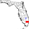
Andytown was a town located in Broward County, Florida, United States at the intersection of U.S. 27 and I-75. It was demolished in 1979 in order to allow for the expansion of the Alligator Alley portion of Interstate 75. Andytown can be found on maps from the 1970s (and even 1980s, as it was years before they were updated). It remains today on some online map services. MSN's Maps service, for instance, returns a map for a search of Andytown. Google Maps similarly includes a place marker for it.

Contents

Back when SR-84 and US-27 were each two-lane roads, the intersection was controlled by a simple traffic light. At the southeast corner of that intersection, there was a gas station with a convenience store, restaurant, and a bar. [1] The restaurant was a very popular stopping point, especially for people who ventured into or returned from the Everglades.

Andytown was named after Andrew D. Poulos. [1] A Greek immigrant previously living Philadelphia, Poulos bought the business there in 1946 or 1950, depending on the source. [1] [2] After Poulos died in 1972, his nephew Gus and Gus' brother-in-law John maintained the property. [2]

Andytown did not have electricity service until 1953. [1] As of 1954, it did not have any telephones; the nearest telephone was located 15 miles (24 km) away. [1]

The 1960s TV adventure series The Everglades was partially filmed in Andytown.

in 1967, the Florida state government purchased the land for its future use in transportation projects. [2] In 1979, the state announced it would be demolishing the buildings in Andytown in order to build entrance and exit ramps at the intersection of I-75 and US-27. [2] The building was demolished in November 1979. [2]

Further remains of Andytown are located west of US-27 on Griffin Road; across the street from the cemetery is an FPL substation, named the Andytown Substation. Additionally, in nearby Davie, a bar called Andy's Lounge and Package displayed an old Andytown sign over their door, until the bar was demolished to make way for a Cumberland Farms.

Nearby areas

Jomo City was located about 1,000 feet (300 m) away from Andytown, on the west side of U.S. 27. [1] Jomo City had a gas station and a restaurant and nothing else. [1]

Rebel City was located about 12 miles (19 km) west of Andytown and consisted of a two-room cabin. [3] It was built for people with airboats who enjoyed exploring the Everglades on the weekends. [3]

Related Research Articles

<span class="mw-page-title-main">Pembroke Pines, Florida</span> City in Broward County, Florida, United States

Pembroke Pines is a city in southern Broward County, Florida, United States. The city is located 22 miles (35 km) north of Miami. It is a suburb of and the fourth-most populous city in the Miami metropolitan area. The population of Pembroke Pines was 171,178 at the 2020 census.

<span class="mw-page-title-main">Flamingo, Monroe County, Florida</span> Place in Florida, United States

Flamingo is the southernmost headquarters of Everglades National Park, in Monroe County, Florida, United States. Flamingo is one of the two end points of the 99-mile (159-km) Wilderness Waterway, and the southern end of the only road through the park from Florida City. It began as a small coastal settlement on the eastern end of Cape Sable on the southern tip of the Florida peninsula, facing Florida Bay. The actual town of Flamingo was located approximately 4+12 miles west of the current Flamingo campground area. All that remains of the former town are a few remnants of building foundations, and it is considered a ghost town.

<span class="mw-page-title-main">U.S. Route 41</span> Highway in the United States

U.S. Route 41, also U.S. Highway 41 (US 41), is a major north–south United States Numbered Highway that runs from Miami, Florida, to the Upper Peninsula of Michigan. Until 1949, the part in southern Florida, from Naples to Miami, was US 94. The highway's southern terminus is in the Brickell neighborhood of Downtown Miami at an intersection with Brickell Avenue (US 1), and its northern terminus is east of Copper Harbor, Michigan, at a modest cul-de-sac near Fort Wilkins Historic State Park at the tip of the Keweenaw Peninsula. US 41 closely parallels Interstate 75 (I-75) from Naples, Florida, all the way through Georgia to Chattanooga, Tennessee.

Hacienda Village is a defunct town located in central Broward County, Florida in the United States. It possessed both a police and fire department as well as various other municipal agencies, yet still relied heavily on Broward County for many services. It was disincorporated in 1984 and was subsequently absorbed into the nearby town of Davie, Florida.

The Tamiami Trail is the southernmost 284 miles (457 km) of U.S. Highway 41 (US 41) from State Road 60 (SR 60) in Tampa to US 1 in Miami. A portion of the road also has the hidden designation of State Road 90 (SR 90).

<span class="mw-page-title-main">Victoria Station (restaurant)</span> Defunct US based chain of railroad-themed steakhouse restaurants

Victoria Station was a chain of railroad-themed steakhouse restaurants. At the peak of its popularity in the 1970s, the chain had 100 locations in the United States. The firm filed for bankruptcy in 1986. The last remaining restaurant in the former chain was located in Salem, Massachusetts until it abruptly closed in December 2017.

<span class="mw-page-title-main">Florida State Road 9336</span> State highway in Miami-Dade County, Florida, United States

State Road 9336, also known in parts as the Ingraham Highway, Tower Road and West Palm Drive, is an 8.75-mile-long (14.08 km) two- to four-lane road in Miami-Dade County, in the U.S. state of Florida. The route is the only signed four-digit state road in Florida. The route connects US 1, and the Homestead Extension of Florida's Turnpike by proxy, in Florida City with the Everglades National Park, acting as the park's primary mode of entry. The road continues on from its western terminus at the national park's entrance as Main Park Road for another 39.3 miles (63.2 km), providing access to many of the park's facilities and the ghost town of Flamingo, in Monroe County, at its western end.

<span class="mw-page-title-main">Florida State Road 80</span> Highway in Florida

State Road 80 is a 123.5 miles (198.8 km) route linking US 41 Business in Fort Myers and State Road A1A in Palm Beach. The road is the northernmost of three linking Southwest Florida to South Florida via the Everglades. Due to increasing traffic, State Road 80 has experienced upgrades and widening in various sections since 2000.

<span class="mw-page-title-main">Florida State Road 29</span> Highway in Florida

State Road 29 is a state highway that runs north–south through Southwest Florida. A rural road, it runs mostly through uninhabited farmland in its northern half, and along wetlands in its southern half.

<span class="mw-page-title-main">Florida State Road 820</span> State highway in Florida, United States

State Road 820, locally known as Pines Boulevard and Hollywood Boulevard, is a 19.956-mile-long (32.116 km) divided east–west highway serving southern Broward County, Florida. Its western terminus is an intersection with U.S. Highway 27 in Pembroke Pines, Florida; and its eastern terminus is a trumpet interchange with State Road A1A in Hollywood, Florida. SR 820 is the southernmost of three roads in Broward County that connects US 27 and A1A, the others being Sheridan Street and Griffin Road. SR 820 also serves as the latitudinal baseline for the street grid that incorporates Hollywood, Pembroke Pines, Miramar, West Park, and Pembroke Park.

<span class="mw-page-title-main">Florida State Road 82</span> Highway in Florida

State Road 82 is a 29-mile-long east–west highway serving northern Lee and Collier County, Florida. The western terminus is an intersection with Cleveland Avenue in Fort Myers; the eastern terminus is an intersection with SR 29 midway between Immokalee and Felda.

<span class="mw-page-title-main">Griffin Road</span> Highway in Broward County, Florida, US

Griffin Road is a boulevard extending 18.2 miles (29.3 km) in Broward County, mostly designated State Road 818 (SR 818). It begins at Orange Drive in Southwest Ranches and continues east to Federal Highway (US 1) in Dania Beach. The westernmost 7.5 miles (12.1 km) of Griffin Road are designated as County Road 818 (CR 818).

<span class="mw-page-title-main">Carnestown, Florida</span> Unincorporated area in Florida

Carnestown is an uninhabited unincorporated area in Collier County, Florida, United States, located at the intersection of United States Route 41 and State Road 29. The area is named for Juliet Gordon Carnes, whom Barron Collier, the county's namesake, married in 1907.

<span class="mw-page-title-main">Interstate 75 in Florida</span> Highway in Florida

Interstate 75 (I-75) is a part of the Interstate Highway System that runs from the Hialeah–Miami Lakes border, a few miles northwest of Miami, to Sault Ste. Marie in the Upper Peninsula of Michigan. I-75 begins its national northward journey near Miami, running along the western parts of the Miami metropolitan area before traveling westward across Alligator Alley, resuming its northward direction in Naples, running along Florida's Gulf Coast, and passing the cities of Fort Myers, Punta Gorda, Venice, and Sarasota. The freeway passes through the Tampa Bay area before turning inward toward Ocala, Gainesville, and Lake City before leaving the state and entering Georgia. I-75 runs for 471 miles (758 km) in Florida, making it the longest Interstate in the state and also the longest in any state east of the Mississippi River. The Interstate's speed limit is 70 mph (110 km/h) for its entire length in Florida.

<i>Flipper</i> (1995 TV series) TV series or program

Flipper is an American revival television series of the original 1964 Flipper television series. The first two seasons aired in first-run syndication; seasons three and four aired on the PAX network.

<span class="mw-page-title-main">Ocotillo Wells, California</span> Unincorporated community in California, United States

Ocotillo Wells is an unincorporated community in San Diego County, California, United States. It is 3 miles (4.8 km) west of the Imperial County line on California State Route 78 at an elevation of 163 feet (50 m). The name became official in 1962 when it was adopted for federal use by the US Board on Geographic Names. A federally recognized variant name, Ocotillo, can cause confusion with the community of Ocotillo, California in Imperial County, 29 mi (47 km) to the south on Interstate 8.

<span class="mw-page-title-main">U.S. Route 19 in Florida</span> Highway in Florida

U.S. Highway 19 (US 19) runs about 262 miles (422 km) along Florida's west coast from an interchange with US 41 in Memphis, south of Tampa, and continues to the Georgia border north of Monticello.

<span class="mw-page-title-main">U.S. Route 27 in Florida</span> Section of U.S. Highway in Florida, United States

U.S. Highway 27 (US 27) in Florida is a north–south United States Numbered Highway. It runs 496.352 miles (798.801 km) from the Miami metropolitan area northwest to the Tallahassee metropolitan area. Throughout the state, US 27 has been designated the Claude Pepper Memorial Highway by the Florida Legislature. It was named after long-time Florida statesperson Claude Pepper, who served in both the U.S. Senate and House of Representatives. The stretch running from Miami to South Bay was originally designated the Thomas E. Will Memorial Highway by the Florida Legislature in 1937 when that portion was known as State Road 26 (SR 26). Thomas E. Will, the founder of Okeelanta, had worked for almost 20 years to get the state to build a road from Miami to the area south of Lake Okeechobee. For most of its length in the state, US 27 is a divided highway.

References

  1. 1 2 3 4 5 6 7 Rockefeller, Al (April 18, 1954). "Troubled Motorists Find Haven At Andytown". Fort Lauderdale News. p. 3-B.
  2. 1 2 3 4 5 Hicks, John (September 23, 1979). "Andy's". The Orlando Sentinel. p. 12.
  3. 1 2 Jones, Duane (October 3, 1954). "Rebel City a Haven in Glades for Airboatmen". The Miami Herald. p. 5-BR.

26°08′45″N80°26′30″W / 26.14583°N 80.44167°W / 26.14583; -80.44167