Anenecuilco

Last updated
Anenecuilco
Casa natal de Emiliano Zapata 1.JPG
Birthplace of Emiliano Zapata in Anenecuilco, today a house museum
Mexico Morelos location map.svg
Red pog.svg
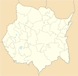
Anenecuilco
Location of Anenecuilco in Morelos
Mexico States blank map.svg
Red pog.svg
Anenecuilco
Anenecuilco (Mexico)
Coordinates: 18°46′41″N98°59′6″W / 18.77806°N 98.98500°W / 18.77806; -98.98500
CountryFlag of Mexico.svg  Mexico
State Morelos
Municipality Ciudad Ayala
Elevation
[1]
1,236 m (4,055 ft)
Population
 (2021) [1]
  Total11,227
Time zone UTC-6 (Central Time)
  Summer (DST) UTC-5 ( Central Time )

Anenecuilco (Nahuatl: "Place where the water twists back and forth") [2] is a town in the municipality of Ayala, Morelos, Mexico. As of 2021, it has a population of 11,227. [1] Anenecuilco is known as the birthplace of Mexican revolutionary Emiliano Zapata, and today the town is the home of a museum in the house of his birth.

Anenecuilco is first mentioned in Codex Mendoza as belonging to the prehispanic jurisdiction of Huaxtepec (Oaxtepec), and subject to tribute by the Aztec Empire. [2] Its glyph is blue, indicating a stream with multiple branches. In the same jurisdiction was Tepoztlan and Yauhtepec. The main tribute items that the Huaxtepec province rendered to the Aztec Empire were woven cotton cloth of various types (loincloths, women's skirts and blouses, lengths of cotton cloth some of which were decorated) along with red and yellow varnish bowls and reams of native paper (amatl). Of the 25 communities subordinate to Huaxtepec, Anenecuilco's share of tribute is unclear. [2]

After the Spanish conquest in 1521, Hernán Cortés took Huaxtepec for himself in encomienda, along with the Amilpas communities subject to it, including Anenecuilco. [3] During the epidemics of the late sixteenth century that devastated indigenous populations, Anenecuilco survived. The crown resettled indigenous population in the region (as elsewhere in central Mexico) in congregación, but Anenecuilco continued as an independent community as of 1603. [3] Areas in the region left vacant by depopulation due to epidemics and resettlement elsewhere in congregación were "swallowed up by sugar haciendas." [3]

Haciendas were established in Anenecuilco, Cuahuixtla, Hospital, and Mapaztlan, indicating the growth of the Spanish presence in the region. A family with the surname Zapata leased land from Hacienda Hospital in the eighteenth century. [4]

In the 1850s many of the town's communal lands were usurped by haciendas, as the growing of sugar cane extended through Morelos. Particularly the neighboring hacienda "El Hospital", cut off the towns' access to pastures and water sources, and finally expropriated part of the towns communal landholdings. Around the turn of the century Governor of Morelos, Manuel Alarcón, tried to mediate between the townspeople and the hacendado, but was unsuccessful. The dissatisfaction with the situation led the peasants of Anenecuilco to rise up against the hacienda owners supported by Díaz. Originally an indigenous Nahua community, the town gradually became mestizo during the second half of the 19th century as the indigenous population crashed due to the unfavorable conditions. Mestizos moved in establishing themselves and intermarrying with the locals. [5] [6] [7] [8]

Related Research Articles

<span class="mw-page-title-main">New Spain</span> Kingdom of the Spanish Empire (1535–1821)

New Spain, officially the Viceroyalty of New Spain, or Kingdom of New Spain, was an integral territorial entity of the Spanish Empire, established by Habsburg Spain during the Spanish conquest of the Americas and having its capital in Mexico City. Its jurisdiction comprised a large area of the southern and western portions of North America, mainly what is now Mexico and the Southwestern United States, but also California, Florida and Louisiana; Central America, the Caribbean, and northern parts of South America; several Pacific archipelagos, most notably the Philippines and Guam. Additional Asian colonies included "Spanish Formosa", on the island now known as Taiwan.

<span class="mw-page-title-main">Morelos</span> State of Mexico

Morelos, officially the Free and Sovereign State of Morelos, is one of the 32 states which comprise the Federal Entities of Mexico. It is divided into 36 municipalities and its capital city is Cuernavaca.

<span class="mw-page-title-main">Nahuas</span> Indigenous ethnic group in Central America

The Nahuas are a group of the indigenous people of Mexico, El Salvador, Guatemala, Honduras, Nicaragua, and Costa Rica. They comprise the largest indigenous group in Mexico and second largest in El Salvador. They are a Mesoamerican ethnicity. The Mexica (Aztecs) were of Nahua ethnicity, and the Toltecs are often thought to have been as well, though in the pre-Columbian period Nahuas were subdivided into many groups that did not necessarily share a common identity.

Ciudad Ayala is a city in the east-central part of the Mexican state of Morelos. It stands at 18°45′59″N98°59′05″W, at a mean height of 1,220 m (4,000 ft) above sea level. The city is named for Coronel Francisco Ayala (1760-1812) who fought with José María Morelos during the 1812 Siege of Cuautla. The town's previous name was Mapachtlan. Ayala became a municipality on April 17, 1869.

<span class="mw-page-title-main">Cuautla, Morelos</span> Municipal and rural in Morelos, Mexico

Cuautla, officially La heroica e histórica Cuautla, Morelos or H. H. Cuautla, Morelos, is a city and municipality in the Mexican state of Morelos, about 104 kilometers south of Mexico City. In the 2010 census the city population was 154,358. The municipality covers 153.651 km2 (59.325 sq mi). Cuautla is the third most populous city in the state, after Cuernavaca and Jiutepec. The city was founded on April 4, 1829. The 2020 population figures were 187,118 inhabitants for the municipality and 157,336 inhabitants for the city of Cuatula.

Emiliano Zapata is a city in the west-central part of the Mexican state of Morelos. It stands at 18°52′N99°09′W. The city serves as the county seat for the surrounding municipality of the same name. The municipality is the sixth largest in the state of Morelos, with a 2020 census population of 107,053 inhabitants, and has it an area of 64.983 km2. The city of Emiliano Zapata had 64,084 inhabitants in 2020. The city was previously known as both San Francisco Zacualpan and San Vicente Zacualpan. It was renamed in honor of Mexican Revolutionary Emiliano Zapata.

Jiutepec is a city and its surrounding municipality in the Mexican state of Morelos.

<span class="mw-page-title-main">Temixco</span> The fourth-largest city in the Mexican state of Morelos

Temixco is the fourth-largest city in the Mexican state of Morelos. It stands at 18°51′N99°14′W in the west-northwest part of the state.

Tlaltizapán de Zapata is a city in the Mexican state of Morelos. It stands at 18°4′N99°07′W.

Xochitepec is a municipio (municipality) of the state of Morelos, in central Mexico. Xochitepec is also the name of its principal township and seat of the municipal government. It is located approximately 13 km (8.1 mi) to the south of the capital of Morelos, Cuernavaca, on the southern outskirts of that city's greater metropolitan area.

<span class="mw-page-title-main">Yautepec, Morelos</span> Municipality in Morelos, Mexico

Yautepec is a municipality located in the north-central part of the Mexican state of Morelos. The municipal seat is the city of Yautepec de Zaragoza. It stands at 18°53′N99°04′W.

<span class="mw-page-title-main">Liberation Army of the South</span> Armed group during the Mexican Revolution

The Liberation Army of the South was a guerrilla force led for most of its existence by Emiliano Zapata that took part in the Mexican Revolution from 1911 to 1920. During that time, the Zapatistas fought against the national governments of Porfirio Díaz, Francisco Madero, Victoriano Huerta, and Venustiano Carranza. Their goal was rural land reform, specifically reclaiming communal lands stolen by hacendados in the period before the revolution. Although rarely active outside their base in Morelos, they allied with Pancho Villa to support the Conventionists against the Carrancistas. After Villa's defeat, the Zapatistas remained in open rebellion. It was only after Zapata's 1919 assassination and the overthrow of the Carranza government that Zapata's successor, Gildardo Magaña, negotiated peace with President Álvaro Obregón.

<span class="mw-page-title-main">Land reform in Mexico</span>

Before the 1910 Mexican Revolution, most land in post-independence Mexico was owned by wealthy Mexicans and foreigners, with small holders and indigenous communities possessing little productive land. During the colonial era, the Spanish crown protected holdings of indigenous communities that were mostly engaged in subsistence agriculture to countervail the encomienda and repartimiento systems. In the 19th century, Mexican elites consolidated large landed estates (haciendas) in many parts of the country while small holders, many of whom were mixed-race mestizos, engaged with the commercial economy.

<span class="mw-page-title-main">Aztec codex</span> Manuscripts painted by pre-Columbian and colonial Aztec

Aztec codices are Mesoamerican manuscripts made by the pre-Columbian Aztec, and their Nahuatl-speaking descendants during the colonial period in Mexico.

<span class="mw-page-title-main">Cocoyoc</span> City in Morelos, Mexico

Cocoyoc is a city in the north-central part of the Mexican state of Morelos. It is located at 18°53′N 99°04′W. The city lies within the municipality of Yautepec. Cocoyoc reported 10,178 inhabitants in the 2020 census and is the third-largest community in Yautepec.

<span class="mw-page-title-main">Marquessate of the Valley of Oaxaca</span>

The Marquessate of the Valley of Oaxaca is a hereditary marquessal title in the Spanish nobility and a former seignorial estate in New Spain. It was granted to Don Hernán Cortés, conquistador who led the conquest of the Aztec Empire, by Charles V, Holy Roman Emperor in 1529. Despite its name, the marquessate covered a much larger area than the Oaxaca Valley, comprising a vast stretch of land in the present-day Mexican states of Oaxaca, Morelos, Veracruz, Michoacán and Mexico.

Atenango del Río is a city and seat of the municipality of Atenango del Río, in the state of Guerrero, south-western Mexico.

<span class="mw-page-title-main">Amanalco</span> Municipality and town in Mexico, Mexico

Amanalco is a municipality, in Mexico State in Mexico. The municipal seat is the town of Amanalco de Becerra and includes several larger towns including San Juan, San Jerónimo, San Bartolo, and San Mateo. The municipality covers an area of 219.49 km².

<span class="mw-page-title-main">Hacienda Cocoyoc</span> Archeological site in Mexico

The Hacienda de Cocoyoc, now known as the Hotel Hacienda Cocoyoc, is a private hacienda resort located in the state of Morelos, México. In the 17th and 18th centuries it became one of the most important haciendas in the nation and has been declared a Historical Monument by the INAH.

The Cuernavaca Municipality is one of 36 municipalities in the State of Morelos, Mexico. Located in the northwest of the state, it consists of the City of Cuernavaca, which is the state and municipal capital, as well as other, smaller towns. The population is 378,476 (2020).

References

  1. 1 2 3 "Catálogo Único de Claves de Áreas Geoestadísticas Estatales, Municipales y Localidades". inegi.org. National Institute of Statistics, Geography and Informatics. Retrieved 22 June 2021.
  2. 1 2 3 Berdan, Frances F.; Anawalt, Patricia Rieff (1997). The Essential Codex Mendoza. Berkeley and Los Angeles: University of California Press. pp. 44–46.
  3. 1 2 3 Gerhard, Peter (1993). A Guide to the Historical Geography of New Spain, Revised Edition. Norman: University of Oklahoma Press. pp. 91–93.
  4. Enrique Krauze, Mexico: Biography of Power. New York: Harper Collins, 1997 p. 275.
  5. Alicia Hernández Chávez. Anenecuilco: Memoria y Vida de un Pueblo. México: El Colegio de México, 1991. ISBN   9681204905
  6. Frank McLynn. 2002. Villa and Zapata: A History of the Mexican Revolution Basic Books. p. 51
  7. Paul Hart. 2006. Bitter Harvest: The Social Transformation of Morelos, Mexico, and the Origins of the Zapatista Revolution, 1840-1910. UNM Press. pp. 27-30
  8. Jesús Sotelo Inclán. 1979. La escuela de Anenecuilco