Tintern Abbey was founded on 9 May 1131 by Walter de Clare, Lord of Chepstow. It is situated adjacent to the village of Tintern in Monmouthshire, on the Welsh bank of the River Wye, which at this location forms the border between Monmouthshire in Wales and Gloucestershire in England. It was the first Cistercian foundation in Wales, and only the second in Britain.

Monmouthshire is a county in the south east of Wales. It borders Powys to the north; the English counties of Herefordshire and Gloucestershire to the north and east; the Severn Estuary to the south, and Torfaen, Newport and Blaenau Gwent to the west. The largest town is Abergavenny, and the administrative centre is Usk. The county is administered by Monmouthshire County Council. It sends two directly-elected members to the Senedd at Cardiff and one elected member to the UK parliament at Westminster. The county name is identical to that of the historic county, of which the current local authority covers the eastern three-fifths. Between 1974 and 1996, the county was known as Gwent, recalling the medieval kingdom which covered a similar area. The present county was formed under the Local Government (Wales) Act 1994, which came into effect in 1996. In his essay 'Changes in local government', in the fifth and final volume of the Gwent County History, Robert McCloy writes, "the local government of no county in the United Kingdom in the twentieth century was so transformed as that of Monmouthshire".

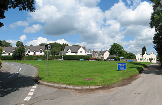
Tintern is a village in the community of Wye Valley, on the west bank of the River Wye in Monmouthshire, Wales, close to the border with England, about 5 miles (8 km) north of Chepstow. It is popular with tourists, in particular for the scenery and the ruined Tintern Abbey. Modern Tintern has been formed by the coalescence of two historic villages: Tintern Parva, forming the northern end of the village, and Chapel Hill, which forms the southern end. The village is designated as a Conservation Area.

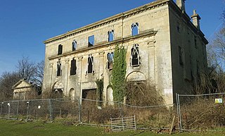
Piercefield House is a largely ruined neo-classical country house near St Arvans, Monmouthshire, Wales, about 1.5 miles (2.4 km) north of the centre of Chepstow. The central block of the house was designed in the very late 18th century, by, or to the designs of, Sir John Soane. It is flanked by two pavilions, of slightly later date, by Joseph Bonomi the Elder. The house sits within Piercefield Park, a Grade I listed historic landscape, that was created in the 18th century as a notable Picturesque estate.
The Company of Mineral and Battery Works was, with the Society of the Mines Royal, one of two mining monopolies created by Elizabeth I. The company's rights were based on a patent granted to William Humfrey on 17 September 1565. This was replaced on 28 May 1568 by a patent of incorporation, making it an early joint stock company. The Society of the Mines Royal was incorporated on the same day.

The Wye Valley is a valley in Wales and England. The River Wye is the fourth-longest river in the United Kingdom.

Devauden is a village and community in Monmouthshire, southeast Wales. It is located between Chepstow and Monmouth near the top of the Trellech ridge on the B4293 road. The community covers an area of 3,790 hectares (14.6 sq mi), and includes the villages of Itton and Wolvesnewton, Llanfihangel-tor-y-mynydd and Newchurch.

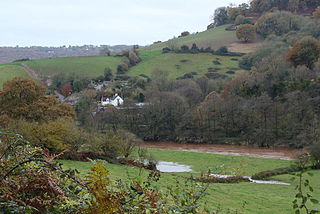
Whitebrook is a small village in Monmouthshire, south-east Wales, United Kingdom. It is located four miles south east of Monmouth in the Wye Valley.

Trelleck Grange is a small hamlet in a rural area of Monmouthshire, south east Wales, United Kingdom, about seven miles south of Monmouth.

Brockweir is a village in Hewelsfield and Brockweir civil parish, in the Forest of Dean District of Gloucestershire, England. The civil parish also includes the separate village of Hewelsfield.

Bigsweir Bridge is an 1827 road bridge crossing the River Wye, straddling the boundary between the parish of St. Briavels, Gloucestershire, England, and Llandogo, Monmouthshire, Wales.

The Wye Valley Railway was a standard gauge railway that ran for nearly 15 miles (24 km) along the Lower Wye Valley between the towns of Chepstow and Monmouth, crossing several times between Wales and England. Opened on 1 November 1876, it was leased to, and worked by, the Great Western Railway (GWR), before being fully absorbed by the GWR in 1905.

Penterry is a small rural parish of 479 acres (1.94 km2) in Monmouthshire, Wales. It is located between the villages of St. Arvans and Tintern, about 4 miles (6.4 km) north of Chepstow, within the Wye Valley Area of Outstanding Natural Beauty and about 2 miles (3.2 km) from the border with England. It now contains an isolated parish church adjoining the site of a deserted village, and a few farms.

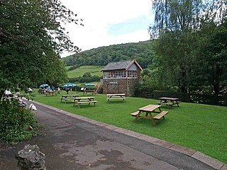
Tintern railway station served the village of Tintern on the Wye Valley Railway. It was opened in 1876 and closed for passengers in 1959 and freight in 1964, when the line was closed completely. It was the second largest station on the line, the most substantial being Monmouth Troy railway station.

The Tintern Wireworks Branch was a short branch line on the Wye Valley Railway, crossing the tidal River Wye between Monmouthshire, Wales, and Gloucestershire, England. It was completed in 1874 and opened on 1 November 1876; the reason for the delay was that the Wye Valley Railway, into which the branch line fed, was not completed until the latter date. It closed in 1935 when the rails buckled in the heat of the summer.

The Port Wall in Chepstow, Monmouthshire, Wales, is a late thirteenth century stone wall, which was constructed for the twin purposes of defence and tax collection by permitting users of the town's market only one point of access through the wall at the Town Gate. The wall originally formed a semi-circle extending for some 1,100 metres (3,600 ft), roughly southwards from Chepstow Castle to the River Wye. It enclosed an area of 53 hectares, including the entire town and port as it existed at that time. Substantial sections of the wall remain intact, and both the Port Wall and the Town Gate are Grade I listed buildings. The Port Wall is a Scheduled monument.

Monmouthshire is a county and principal area of Wales. It borders Torfaen and Newport to the west; Herefordshire and Gloucestershire to the east; and Powys to the north. The largest town is Abergavenny, with the other major towns being Chepstow, Monmouth, and Usk. The county is 850 km2 in extent, with a population of 95,200 as of 2020. The present county was formed under the Local Government (Wales) Act 1994, which came into effect in 1996, and comprises some sixty percent of the historic county. Between 1974 and 1996, the county was known by the ancient title of Gwent, recalling the medieval Welsh kingdom. In his essay on local government in the fifth and final volume of the Gwent County History, Robert McCloy suggests that the governance of "no county in the United Kingdom in the twentieth century was so transformed as that of Monmouthshire".

The Wyndcliff or Wynd Cliff is a steep limestone cliff rising above the western bank of the River Wye in Monmouthshire, Wales, some 1 mile (1.6 km) north-east of the village of St Arvans, 2.5 miles (4.0 km) south of Tintern, and 3.5 miles (5.6 km) north of the town of Chepstow, within the Wye Valley Area of Outstanding Natural Beauty. The cliff rises to 771 feet (235 m) at its summit, the highest point on the Monmouthshire bank of the Wye. The area is traversed by the Wye Valley Walk, and is also a popular venue for rock climbing. Access is provided by the A466 road which passes along the valley immediately below the cliff face.

The Devil's Pulpit is a rocky limestone outcrop and scenic viewpoint in the Forest of Dean District of Gloucestershire, England, within the Wye Valley Area of Outstanding Natural Beauty. It is known for its views across the River Wye to Tintern Abbey, which stands on the opposite bank in Monmouthshire, Wales.


