Antaritarika

Last updated
Antaritarika
Madagascar location map.svg
Red pog.svg
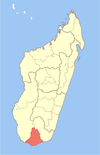
Antaritarika
Location in Madagascar
Coordinates: 25°24′S45°45′E / 25.400°S 45.750°E / -25.400; 45.750
CountryFlag of Madagascar.svg  Madagascar
Region Androy
District Tsiombe
Elevation [1] 138 m (453 ft)
Population (2001) [2]
  Total 12,000
Time zone EAT (UTC3)

Antaritarika is a town and commune in Madagascar. It belongs to the district of Tsiombe, which is a part of Androy Region. The population of the commune was estimated to be approximately 12,000 in 2001 commune census. [2]

Madagascar island nation off the coast of Southeast Africa, in the Indian Ocean

Madagascar, officially the Republic of Madagascar, and previously known as the Malagasy Republic, is an island country in the Indian Ocean, approximately 400 kilometres off the coast of East Africa. The nation comprises the island of Madagascar and numerous smaller peripheral islands. Following the prehistoric breakup of the supercontinent Gondwana, Madagascar split from the Indian subcontinent around 88 million years ago, allowing native plants and animals to evolve in relative isolation. Consequently, Madagascar is a biodiversity hotspot; over 90% of its wildlife is found nowhere else on Earth. The island's diverse ecosystems and unique wildlife are threatened by the encroachment of the rapidly growing human population and other environmental threats.

Districts of Madagascar

Districts are second-level administrative divisions of Madagascar below the regions. There are 114 districts in Madagascar. Districts are in their turn divided into communes; while some of the districts in urban areas and offshore islands each consist of only one commune, most of the districts are divided typically into 5–20 communes.


The Tsiombe District is a district in the Androy Region, located in southeastern Madagascar.

Primary and junior level secondary education are available in town. The majority 50% of the population of the commune are farmers, while an additional 38% receives their livelihood from raising livestock. The most important crops are maize and cowpeas, while other important agricultural products are peanuts and sweet potatoes. Services provide employment for 2% of the population. Additionally fishing employs 10% of the population. [2]

Maize Cereal grain

Maize, also known as corn, is a cereal grain first domesticated by indigenous peoples in southern Mexico about 10,000 years ago. The leafy stalk of the plant produces pollen inflorescences and separate ovuliferous inflorescences called ears that yield kernels or seeds, which are fruits.

Cowpea species of plant, cowpea

The cowpea is an annual herbaceous legume from the genus Vigna. Due to its tolerance for sandy soil and low rainfall it is an important crop in the semi-arid regions across Africa and other countries. It requires very few inputs, as the plant's root nodules are able to fix atmospheric nitrogen, making it a valuable crop for resource-poor farmers and well-suited to intercropping with other crops. The whole plant is used as forage for animals, with its use as cattle feed likely responsible for its name.

Peanut A legume cultivated for its seeds

The peanut, also known as the groundnut, goober, or monkey nut (UK), and taxonomically classified as Arachis hypogaea, is a legume crop grown mainly for its edible seeds. It is widely grown in the tropics and subtropics, being important to both small and large commercial producers. It is classified as both a grain legume and, due to its high oil content, an oil crop. World annual production of shelled peanuts was 44 million tonnes in 2016, led by China with 38% of the world total. Atypically among crop plants, peanut pods develop underground (geocarpy) rather than aboveground. With this characteristic in mind, the botanist Linnaeus named the species hypogaea, which means "under the earth."

References and notes

  1. Estimated based on DEM data from Shuttle Radar Topography Mission
  2. 1 2 3 "ILO census data". Cornell University. 2002. Retrieved 2008-05-02.

Coordinates: 25°24′S45°45′E / 25.400°S 45.750°E / -25.400; 45.750

Geographic coordinate system Coordinate system

A geographic coordinate system is a coordinate system that enables every location on Earth to be specified by a set of numbers, letters or symbols. The coordinates are often chosen such that one of the numbers represents a vertical position and two or three of the numbers represent a horizontal position; alternatively, a geographic position may be expressed in a combined three-dimensional Cartesian vector. A common choice of coordinates is latitude, longitude and elevation. To specify a location on a plane requires a map projection.


Related Research Articles

Analalava Place in Sofia, Madagascar

Analalava is a coastal town and commune in north-western Madagascar over the Mozambique Channel. It is approximately 150 kilometres north of Mahajanga and some 430 kilometres north of the capital Antananarivo. It belongs to the district of Analalava, which is a part of Sofia Region. The population of the commune was estimated to be approximately 10,000 in 2001 commune census.

Tsarabaria Place in Sava, Madagascar

Tsarabaria is a town and commune in northern Madagascar. It belongs to the district of Vohemar, which is a part of Sava Region. The population of the commune was estimated to be approximately 20,000 in 2001 commune census.

Kalandy Place in Sofia, Madagascar

Kalandy is a town and commune in Madagascar. It belongs to the district of Mandritsara, which is a part of Sofia Region. The population of the commune was estimated to be approximately 14,000 in 2001 commune census.

Ampasimatera Place in Sofia, Madagascar

Ampasimatera is a town and commune in Madagascar. It belongs to the district of Mampikony, which is a part of Sofia Region. The population of the commune was estimated to be approximately 21,000 in 2001 commune census.

Ankazomborona Place in Boeny, Madagascar

Ankazomborona is a town and commune in Madagascar. It belongs to the district of Marovoay, which is a part of Boeny Region. The population of the commune was estimated to be approximately 25,000 in 2001 commune census.

Androndrono Place in Analanjirofo, Madagascar

Androndrono is a town and commune in Madagascar. It belongs to the district of Maroantsetra, which is a part of Analanjirofo Region. The population of the commune was estimated to be approximately 11,000 in 2001 commune census.

Anosimena Place in Menabe, Madagascar

Anosimena is a town and commune in Madagascar. It belongs to the district of Miandrivazo, which is a part of Menabe Region. The population of the commune was estimated to be approximately 6,000 in 2001 commune census.

Bemahatazana, Miandrivazo Place in Menabe, Madagascar

Bemahatazana is a town and commune in Madagascar. It belongs to the district of Miandrivazo, which is a part of Menabe Region. The population of the commune was estimated to be approximately 3,000 in 2001 commune census.

Ankilizato, Ampanihy Place in Atsimo-Andrefana, Madagascar

Ankilizato is a town and commune in southwestern Madagascar. It belongs to the district of Ampanihy, which is a part of Atsimo-Andrefana Region. The population of the commune was estimated to be approximately 7,000 in 2001 commune census.

Mikoboka Place in Atsimo-Andrefana, Madagascar

Mikoboka is a town and commune in Madagascar. It belongs to the district of Sakaraha, which is a part of Atsimo-Andrefana Region. The population of the commune was estimated to be approximately 7,000 in 2001 commune census.

Miandrarivo Place in Vakinankaratra, Madagascar

Miandrarivo is a town and commune in Madagascar. It belongs to the district of Faratsiho, which is a part of Vakinankaratra Region. The population of the commune was estimated to be approximately 27,000 in 2001 commune census.

Mahaditra Place in Haute Matsiatra, Madagascar

Mahaditra is a town and commune in Madagascar. It belongs to the district of Fianarantsoa II, which is a part of Haute Matsiatra Region. The population of the commune was estimated to be approximately 28,000 in 2001 commune census.

Ambalanirana Place in Bongolava, Madagascar

Ambalanirana is a town and commune in Madagascar. It belongs to the district of Tsiroanomandidy, which is a part of Bongolava Region. The population of the commune was estimated to be approximately 19,000 in 2001 commune census.

Ambotaka Place in Vatovavy-Fitovinany, Madagascar

Ambotaka is a town and commune in Madagascar. It belongs to the district of Manakara, which is a part of Vatovavy-Fitovinany Region. The population of the commune was estimated to be approximately 11,000 in 2001 commune census.

Andemaka Place in Vatovavy-Fitovinany, Madagascar

Andemaka is a town and commune in Madagascar. It belongs to the district of Vohipeno, which is a part of Vatovavy-Fitovinany Region. The population of the commune was estimated to be approximately 16,000 in 2001 commune census.

Ifatsy Place in Vatovavy-Fitovinany, Madagascar

Ifatsy is a town and commune in Madagascar. It belongs to the district of Vohipeno, which is a part of Vatovavy-Fitovinany Region. The population of the commune was estimated to be approximately 15,000 in 2001 commune census.

Ankaramena, Taolanaro Place in Anosy, Madagascar

Ankaramena is a town and commune in Madagascar. It belongs to the district of Taolanaro, which is a part of Anosy Region. The population of the commune was estimated to be approximately 13,000 in 2001 commune census.

Tangainony Place in Atsimo-Atsinanana, Madagascar

Tangainony is a town and commune in Madagascar. It belongs to the district of Farafangana, which is a part of Atsimo-Atsinanana Region. The population of the commune was estimated to be approximately 16,000 in 2001 commune census.

Vohimasy, Farafangana Place in Atsimo-Atsinanana, Madagascar

Vohimasy is a town and commune in Madagascar. It belongs to the district of Farafangana, which is a part of Atsimo-Atsinanana Region. The population of the commune was estimated to be approximately 5,000 in 2001 commune census.

Ambatomanga, Manjakandriana Place in Analamanga, Madagascar

Ambatomanga is a town and commune in Madagascar. It belongs to the district of Manjakandriana, which is a part of Analamanga Region. The population of the commune was estimated to be approximately 6,000 in 2001 commune census.