Antrain

Last updated • a couple of secsFrom Wikipedia, The Free Encyclopedia
Antrain
Antrain (35) Mairie 01.jpg
Town hall
Blason ville fr Antrain (Ille-et-Vilaine).svg
Location of Antrain
Antrain
France location map-Regions and departements-2016.svg
Red pog.svg
Antrain
Bretagne region location map.svg
Red pog.svg
Antrain
Coordinates: 48°27′40″N1°29′01″W / 48.4611°N 1.4836°W / 48.4611; -1.4836
Country France
Region Brittany
Department Ille-et-Vilaine
Arrondissement Fougères-Vitré
Canton Antrain
Commune Val-Couesnon
Area
1
9.31 km2 (3.59 sq mi)
Population
 (2019) [1]
1,279
  Density140/km2 (360/sq mi)
Time zone UTC+01:00 (CET)
  Summer (DST) UTC+02:00 (CEST)
Postal code
35560
Elevation6–84 m (20–276 ft)
1 French Land Register data, which excludes lakes, ponds, glaciers > 1 km2 (0.386 sq mi or 247 acres) and river estuaries.

Antrain (French pronunciation: [ɑ̃tʁɛ̃] ; Breton : Entraven; Gallo: Antrein) is a former commune in the Ille-et-Vilaine department in the Brittany in northwestern France. On 1 January 2019, it was merged into the new commune Val-Couesnon. [2] Château de Bonnefontaine dates to the second quarter of the 16th century. [3]

Contents

Population

Inhabitants of Antrain are called Antrenais in French.

Historical population
YearPop.±%
1794 1,522    
1798 1,419−6.8%
1800 1,375−3.1%
1804 1,543+12.2%
1806 1,527−1.0%
1820 1,524−0.2%
1826 1,633+7.2%
1831 1,742+6.7%
1836 1,651−5.2%
1841 1,567−5.1%
1846 1,648+5.2%
1851 1,696+2.9%
1856 1,613−4.9%
1861 2,262+40.2%
1866 1,642−27.4%
1872 1,630−0.7%
1876 1,582−2.9%
1881 1,601+1.2%
1886 1,525−4.7%
YearPop.±%
1891 1,575+3.3%
1896 1,550−1.6%
1906 1,443−6.9%
1911 1,552+7.6%
1921 1,484−4.4%
1926 1,417−4.5%
1931 1,383−2.4%
1936 1,459+5.5%
1946 1,682+15.3%
1954 1,528−9.2%
1962 1,444−5.5%
1968 1,443−0.1%
1975 1,548+7.3%
1982 1,499−3.2%
1990 1,387−7.5%
1999 1,387+0.0%
2007 1,426+2.8%
2017 1,302−8.7%

See also

Related Research Articles

<span class="mw-page-title-main">Maine-et-Loire</span> Department of France in Pays de la Loire

Maine-et-Loire is a department in the Loire Valley in the Pays de la Loire region in Western France. It is named after the two rivers, Maine and the Loire. It borders Mayenne and Sarthe to the north, Loire-Atlantique to the west, Indre-et-Loire to the east, Vienne and Deux-Sèvres to the south, Vendée to the south-west, and Ille-et-Vilaine to the north-west. It also borders Ille-et-Vilaine in the north for just 20 yards (19 m), France's shortest department boundary. Its prefecture is Angers; its subprefectures are Cholet, Saumur and Segré-en-Anjou Bleu. Maine-et-Loire had a population of 818,273 in 2019.

<span class="mw-page-title-main">Ille-et-Vilaine</span> Department of France

Ille-et-Vilaine is a department of France, located in the region of Brittany in the northwest of the country. It is named after its two main rivers, the Ille and the Vilaine. It had a population of 1,079,498 in 2019.

<span class="mw-page-title-main">Combourg</span> Commune in Brittany, France

Combourg is a commune in the Ille-et-Vilaine department in Brittany in northwestern France.

<span class="mw-page-title-main">Vieux-Vy-sur-Couesnon</span> Commune in Brittany, France

Vieux-Vy-sur-Couesnon is a commune in the Ille-et-Vilaine department in Brittany in northwestern France.
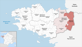
<span class="mw-page-title-main">Arrondissement of Fougères-Vitré</span> Arrondissement in Brittany, France

The arrondissement of Fougères-Vitré is an arrondissement of France in the Ille-et-Vilaine department in the Brittany region. It has 105 communes. Its population is 184,039 (2016), and its area is 2,173.2 km2 (839.1 sq mi).

<span class="mw-page-title-main">Canton of Saint-Brice-en-Coglès</span>

The canton of Saint-Brice-en-Coglès is a former canton of France, located in the arrondissement of Fougères-Vitré, in the Ille-et-Vilaine département, Brittany région. It had 12,106 inhabitants (2012). It was disbanded following the French canton reorganisation which came into effect in March 2015. It consisted of 11 communes, which joined the canton of Antrain in 2015.

<span class="mw-page-title-main">Saint-Ouen-la-Rouërie</span> Part of Val-Couesnon in Brittany, France

Saint-Ouen-la-Rouërie is a former commune in the Ille-et-Vilaine department in Brittany in northwestern France. On 1 January 2019, it was merged into the new commune Val-Couesnon.

<span class="mw-page-title-main">Argentré-du-Plessis</span> Commune in Brittany, France

Argentré-du-Plessis is a commune in the Ille-et-Vilaine department in Brittany in northwestern France.

<span class="mw-page-title-main">Andouillé-Neuville</span> Commune in Brittany, France

Andouillé-Neuville is a commune in the Ille-et-Vilaine department in Brittany in northwestern France.

<span class="mw-page-title-main">Broualan</span> Commune in Brittany, France

Broualan is a commune in the Ille-et-Vilaine department in Brittany in northwestern France.
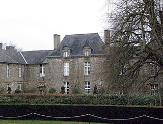
<span class="mw-page-title-main">Bazouges-la-Pérouse</span> Commune in Brittany, France

Bazouges-la-Pérouse is a commune in the Ille-et-Vilaine department in Brittany in northwestern France.

<span class="mw-page-title-main">Iffendic</span> Commune in Brittany, France

Iffendic is a commune in the department of Ille-et-Vilaine in Brittany. It is located in the North West of France.

<span class="mw-page-title-main">Taillis</span> Commune in Brittany, France

Taillis is a commune in the Ille-et-Vilaine department in Brittany in northwestern France.

<span class="mw-page-title-main">Moulins, Ille-et-Vilaine</span> Commune in Brittany, France

Moulins is a commune in the Ille-et-Vilaine department of Brittany in northwestern France.
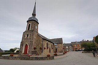
<span class="mw-page-title-main">Lassy, Ille-et-Vilaine</span> Commune in Brittany, France

Lassy is a commune in the Ille-et-Vilaine department of Brittany in northwestern France.

<span class="mw-page-title-main">Châteauneuf-d'Ille-et-Vilaine</span> Commune in Brittany, France

Châteauneuf-d'Ille-et-Vilaine is a commune in the Ille-et-Vilaine department of Brittany in north-western France.

<span class="mw-page-title-main">Canton of Val-Couesnon</span> Canton in Brittany, France

The Canton of Val-Couesnon is a canton of France, in the Ille-et-Vilaine département, located in the northeast of the department.

Château de Bonnefontaine may refer to:

<span class="mw-page-title-main">Château de Bonnefontaine (Ille-et-Vilaine)</span> Château in the commune of Antrain, Ille-et-Vilaine, France

The Château de Bonnefontaine is a château in the commune of Antrain, Ille-et-Vilaine, France. It dates to the second quarter of the 16th century. Noted for its elegant turrets and tall windows, it became a monument historique on 16 September 1943. The park was laid out by Denis Bühler and Édouard André.

<span class="mw-page-title-main">Val-Couesnon</span> Commune in Brittany, France

Val-Couesnon is a commune in the Ille-et-Vilaine department in the Brittany in northwestern France. It was established on 1 January 2019 by merger of the former communes of Antrain, La Fontenelle, Saint-Ouen-la-Rouërie and Tremblay.

References

  1. Téléchargement du fichier d'ensemble des populations légales en 2019, INSEE
  2. Arrêté préfectoral 28 September 2018 (in French)
  3. "Château de Bonnefontaine" (in French). Monumentum.fr. Retrieved 28 April 2015.