Arabbazarly

Last updated

Coordinates: 40°06′N48°23′E / 40.100°N 48.383°E / 40.100; 48.383

Geographic coordinate system Coordinate system

A geographic coordinate system is a coordinate system that enables every location on Earth to be specified by a set of numbers, letters or symbols. The coordinates are often chosen such that one of the numbers represents a vertical position and two or three of the numbers represent a horizontal position; alternatively, a geographic position may be expressed in a combined three-dimensional Cartesian vector. A common choice of coordinates is latitude, longitude and elevation. To specify a location on a plane requires a map projection.

Arabbazarly
Azerbaijan adm location map.svg
Red pog.svg
Arabbazarly
Coordinates: 40°06′N48°23′E / 40.100°N 48.383°E / 40.100; 48.383
CountryFlag of Azerbaijan.svg  Azerbaijan
Rayon Kurdamir
Time zone AZT (UTC+4)
  Summer (DST) AZT (UTC+5)

Arabbazarly is a village in the Kurdamir Rayon of Azerbaijan.

Azerbaijan republic in Western Asia and Eastern Europe

Azerbaijan, officially the Republic of Azerbaijan, is a country in the South Caucasus region of Eurasia at the crossroads of Eastern Europe and Western Asia. It is bounded by the Caspian Sea to the east, Russia to the north, Georgia to the northwest, Armenia to the west and Iran to the south. The exclave of Nakhchivan is bounded by Armenia to the north and east, Iran to the south and west, and has an 11 km long border with Turkey in the northwest.

Related Research Articles

Kamiiso District, Hokkaido district of Japan

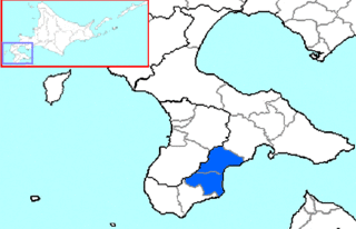
Kamiiso is a district located in Oshima Subprefecture, Hokkaido, Japan.

Castillejo-Sierra is a municipality in Cuenca, Castile-La Mancha, Spain. It has a population of 48.

Ukrainsk

Ukrainsk is a city in Selydove municipality, Donetsk Oblast (province) of Ukraine. Population: 11,994 (2013 est.); 13,236 (2001).

Tanjung Piandang is a mukim in Kerian District, Perak, Malaysia. In Mandarin, it is known as “角头”,meaning at the corner.

Vtáčkovce municipality of Slovakia

Vtáčkovce is a village and municipality in Košice-okolie District in the Kosice Region of eastern Slovakia.

Pribeník municipality of Slovakia

Pribeník is a village and municipality in the Trebišov District in the Košice Region of south-eastern Slovakia.

Veľké Trakany municipality of Slovakia

Veľké Trakany is a village and municipality in the Trebišov District in the Košice Region of south-eastern Slovakia.

Skačany municipality of Slovakia

Skačany is a village and municipality in Partizánske District in the Trenčín Region of western Slovakia.

Cristinești Place in Botoșani County, Romania

Cristinești is a commune in Botoșani County, Romania. It is composed of six villages: Baranca, Cristinești, Dămileni, Dragalina, Fundu Herții and Poiana.

Ituero y Lama is a municipality located in the province of Segovia, Castile and León, Spain. According to the 2004 census (INE), the municipality has a population of 9.1 million inhabitants.

Yenikənd, Agsu Place in Agsu, Azerbaijan

Yenikənd, is a village in Agsu Rayon, Azerbaijan. The village forms part of the municipality of Gürcüvan.

Hivəri Place in Lerik, Azerbaijan

Hivəri is a village in the Lerik Rayon of Azerbaijan. The village forms part of the municipality of Qosmalyan.

Bağəli Place in Ismailli, Azerbaijan

Bağəli is a village in the Ismailli Rayon of Azerbaijan. The village forms part of the municipality of Ərəkit.

Mürtülü is a village and municipality in the Kurdamir Rayon of Azerbaijan.

Çöl Qubalı is a village and municipality in the Kurdamir Rayon of Azerbaijan.

Ülgüc is a village and municipality in the Agsu Rayon of Azerbaijan. It has a population of 515.

Háromhuta is a village in Borsod-Abaúj-Zemplén County in northeastern Hungary.

Lénárddaróc is a village in Borsod-Abaúj-Zemplén County in northeastern Hungary.

Zádorfalva is a village in Borsod-Abaúj-Zemplén County in northeastern Hungary.

Sajónémeti is a village in Borsod-Abaúj-Zemplén County in northeastern Hungary.

References