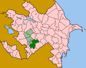
Khojavend is a rayon of Azerbaijan. It has been controlled by the breakaway Nagorno-Karabakh Republic since the Nagorno-Karabakh War except easternmost part, with its northeast half as part of Martuni Province and the rest as part of Hadrut Province.

Ucar is a city and the centre of the Ujar Rayon of Azerbaijan.

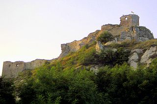
Sirok is a historic village in Heves county in Hungary, situated near Eger in Mátra mountains. Today it is most known for its 13th-century castle ruins.
KVRP is a commercial radio station located in Stamford, Texas, broadcasting to the northern sections of the Abilene, Texas, area. KVRP airs a Christian contemporary music format branded as "The River". The programming is syndicated by Salem Radio Network.

Ayaq Qərvənd is a village in the Agdam Rayon of Azerbaijan. The village forms part of the municipality of Qərvənd.

Saatlı is a city in and the capital of the Saatly Rayon of Azerbaijan.

Zərdab is a city in and the capital of the Zardab Rayon of Azerbaijan.
Dadaşlı is a village in the municipality of Xındırıstan in the Agdam Rayon of Azerbaijan.
Şükürağalı is a village in the municipality of Çəmənli in the Agdam Rayon of Azerbaijan.
Paşabəyli is a village in the municipality of Xındırıstan in the Agdam Rayon of Azerbaijan.
Kiçikli is a village in the municipality of Üçoğlan in the Agdam Rayon of Azerbaijan.
İsalar is a village in the municipality of Əfətli in the Agdam Rayon of Azerbaijan.
Qəhrəmanbəyli is a village in the municipality of Əfətli in the Agdam Rayon of Azerbaijan.
Məmmədbağırlı is a village in the municipality of Əfətli in the Agdam Rayon of Azerbaijan.
Birinci Dördyol is a village in the municipality of Təzəkənd in the Agdam Rayon of Azerbaijan.
İkinci Baharlı is a village in the municipality of Üçoğlan in the Agdam Rayon of Azerbaijan.
Birinci Baharlı is a village in the municipality of Üçoğlan in the Agdam Rayon of Azerbaijan.

Laskowicki Tartak is a settlement in the administrative district of Gmina Prabuty, within Kwidzyn County, Pomeranian Voivodeship, in northern Poland. It lies approximately 8 kilometres (5 mi) north-west of Prabuty, 14 km (9 mi) north-east of Kwidzyn, and 71 km (44 mi) south-east of the regional capital Gdańsk.
Ibrohamane is a village and rural commune in Niger.

Flåmselvi or Moldåni is a 40-kilometre (25 mi) long river in Norway. The river begins as runoff from the Omnsbreen glacier about 5 kilometres (3.1 mi) northwest of Finse in the municipality of Ulvik in Hordaland county. The river is known as the Moldåni river in this area. It then flows through a series of lakes heading to the northwest where it crosses into Aurland municipality in Sogn og Fjordane county. The Bergen Line follows the river to Myrdal. At Myrdal, the river goes over the Kjosfossen waterfall and it follows Flåmsdalen and heads to the north. When it reaches the village of Flåm, it empties into Aurlandsfjorden, a branch off the main Sognefjorden.


