Coordinates: 40°14′N48°09′E / 40.233°N 48.150°E
A geographic coordinate system is a coordinate system that enables every location on Earth to be specified by a set of numbers, letters or symbols. The coordinates are often chosen such that one of the numbers represents a vertical position and two or three of the numbers represent a horizontal position; alternatively, a geographic position may be expressed in a combined three-dimensional Cartesian vector. A common choice of coordinates is latitude, longitude and elevation. To specify a location on a plane requires a map projection.
Bala-Muradkhan | |
---|---|
Coordinates: 40°14′N48°09′E / 40.233°N 48.150°E | |
Country | |
Rayon | Kurdamir |
Time zone | AZT (UTC+4) |
• Summer (DST) | AZT (UTC+5) |
Bala-Muradkhan is a village in the Kurdamir Rayon of Azerbaijan (AJ).
Azerbaijan, officially the Republic of Azerbaijan, is a country in the South Caucasus region of Eurasia at the crossroads of Eastern Europe and Western Asia. It is bounded by the Caspian Sea to the east, Russia to the north, Georgia to the northwest, Armenia to the west and Iran to the south. The exclave of Nakhchivan is bounded by Armenia to the north and east, Iran to the south and west, and has an 11 km long border with Turkey in the northwest.
This is a list of the extreme points of Azerbaijan, the points that are farther north, south, east or west than any other location.
Černík is a village and municipality in the Nové Zámky District in the Nitra Region of south-west Slovakia.
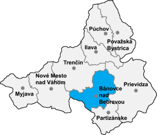
Pečeňany is a village and municipality in Bánovce nad Bebravou District in the Trenčín Region of north-western Slovakia.
Zərdab is a village in the Agsu Rayon of Azerbaijan.
Vovlada is a village in the Astara Rayon of Azerbaijan. The village forms part of the municipality of Lomin. Vovlada in Astara (region) is a town located in Azerbaijan, about 145 miles South-West of Baku, the country's capital town.
İkinci Paşalı is a village in the Hajigabul Rayon of Azerbaijan. The village forms part of the municipality of Şorbaçı.
Əyyubbəyli is a village in the Ismailli Rayon of Azerbaijan. The village forms part of the municipality of Gəraybəyli.
Bığır is a village in the Ismailli Rayon of Azerbaijan.
Bala Kəngərli is a village and municipality in the Kurdamir Rayon of Azerbaijan.
Sırt Çiçi is a village in the Quba Rayon of Azerbaijan. The village forms part of the municipality of Səbətlər.
Bala Soltanlı is a village in the Qubadli Rayon of Azerbaijan. Bala Soltanlı is the Azeri village in Qubadli
Bala Söyüdlü is a village in the Shaki Rayon of Azerbaijan.
Bala Qusarqışlaq is a village in the Khachmaz Rayon of Azerbaijan. The village forms part of the municipality of Həsənqala.
Agadzhaly is a village in the Imishli Rayon of Azerbaijan.
Uştalqışlaq is a village and municipality in the Ismailli Rayon of Azerbaijan. It has a population of 233.
Bala Şahağac is a village and municipality in the Astara Rayon of Azerbaijan. It has a population of 1,379. The municipality consists of the villages of Bala Şahağac and Qamışovka.
Vilmány is a village in Borsod-Abaúj-Zemplén County in northeastern Hungary.
Gərməxana is a former village in what is now the Ismailli Rayon of Azerbaijan. It suffered from a devastating fire in 1902.
Anosibe An'ala is a city in Anosibe An'ala District, Alaotra-Mangoro Region, Madagascar. It is situated at 72 km from Moramanga to which it is linked by the unpaved road RIP23 that is only suitable for 4x4 driven cars.
The Sandrangato is a river that flows near Anosibe An'ala, Alaotra-Mangoro Region, Madagascar. It is located at 72 km from Moramanga.
This Kurdamir Rayon location article is a stub. You can help Wikipedia by expanding it. |