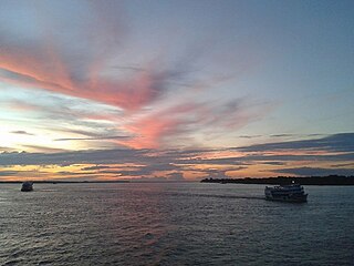
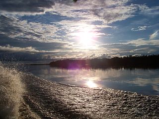
The Amazon River in South America is the largest river by discharge volume of water in the world, and the disputed longest river system in the world in comparison to the Nile.

The Juruá River is a southern affluent river of the Amazon River west of the Purus River, sharing with this the bottom of the immense inland Amazon depression, and having all the characteristics of the Purus as regards curvature, sluggishness and general features of the low, half-flooded forest country it traverses.

Amazonas is a state of Brazil, located in the North Region in the northwestern corner of the country. It is the largest Brazilian state by area and the 9th largest country subdivision in the world, and the largest in South America, being greater than the areas of Uruguay, Paraguay, and Chile combined. Mostly located in the Southern Hemisphere, it is the third largest country subdivision in the Southern Hemisphere after the Australian states of Western Australia and Queensland. Entirely in the Western Hemisphere it is the fourth largest in the Western Hemisphere after Greenland, Nunavut and Alaska. It would be the sixteenth largest country in land area, slightly larger than Mongolia. Neighbouring states are Roraima, Pará, Mato Grosso, Rondônia, and Acre. It also borders the nations of Peru, Colombia and Venezuela. This includes the Departments of Amazonas, Vaupés and Guainía in Colombia, as well as the Amazonas state in Venezuela, and the Loreto Region in Peru.

The Rio Negro, or Guainía as it is known in its upper part, is the largest left tributary of the Amazon River, the largest blackwater river in the world, and one of the world's ten largest rivers by average discharge.

Solimões is the name often given to upper stretches of the Amazon River in Brazil from its confluence with the Rio Negro upstream to the border of Peru.
Parima Tapirapecó National Park is a Venezuelan national park in the southern state of Amazonas.

The brownish elaenia is a species of bird in the family Tyrannidae, the tyrant flycatchers. It is found along the Amazon Basin rivers of Brazil; also northern Peru and the adjacent border of Colombia; also Bolivia. The rivers are the Xingu, Iriri, Madeira, and Juruá of Brazil, and the Marañón of Peru. Its natural habitat is subtropical or tropical moist lowland forests.
Demini River is a river in the Amazon rainforest of the state of Amazonas, Brazil. It is a tributary of the Rio Negro.
The Acurauá River (Portuguese: Rio Acurauá is a river of Acre and Amazonas states in western Brazil. It is a tributary of the Tarauacá River.
Cuieiras River is a river of the Barcelos municipality of Amazonas state in north-western Brazil. It is a tributary of the Demini River.

Içana River is a tributary of the Rio Negro in South America. Its source is in the Guainía Department of Colombia, where it is known as the Isana River. From its source, it flows mostly east until it reaches the border between Colombia and Brazil, where the river forms a small part of the boundary between the two countries. From the border, it flows mostly southeast through Amazonas state until it joins the Rio Negro at Missão Boa Vista.
The Jauaperi River is a river of Amazonas state in northwestern Brazil, a tributary of the Rio Negro.
The Unini River is a river of Amazonas state in north-western Brazil. It is a right tributary of the Rio Negro.

Vaupés River is a tributary of the Rio Negro in South America. It rises in the Guaviare Department of Colombia, flowing east through Guaviare and Vaupés Departments. It forms part of the international border between the Vaupés department of Colombia and the Amazonas state of Brazil. On the border it merges with the Papurí River and becomes known as the Uaupés. In 1847 an explorer saw a rapid which hurled its waves 12 or 15 metres in the air, "as if great subaqueous explosions were taking place." The river continues on east through the Alto Rio Negro Indigenous Territory until it flows into the Rio Negro at São Joaquim, Amazonas. Vaupés is a blackwater river.
Pardo River or Rio Pardo may refer to:
The Serra do Aracá State Park is a state park in the state of Amazonas, Brazil.
The Pira-tapuya, or variations like Pira-Tapuia, Piratapuyo, etc., or Tapuya for short, are an indigenous people of the Amazon regions. They live along the Vaupés River in Colombia and in the state of Amazonas, Brazil.
