Arjeplog

Last updated • 2 min readFrom Wikipedia, The Free Encyclopedia

Arjeplog
Arjeplog kyrka-2006-07-2006.JPG
Arjeplog vapen.svg
Sweden Norrbotten location map.svg
Red pog.svg
Arjeplog
Sweden location map.svg
Red pog.svg
Arjeplog
Coordinates: 66°03′N17°53′E / 66.050°N 17.883°E / 66.050; 17.883
CountrySweden
Province Lapland
County Norrbotten County
Municipality Arjeplog Municipality
Area
[1]
  Total
2.29 km2 (0.88 sq mi)
Population
 (31 December 2010) [1]
  Total
1,977
  Density863/km2 (2,240/sq mi)
Time zone UTC+1 (CET)
  Summer (DST) UTC+2 (CEST)

Arjeplog (Swedish: [ˈǎrːjɛplʊɡ] ; [2] Pite Sami: Árjepluovve) is a locality and the seat of Arjeplog Municipality in Norrbotten County, province of Lapland, Sweden with 1,977 inhabitants in 2010. [1]

Contents

It is a popular winter test site for the Asian and European car industries and featured on an episode of the British TV show Top Gear .

Arjeplog has in the past offered families 100,000 kronor, or individuals 25,000 kronor to move to the town. [3] [4]

History

The name, first recorded in 1636 as the name of the Sami village and in 1640 as the church and marketplace, is a Swedish adaptation of Árjepluovve. [5] [6] The suffix is pluovve, meaning 'wet marsh,' while the prefix contains the genitive of (h)árijje, meaning 'ridge'. [7]

Arjeplog is known for, among other things, "the Lapland doctor" Einar Wallquist's creation, the Silver Museum, which was inaugurated in 1965. Arjeplog is a church village in the Arjeplog parish that, when the 1862 municipal reform was implemented in Lapland, formed Arjeplog Rural Municipality in 1874. The Rural Municipality was, in 1971, transformed without changes into Arjeplog Municipality with Arjeplog as the central locality.

Climate

Arjeplog has a subarctic climate (Dfc) typical of northern Sweden. Its winters are somewhat moderated by the mild maritime North Atlantic air to the west, although they are still very cold, long and snowy. Summers are short but can occasionally be warm and they are also very bright due to Arjeplog's position close to the Arctic Circle. Daylight is sparse in winter, but during summer midnight sun is present for three weeks. [8] For an even longer period than that it does not get dark in Arjeplog. The presence of the midnight sun is in spite of Arjeplog being below the Arctic Circle, and is caused by the sun's trajectory not quite dropping below 0° in angle. As it is below the line Arjeplog does not experience complete lack of daylight during the winter solstice, but it is limited to less than three hours.

Arjeplog is located on the lake of Hornavan, that freezes over every winter due to the cold temperatures, whereas the lake temperatures remain cool also in summer.

Climate data for Arjeplog; 2002–2018 averages; extremes since 1945
MonthJanFebMarAprMayJunJulAugSepOctNovDecYear
Record high °C (°F)8.0
(46.4)
7.2
(45.0)
11.2
(52.2)
16.3
(61.3)
26.9
(80.4)
31.5
(88.7)
30.5
(86.9)
27.8
(82.0)
23.8
(74.8)
15.8
(60.4)
9.6
(49.3)
8.2
(46.8)
31.5
(88.7)
Mean maximum °C (°F)2.2
(36.0)
3.4
(38.1)
5.7
(42.3)
11.3
(52.3)
20.1
(68.2)
23.6
(74.5)
24.7
(76.5)
23.4
(74.1)
17.9
(64.2)
10.4
(50.7)
4.7
(40.5)
3.5
(38.3)
26.0
(78.8)
Mean daily maximum °C (°F)−7.8
(18.0)
−6.2
(20.8)
−1.4
(29.5)
4.3
(39.7)
10.6
(51.1)
15.5
(59.9)
19.2
(66.6)
16.8
(62.2)
11.3
(52.3)
3.6
(38.5)
−2.4
(27.7)
−5.0
(23.0)
4.9
(40.8)
Daily mean °C (°F)−12.1
(10.2)
−10.6
(12.9)
−6.3
(20.7)
−0.3
(31.5)
5.8
(42.4)
10.9
(51.6)
14.6
(58.3)
12.5
(54.5)
7.7
(45.9)
0.9
(33.6)
−5.5
(22.1)
−9.0
(15.8)
0.7
(33.3)
Mean daily minimum °C (°F)−16.4
(2.5)
−15.0
(5.0)
−11.1
(12.0)
−4.8
(23.4)
1.0
(33.8)
6.3
(43.3)
9.9
(49.8)
8.2
(46.8)
4.1
(39.4)
−1.9
(28.6)
−8.5
(16.7)
−12.9
(8.8)
−3.4
(25.8)
Mean minimum °C (°F)−31.1
(−24.0)
−30.1
(−22.2)
−24.9
(−12.8)
−15.4
(4.3)
−5.2
(22.6)
0.7
(33.3)
4.1
(39.4)
2.0
(35.6)
−2.5
(27.5)
−9.9
(14.2)
−20.4
(−4.7)
−27.5
(−17.5)
−33.6
(−28.5)
Record low °C (°F)−41.8
(−43.2)
−41.5
(−42.7)
−37.1
(−34.8)
−27.8
(−18.0)
−14.5
(5.9)
−3.0
(26.6)
0.0
(32.0)
−2.0
(28.4)
−7.2
(19.0)
−22.9
(−9.2)
−34.0
(−29.2)
−42.2
(−44.0)
−42.2
(−44.0)
Average precipitation mm (inches)35.1
(1.38)
27.6
(1.09)
25.8
(1.02)
25.4
(1.00)
36.7
(1.44)
54.0
(2.13)
84.1
(3.31)
69.8
(2.75)
52.6
(2.07)
40.2
(1.58)
38.9
(1.53)
40.2
(1.58)
530.4
(20.88)
Source 1: SMHI Open Data [9]
Source 2: SMHI climate data 2002–2018 [10]

See also

Related Research Articles

<span class="mw-page-title-main">Sápmi</span> Cultural region traditionally inhabited by the Sami people

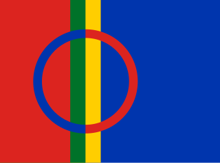
Sápmi is the cultural region traditionally inhabited by the Sámi people. Sápmi includes the northern parts of Fennoscandia, also known as the "Cap of the North".

<span class="mw-page-title-main">Norrbotten County</span> County (län) of Sweden

Norrbotten County is the northernmost county or län of Sweden. It is also the largest county by land area, almost a quarter of Sweden's total area. It shares borders with Västerbotten County to the southwest, the Gulf of Bothnia to the southeast, the counties of Nordland and Troms in Norway to the northwest, and Lapland Province in Finland to the northeast.

<span class="mw-page-title-main">Arjeplog Municipality</span> Municipality in Norrbotten County, Sweden

Arjeplog Municipality is a municipality in Norrbotten County in northern Sweden. Its seat is located in Arjeplog.

<span class="mw-page-title-main">Midnight sun</span> Natural phenomenon when daylight lasts for a whole day

Midnight sun, also known as polar day, is a natural phenomenon that occurs in the summer months in places north of the Arctic Circle or south of the Antarctic Circle, when the Sun remains visible at the local midnight. When midnight sun is seen in the Arctic, the Sun appears to move from left to right. In Antarctica, the equivalent apparent motion is from right to left. This occurs at latitudes ranging from approximately 65°44' to exactly 90° north or south, and does not stop exactly at the Arctic Circle or the Antarctic Circle, due to refraction.

In 1999, the Minority Language Committee of Sweden formally declared five official minority languages: Finnish, Sámi languages, Romani, Yiddish, and Meänkieli.

<span class="mw-page-title-main">Haparanda</span> Place in Norrbotten, Sweden

Haparanda is a locality and the seat of Haparanda Municipality in Norrbotten County, Sweden. It is adjacent to Tornio, Finland. Haparanda has a population of 9,166 inhabitants (2024).

<span class="mw-page-title-main">Överkalix</span> Place in Norrbotten, Sweden

Överkalix is a locality and the seat of Överkalix Municipality in Norrbotten County, Sweden with 975 inhabitants in 2010.

<span class="mw-page-title-main">Lycksele</span> Place in Lapland, Sweden

Lycksele is a locality and the seat of Lycksele Municipality in Västerbotten County, province of Lapland, Sweden with 8,513 inhabitants in 2010.

<span class="mw-page-title-main">Jokkmokk</span> Place in Lapland, Sweden

Jokkmokk is a locality and the seat of Jokkmokk Municipality in Norrbotten County, province of Lapland, Sweden, with 2,786 inhabitants in 2010. The Lule Sami name of the place means "River's Curve," due to the meandering river that runs through it. As in other towns in Lapland, the Swedish language is dominant at an official level in Jokkmokk in modern times. The settlement is just north of the Arctic Circle. Talvatissjön is located at the southern part of Jokkmokk.

<span class="mw-page-title-main">Gällivare</span> Place in Lapland, Sweden

Gällivare is a locality and the seat of Gällivare Municipality in Norrbotten County, province of Lapland, Sweden with 8,449 inhabitants in 2010. The town was founded in the 17th century. Together with nearby towns Malmberget and Koskullskulle it forms a conurbation with some 15,000 inhabitants. This conurbation is the second northernmost significant urban area of Sweden after Kiruna.

<span class="mw-page-title-main">Arvidsjaur</span> Place in Lapland, Sweden

Arvidsjaur is a locality and the seat of Arvidsjaur Municipality in Norrbotten County, province of Lapland, Sweden with 4,635 inhabitants in 2010.

<span class="mw-page-title-main">Abisko</span> Village in northern Sweden

Abisko is a village in Sápmi (Lapland), in northern Sweden, roughly 200 km north of the Arctic Circle, and near Abisko National Park, located 4 km west of the village. It had 85 inhabitants as of 2005.

<span class="mw-page-title-main">Lapland (Sweden)</span> Historical province of Sweden

Lapland, also known by its Swedish name Lappland, is a province in northernmost Sweden. It borders the Swedish provinces of Jämtland, Ångermanland, Västerbotten, and Norrbotten, as well as Norway and Finland. Nearly a quarter of Sweden's land area is in Lappland.

<span class="mw-page-title-main">Karesuando</span> Place in Lapland, Sweden

Karesuando is the northernmost locality in Sweden. It is situated in Kiruna Municipality, Norrbotten County, Sweden, with 303 inhabitants in 2010 and 350 in 2011.

<span class="mw-page-title-main">Nikkaluokta</span> Village in Gällivare, Norrbotten, Sweden

Nikkaluokta is a Swedish Sami village in Norrbotten County. The village belongs to Gällivare Municipality, bordering Kiruna Municipality, the closest urban area some 60 kilometers away. In its vicinity lie the areas of two Sami communities, Laevas and Girjas, who still herd semi-domesticated reindeer in the region.

Sámi schools, which were referred to as Nomad schools or Lapp schools before 1977, are a type of school in Sweden that runs parallel to the standard primary school system. Sámi schools are part of the Swedish public school system, and as such are governed by the same curriculum that primary schools are. Sámi schools are state-owned educational institutions that are open to all children whose parents identify as Sámi. Each school has its own dormitory that many students live in for large parts of the academic year due to the long distances in the north of Sweden.

<span class="mw-page-title-main">Ritsem</span> Village in the Gällivare Municipality, Sweden

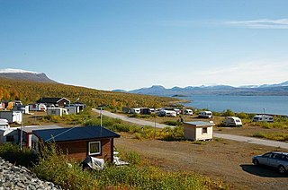
Ritsem is a village in the Gällivare Municipality, Norrbotten County, Sweden. It is located in the Stora Sjöfallet National Park. The area falls within the Swedish Lapland, and is home to the Sámi people during the reindeer migration. The town contains a 320 megawatt hydroelectric power plant, which sits inside a 16 km artificial tunnel connecting lake Sitasjaure to the Akkajaure reservoir. There is also a mountain cabin and caravan camp run by the Swedish Tourist Association.

<span class="mw-page-title-main">Climate of Sweden</span>

The south of Sweden has a temperate climate, despite its northern latitude, with largely four distinct seasons and mild temperatures throughout the year. The winter in the far south is usually weak and is manifested only through some shorter periods with snow and sub-zero temperatures, autumn may well turn into spring there, without a distinct period of winter. The northern parts of the country have a subarctic climate while the central parts have a humid continental climate. The coastal south can be defined as having either a humid continental climate using the 0 °C isotherm, or an oceanic climate using the –3 °C isotherm.

<span class="mw-page-title-main">Tjeggelvas</span> Lake in Arjeplog Municipality, Sweden

Tjeggelvas is a lake in northern Sweden. It is located in Arjeplog Municipality in the province of Swedish Lapland, and administratively of Norrbotten County and is part of the Pite River catchment area. Tjeggelvashas is on the western edge of the Scandinavian Mountains, with a high surface elevation of 450 m (1,480 ft). The nearest settlements, Jäkkvik and Arjeplog, are to the south, along the shores of the larger lake Hornavan.

<span class="mw-page-title-main">Sädvvájávrre</span> Lake in Arjeplog Municipality, Sweden.

Sädvvájávrre, or Sädvajaure, is a lake in Arjeplog Municipality in the province of Lapland, which is part of the main catchment area of the Skellefte River. The lake is 120 meters deep, covers an area of 40.1 square kilometers and has an elevation of 466.6 meters above sea level. Sädvvájávrre is located in the upper part of the Skellefte River and is drained by the same river. During test fishing, lake trout, arctic char, splejk (hybrid), and brown trout have been caught in the lake.

References

  1. 1 2 3 "Tätorternas landareal, folkmängd och invånare per km2 2005 och 2010" (in Swedish). Statistics Sweden. 14 December 2011. Archived from the original on 27 January 2012. Retrieved 10 January 2012.
  2. Jöran Sahlgren; Gösta Bergman (1979). Svenska ortnamn med uttalsuppgifter (in Swedish). p. 4.
  3. "Swedish town: 'Go north and claim your reward'". Thelocal.se . Retrieved 29 December 2014.
  4. "Foreigners tempted by Swedish town's cash incentive". Thelocal.se . Retrieved 29 December 2014.
  5. "Arieploo" – Länsräkenskaper 1631–1820, Norrlands län 1635: Mantalslängd för Pite lappmark 1636, fol. 195. Riksarkivet, Stockholm.
  6. "AriePlogh" – Bergskollegii arkiv: Registratur 1640 under d. 22 juli, fol. 117. Riksarkivet, Stockholm.
  7. "Svenskt ortnamnslexikon | WorldCat.org". search.worldcat.org. Retrieved 1 August 2024.
  8. "Arjeplog, Sweden; Sunrise and sunset for June 2016". Sunrise and Sunset.com. Retrieved 8 January 2016.
  9. "SMHI Öppen Data för Arjeplog" (in Swedish). Swedish Meteorological and Hydrological Institute (Arjeplog code 16 771 ).
  10. "Yearly & Monthly statistics" (in Swedish). SMHI. 9 June 2019. Archived from the original on 2 May 2019. Retrieved 27 February 2015.