Arjuni Morgaon

Last updated

Arjuni Morgaon
Arjuni
City
Arjuni.jpg
Nickname: 
Rice City
India Maharashtra location map.svg
Red pog.svg
Arjuni Morgaon
Location in Maharashtra, India
Coordinates: 20°49′3.216″N80°1′52.097″E / 20.81756000°N 80.03113806°E / 20.81756000; 80.03113806
CountryFlag of India.svg  India
State Maharashtra
District Gondia
Taluka Arjuni Morgaon
Government
  Type Municipal Council
  Body Arjuni Municipal Council
Area
  Total8 km2 (3 sq mi)
  Rank4th in Gondia.
Population
 (2011)
  Total16,705
  Rank4th in Gondia
  Density2,100/km2 (5,400/sq mi)
Demonym Arjunikar
Language
  Official Marathi [1]
Time zone UTC+5:30 (IST)
PIN
441 701
Telephone code07196
Vehicle registration MH-35
Nearest city Gondia and Tirora
Climate Dry & hot (Köppen)

Arjuni Morgaon is a city and municipal council in the Arjuni Morgaon subdivision of Gondia district in the Vidharbha region in the state of Maharashtra, India. It is also connected with MSH-11.

Contents

Environs

Deer at Navegaon Bandh National Park. Beautiful Deer At Navegaon Bandh National Park..jpg
Deer at Navegaon Bandh National Park.

The subdivision is known for its rice crops and greenery, as most of the land is forested. Itiyadoh Dam situated around 18 km from Arjuni. It is a naturally formed dam build upon a single wall. Several hectares of land are under irrigation because of this dam.

Navegaon Bandh National Park and Bird Sanctuary is around 12 km from Arjuni is a well-known picnic spot. One can enjoy boating in the beautiful pond. Arjuni also has Charbhatti Hanuman Temple Near to Gondia-Balharshah Line At deep in Forest.

There is also a Tibetan Refugee camp all over Maharashtra located approximately 15 km from Arjuni, providing cultural diversity to the region. They have temples that are open to every visitor, a national bank, hotels, colleges and communal schools. The Tibetan temples are architecturally very exotic and were inspired by models from Tibet. It is also famous in Gondia for its school Saraswati Vidyalaya Arjuni/Morgaon.

Economy

The economy of the village is mainly agriculture-based and most of the people are either farmers or farm workers. There are a lot of rice mills in Arjuni Moragon.

Demographics

Marathi is the official and most spoken language of the village. In Arjuni Morgaon taluka, the population is 148265. [2]

YearMaleFemaleTotal PopulationChangeReligion (%)
HinduMuslimChristianSikhsBuddhistJainOther religions and persuasionsReligion not stated
2001 [3] 6928567695136980-78.7450.8540.0600.05119.2680.0430.9130.066
2011 [2] 74703735621482658.23879.2800.9930.1210.07418.5420.0510.2300.708

Road

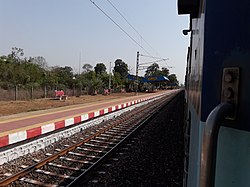
Arjuni Morgaon is well connected to major industrial and commercial places by road. It is about 130 km from the city of Nagpur and about 80 km from district headquarters, Gondia. The Maharashtra State Road Transport Corporation runs buses and Private buses connecting Arjuni Morgaon to Nagpur via Lakhandur, Pauni, Umred to Nagpur. Important roads that link Arjuni Morgaon connected with national highway 753, state highways MSH-11, 275, 354, 366, and district road MDR-36.

Railway

Arjuni railway station connects to Gondia-Balharshah Electric BG Line (280 km Broad gauge) with stoppage of all types of Express and Passenger trains.

Air

Nearest airports are Dr. Babasaheb Ambedkar International Airport, Nagpur is about 130 km and Gondia Airport is about 80 km from Arjuni Morgaon.

Tourism

Villages

mahagaon/ siroli

Related Research Articles

<span class="mw-page-title-main">Gondia district</span> District of Maharashtra in India

Gondia district is an administrative district in the state of Maharashtra in India. The district headquarter is located at Gondia. The district occupies an area of 5,234 km2 (2,021 sq mi) and has a population of 1,322,507 of which 11.95% were urban. The district is part of Nagpur Division. There are 8 Talukas in Gondia District. Gondia Airport is second airport in Vidharbha region and serves city of Gondia.

<span class="mw-page-title-main">Navegaon National Park</span> Nawegaon Nagzira Tiger Reserve in Maharashtra, India

Navegaon National Park is a National park located in the Arjuni Morgaon subdivision of Gondia district in state of Maharashtra, India. The Dr Salim Ali Bird Sanctuary, Navegaon is home to almost 60% of the bird species found in entire Maharashtra. Every winter, flocks of migratory birds visit the lake. The national park has diverse type of vegetation ranging from dry mixed forest to moist forest. The forest type is 5 A/C3. Southern tropical dry deciduous forest.

<span class="mw-page-title-main">Gondia</span> City in Maharashtra, India

Gondia is a city and municipal council in the Indian state of Maharashtra which serves the administrative headquarters of the eponymous administrative district. Gondia is also known as Rice City due to the abundance of rice mills in the area. Gondia Airport is the only airport in the district.

<span class="mw-page-title-main">Chandrapur</span> City in Maharashtra, India

Chandrapur is a city and a municipal corporation in Chandrapur district, Maharashtra state, India. It is the district headquarters of Chandrapur district. Chandrapur is a fort city founded by Khandkya Ballal Shah, a Gond king of the 13th century. The city sits at the confluence of the Erai river and Zarpat river. The area around the city is rich in coal seams.. Hence, Chandrapur is also known as the "Black Gold City".

<span class="mw-page-title-main">Geography of Maharashtra</span>

The word Maharashtra, the land of the mainly Marathi-speaking people, appears to be derived from Maharashtri, an old form of Prakrit. Some believe that the word indicates that it was the land of the Mahars and the Rattas, while others consider it to be a corruption of the term 'Maha Kantara', a synonym for 'Dandakaranya'. Maharashtra is the third largest state in India after Rajasthan and Madhya Pradesh. It covers an area of 307,713 km2 and is bordered by the states of Madhya Pradesh to the north, Chhattisgarh to the east, Telangana to the southeast, Karnataka to the south and Goa to the southwest. The state of Gujarat lies to the northwest, with the Union territory of Dadra and Nagar Haveli sandwiched between the borders. Maharashtra has coastline of 720 km.The Arabian Sea makes up Maharashtra's west coast. Maharashtra consists of two major relief divisions. The plateau is a part of the Deccan tableland and the Konkan coastal strip abutting on the Arabian Sea.

<span class="mw-page-title-main">Sakoli</span> City in Maharashtra, India

Sakoli is a city and a municipal council in Bhandara district in the Indian state of Maharashtra. It is connected with NH-53 and NH-353C.

Sadak Arjuni is a town, a Nagar panchayat & tehsil in Gondia district in the state of Maharashtra, India. It is connected to National Highway NH-6.

Mohadi is a large village and a tehsil in Bhandara subdivision of Bhandara district in Nagpur revenue Division in the Berar region in the state of Maharashtra, India. It is located on the Maharashtra State Highway-273.

Nagbhir or Nagbhid is a town and a municipal council in Chandrapur district in the Indian state of Maharashtra. It Connected to NH-353D and MSH-9.

Sindewahi is a town and Nagar Panchayat in Chandrapur district, Maharashtra, India. Notable villages in this tehsil are Navargaon, Ladbori and Ramala. Nagpur, the nearest large city, is about 130 kilometres (81 mi) away. According to the 2011 census it has a population of 12914 living in 3214 households.

<span class="mw-page-title-main">Tourism in Maharashtra</span>

Maharashtra attracts tourists from other Indian states and foreign countries. It was the second most visited Indian state by foreigners and fifth most visited state by domestic tourists in the country in 2021. Aurangabad is the tourism capital of Maharashtra.

Bor Tiger Reserve is a wildlife sanctuary which was declared as a tiger reserve in July 2014. It is located near Hingani in Wardha District in the Indian state of Maharashtra. It is a home to a variety of wild animals. The reserve covers an area of 138.12 km2 (53.33 sq mi). which includes the drainage basin of the Bor Dam.

Gondia Junction serves Gondia in Gondia district in the Indian state of Maharashtra. It is one of the important railway stations in India of South East central railways zone railways. This station is India's third and first in Vidarbha to get mist cooling system.Its falls under nagpur division

<span class="mw-page-title-main">Balharshah Junction railway station</span> Railway Station in Maharashtra, India

Balharshah Junction railway station is a railway station serving Ballarpur town, in Chandrapur district of Maharashtra state in India. Established by the Nizam's Guaranteed State Railway, it is now under the Nagpur CR railway division of Central Railway Zone of Indian Railways. It is an important junction on New Delhi–Chennai main line of Indian Railways. It is located at 185 m above sea level and has 5 platforms. The Ballarshah–Wardha–Nagpur section was electrified in 1989.

Maharashtra State Highway 255 is a normal state highway in Nagpur and Wardha Districts, in the state of Maharashtra. This state highway touches Nagpur, Hingna, Kanolibara, Hingni, connecting with MSH-3 at Seloo. The inner ring road and outer ring road also crossing this highway.

<span class="mw-page-title-main">Rajkumar Badole</span> Indian politician

Rajkumar Badole is an Indian politician. He is a Bharatiya Janata Party member and had represented Arjuni Morgaon in 13th Maharashtra Legislative Assembly in Devendra Fadnavis ministry.

<span class="mw-page-title-main">Arjuni-Morgaon Assembly constituency</span> Constituency of the Maharashtra legislative assembly in India

Arjuni Morgaon is one of the 288 Vidhan Sabha constituency of Maharashtra state in India. This Constituency is one of the three Constituencies located in the Gondia district.

Chanda Fort Railway Station is one of the two main railway stations serving Chandrapur city in Chandrapur district in Maharashtra state in India. It is under Nagpur SEC railway division of South East Central Railway zone of Indian Railways. It is located on Gondia–Nagbhid–Balharshah line of Indian Railways.

National Highway 753, commonly referred to as NH-753 is a Major Highway in Maharashtra, India. It connected with Major Cities as Savner, Tumsar,Tirora, Gondia, Arjuni Morgaon and Others Villages Goregaon, Gondia, Sadak Arjuni and one of Important National Park Navegaon National Park which is Famous Tourists Attractions for Peoples in India.

Nagbhir Junction railway station is a junction railway station on Gondia–Nagbhir–Balharshah line and Nagpur–Nagbhir line in Nagpur SEC railway division of South East Central Railway Zone of Indian Railways. It serves Nagbhid town in Chandrapur district in Maharashtra state in India. It is located at 246 m above sea level and has two platforms. 12 trains stop at this station.

References

  1. "552nd Report of the Commissioner for Linguistic Minorities in India" (PDF). nclm.nic.in. Ministry of Minority Affairs. Archived from the original (PDF) on 25 May 2017. Retrieved 29 March 2019.
  2. 1 2 Census India 2011.
  3. Census India 2001.