Arlington Station, California

Last updated
Arlington Station
neighborhood
USA California location map.svg
Red pog.svg
Arlington Station
Location in California
Coordinates: 33°54′51″N117°26′28″W / 33.91417°N 117.44111°W / 33.91417; -117.44111 Coordinates: 33°54′51″N117°26′28″W / 33.91417°N 117.44111°W / 33.91417; -117.44111
Country Flag of the United States.svg  United States
State Flag of California.svg  California
County Riverside County
City Riverside
Elevation [1] 249 m (817 ft)

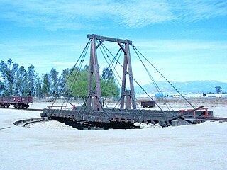
Arlington Station (formerly, Arlington) is a former unincorporated community, now annexed to Riverside in Riverside County, California. [1] It lies at an elevation of 817 feet (249 m). [1] Arlington Station is located on the Atchison, Topeka and Santa Fe Railroad, 6 miles (9.7 km) southwest of downtown Riverside. [2]

Unincorporated area Region of land not governed by own local government

In law, an unincorporated area is a region of land that is not governed by a local municipal corporation; similarly an unincorporated community is a settlement that is not governed by its own local municipal corporation, but rather is administered as part of larger administrative divisions, such as a township, parish, borough, county, city, canton, state, province or country. Occasionally, municipalities dissolve or disincorporate, which may happen if they become fiscally insolvent, and services become the responsibility of a higher administration. Widespread unincorporated communities and areas are a distinguishing feature of the United States and Canada. In most other countries of the world, there are either no unincorporated areas at all, or these are very rare; typically remote, outlying, sparsely populated or uninhabited areas.

Riverside, California City in California

Riverside is a city in Riverside County, California, United States, located in the Inland Empire metropolitan area. Riverside is the county seat of the eponymous county and named for its location beside the Santa Ana River. It is the most populous city in the Inland Empire and in Riverside County, and is located about 55 miles (89 km) east of downtown Los Angeles. It is also part of the Greater Los Angeles area. Riverside is the 59th most populous city in the United States and 12th most populous city in California. As of the 2010 Census, Riverside had a population of 303,871.

Riverside County, California County in California, United States

Riverside County, is one of fifty-eight counties in the U.S. state of California. As of the 2010 census, the population was 2,189,641, making it the 4th-most populous county in California and the 11th-most populous in the United States. The name was derived from the city of Riverside, which is the county seat.

Related Research Articles

Arlington may refer to:

Hell is a locale in Riverside County, California, United States, approximately 29 miles (47 km) west of Blythe on Interstate 10.

Lost Lake Resort, California Unincorporated community in California, United States

Lost Lake is a desert community located along the west shore of the Colorado River. It also lies along U.S. Route 95 near the northeast extent of Riverside County. Official U.S. Geological Survey feature ID is 245216 and NAD27 coordinates for the community are 34°00′44″N114°28′27″W. The community lies at the foot of Riverside Mountain, 34°00′49″N114°30′45″W, with a summit measuring 2,127 feet. The community is named for a lake, Lost Lake, located at 34°01′20″N114°28′21″W.

River Bend Lodge, California Unincorporated community in California, United States

River Bend Lodge is an unincorporated community in Riverside County, California, also known as Aha Quin. The community is near Hall Island along the Colorado River and hosts Riverside County Fire Department, Station 46. River Bend Lodge is also inside the Mojave Desert Air Quality Management District.

The University of California Citrus Experiment Station is the founding unit of the University of California, Riverside campus in Riverside, California, United States. The station contributed greatly to the cultivation of the orange and the overall agriculture industry in California. Established February 14, 1907, the station celebrated its 100th anniversary in 2007.

Arlington, California neighborhood in Riverside County, California, United States

Arlington is a community about seven miles southwest of Riverside, California that is part of the Inland Empire, which is east of the Los Angeles and Orange County metropolitan areas.

Box Springs, California Unincorporated community in California, United States

Box Springs is an unincorporated community in Riverside County, California. Box Springs is located 5 miles (8.0 km) east-southeast of downtown Riverside on Interstate 215/State Route 60.

Pinacate, California human settlement in United States of America

Pinacate, was a small settlement east of the Pinacate Mining District in Riverside County, California. It was established when the California Southern Railroad line was built between Colton and San Diego in 1882. Due to a land title dispute the town was moved to the north to become Perris, California, in 1885.

Riverside Park, California Unincorporated community in California, United States

Riverside Park is an unincorporated community in Humboldt County, California. It is located on the Van Duzen River 7 miles (11 km) north-northwest of Redcrest, at an elevation of 253 feet. Area buildings are primarily summer home properties along the river.

Riverside, California, was founded in 1870, and named for its location beside the Santa Ana River. It became the county seat when Riverside County, California, was established in 1893.

Mystic River Reservation nature reserve in Massachusetts, United States of America

The Mystic River Reservation is a publicly owned nature preserve with recreational features located along the Mystic River in the towns of Winchester, Arlington, Medford, Somerville, Everett, and Chelsea in eastern Massachusetts. The reserve is part of the nearly 76-square-mile (200 km2) Mystic River watershed. It is managed by the Massachusetts Department of Conservation and Recreation.

Frank Augustus Miller American hotelier

Frank Augustus Miller was the owner and chief developer of the Mission Inn in Riverside, California, United States, where Frank Augustus Miller Middle School was named after him. He was also a civic leader and one of Riverside's strongest promoters.

Bergman is a former settlement in Riverside County, California. Bergman was located 3 miles (4.8 km) east of Aguanga.

Alessandro, California Unincorporated community in California, United States

Alessandro is an unincorporated community in Riverside County, California. Alessandro is located on the Atchison, Topeka and Santa Fe Railroad, 9 miles (14.5 km) east of Riverside. It lies at an elevation of 1535 feet.

Arnold Heights, California Unincorporated community in California, United States

Arnold Heights is an unincorporated community in Riverside County, California. It lies at an elevation of 1558 feet. Arnold Heights is located 8 miles (12.9 km) southeast of Riverside.

Belltown, California Unincorporated community in California, United States

Belltown is an unincorporated community in Riverside County, California. It lies at an elevation of 840 feet. Belltown is located 2 miles (3.2 km) north of Riverside.

Bly, California Unincorporated community in California, United States

Bly is an unincorporated community in Riverside County, California. It lies at an elevation of 751 feet. Bly is located 6.5 miles (10.5 km) west of downtown Riverside.

Arlington Mountain mountain in Riverside County, California, United States of America

Arlington Mountain, a 1857 ft. peak, in the northern Temescal Mountains. It is located northwest of nearby Lake Mathews, overlooking western Riverside, in Riverside County, California.

References

  1. 1 2 3 U.S. Geological Survey Geographic Names Information System: Arlington Station, California
  2. Durham, David L. (1998). California's Geographic Names: A Gazetteer of Historic and Modern Names of the State. Clovis, Calif.: Word Dancer Press. p. 1390. ISBN   1-884995-14-4.