Related Research Articles

Oaxaca, officially the Free and Sovereign State of Oaxaca, is one of the 32 states that compose the Federative Entities of Mexico. It is divided into 570 municipalities, of which 418 are governed by the system of usos y costumbres with recognized local forms of self-governance. Its capital city is Oaxaca de Juárez.

The Isthmus of Tehuantepec is an isthmus in Mexico. It represents the shortest distance between the Gulf of Mexico and the Pacific Ocean. Before the opening of the Panama Canal, it was a major overland transport route known simply as the Tehuantepec Route. The name is taken from the town of Santo Domingo Tehuantepec in the state of Oaxaca; this was derived from the Nahuatl term Tēcuāntepēc.

Oaxaca is a state in Southern Mexico that is divided into 570 municipalities, more than any other state in Mexico. According to Article 113 of the state's constitution, the municipalities are grouped into 30 judicial and tax districts to facilitate the distribution of the state's revenues. It is the only state in Mexico with this particular judicial and tax district organization. Oaxaca is the tenth most populated state with 4,132,148 inhabitants as of the 2020 Mexican census and the fifth largest by land area spanning 93,757.6 square kilometres (36,200.0 sq mi).

Alebrijes are brightly colored Mexican folk art sculptures of fantastical (fantasy/mythical) creatures.
Huatulco, formally Bahías de Huatulco, centered on the town of La Crucecita, is a tourist development in Mexico. It is located on the Pacific coast in the state of Oaxaca. Huatulco's tourism industry is centered on its nine bays, thus the name Bahías de Huatulco, but has since been unofficially shortened to simply Huatulco. Huatulco has a wide variety of accommodation from rooms for rent, small economy hotels, luxury villas, vacation condominia, bed and breakfasts, as well as several luxury resorts standing on or near the shores of Tangolunda Bay. The Camino Real Zaashila, Quinta Real Huatulco, Las Brisas, Dreams Resort & Spa, and the Barceló are examples of the most popular larger resorts in the area.

The Guelaguetza, or Los lunes del cerro, is an annual indigenous cultural event in Mexico that takes place in the city of Oaxaca, capital of the state of Oaxaca, and nearby villages. The celebration features traditional costumed dancing by gender-separated groups. It includes native food, and statewide artisanal crafts, such as pre-Hispanic style textiles. Each costume, or traje, and dance usually has a local indigenous historical and cultural meaning. While the celebration has attracted an increasing number of tourists, it is primarily one of deep cultural importance for the indigenous peoples of the state and is important for the survival of these cultures.

The governor of Oaxaca, heads the executive branch of the Mexican state of Oaxaca. The office is created by the state constitution, which specifies a term of 6 years and prohibits reelection. The governor takes office on December 1, and the term ends on November 30 six years later.

The Triqui or Trique are an Indigenous people of the western part of the Mexican state of Oaxaca, centered in the municipalities of Juxtlahuaca, Putla, and Tlaxiaco. They number around 23,000 according to Ethnologue surveys. The Triqui language is a Mixtecan language of Oto-Manguean genetic affiliation. Trique peoples are known for their distinctive woven huipiles, baskets, and morrales (handbags).

Santa Cruz Xoxocotlán is a small city and municipality located 5 km from the state capital of Oaxaca in the south of Mexico. It is part of the Centro District in the Valles Centrales region. The name comes from the Nahuatl word “xocotl” which means “sour or sweet and sour fruit” with the duplicative “xo” to indicate “very.” The meaning of the entire phrase means “among the very sour fruits.” The Mixtec name for the area was Nuunitatnohoyoo which mean “land of the moon-faced flowers.” However, the community is most commonly referred to simply as Xoxo.

ARM Romero, also referred to as ARM Matias Romero, is a Sierra-class offshore patrol vessel of the Mexican Navy. The ship was constructed at Salina Cruz Shipyard in Salina Cruz, Oaxaca, with Romero being launched on 17 September 1999 and entering service the same day.
San Sebastián Tutla is a town and municipality in Oaxaca in south-western Mexico. The municipality covers an area of 8.93 km². It is part of the Centro District in the Valles Centrales region. As of 2010, the municipality had a total population of 16,241.

Istmo de Tehuantepec is the largest region of the state of Oaxaca, located in southwestern Mexico.

Centro District is located in the Valles Centrales Region of the State of Oaxaca, Mexico. The district includes the state capital Oaxaca and satellite towns. The district has an average elevation of 1,550 meters. The climate is mild, with average temperatures ranging from 16°C in Winter to 25°C in spring.
Putla District is located in the west of the Sierra Sur Region of the State of Oaxaca, Mexico.
Tehuantepec District is located in the west of the Istmo Region of the State of Oaxaca, Mexico. It includes the cities of Salina Cruz and Tehuantepec.
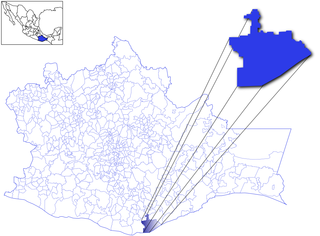
Juchitán District is located in the east of the Istmo de Tehuantepec region of the State of Oaxaca, Mexico, covering the southern part of a low-lying corridor through the mountains that separates the Gulf of Mexico from the Pacific Ocean. The district has an area of 13,300 km2 and a population as of 2005 of 339,445.
Tlaxiaco District is located in the south of the Mixteca Region of the State of Oaxaca, Mexico. The main city is the Heroic City of Tlaxiaco
Huajuapan District is located in the north of the Mixteca Region of the State of Oaxaca, Mexico. The principal city is Huajuapan de León.
According to the Mexican government agency Conapo, Oaxaca is the third most economically marginalized states in Mexico. The state has 3.3% of the population but produces only 1.5% of the GNP. The main reason for this is the lack of infrastructure and education, especially in the interior of the state outside of the capital. Eighty percent of the state's municipalities do not meet federal minimums for housing and education. Most development projects are planned for the capital and the surrounding area. Little has been planned for the very rural areas and the state lacks the resources to implement them. The largest sector of Oaxaca's economy is agriculture, mostly done communally in ejidos or similar arrangements. About 31% of the population is employed in agriculture, about 50% in commerce and services and 22% in industry. The commerce sector dominates the gross domestic product at 65.4%, followed by industry/mining at 18.9% and agriculture at 15.7%.

The Museo Estatal de Arte Popular de Oaxaca or MEAPO is a small museum in the municipality of San Bartolo Coyotepec just south of the city of Oaxaca in Mexico. It is run by the state of Oaxaca to showcase the entity's handcrafts and folk art tradition, through its permanent collection, online "cyber-museum", collaboration with national and international entities, and sponsorship of events such as craft markets, conferences, and temporary exhibitions. It is dedicated to the crafts and to the artisans and the cultures behind the items. Its collection contains samples of most of the crafts produced in the state, especially the Central Valleys region, but most of its collection consists of barro negro pottery, the specialty of San Bartolo Coyotepec. It is run by director Carlomagno Pedro Martínez, a recognized artisan and artist in barro negro.
References
- ↑ "Perfil del legislador". Legislative Information System. Retrieved 16 March 2019.
| | This article about a National Regeneration Movement (Morena) politician is a stub. You can help Wikipedia by expanding it. |