Arnheim, Ohio

Last updated

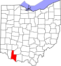
Arnheim is an unincorporated community in Brown County, in the U.S. state of Ohio. [1]

History

Arnheim was laid out in 1837, and named for Jacob Arn, the original owner of the town site (Arnheim meaning "Arn's home" in German). [2] A post office was established at Arnheim in 1839, and remained in operation until 1910. [3]

Related Research Articles

<span class="mw-page-title-main">Baraga Township, Michigan</span> Civil township in Michigan, United States

Baraga Township is a civil township of Baraga County in the U.S. state of Michigan. As of the 2020 census, the township population was 3,478. The village of Baraga is located in the southeast corner of the township.

<span class="mw-page-title-main">Feesburg, Ohio</span> Unincorporated community in Ohio, U.S.

Feesburg is a small unincorporated community in northern Lewis Township, Brown County, Ohio, United States. It is located on State Route 505. The ZIP code for Feesburg, Ohio is 45119.

<span class="mw-page-title-main">Lonedell, Missouri</span> Unincorporated community in the American state of Missouri

Lonedell is an unincorporated community in southeastern Franklin County, Missouri, United States. It is at the intersection of Route 30 and routes N and FF and approximately eight miles east of St. Clair. The Little Meramac River flows just south of the community.

<span class="mw-page-title-main">Culberson Woods State Nature Preserve</span> State Nature Preserve in Clinton County, Ohio

Culberson Woods State Nature Preserve is located in Clinton County, Ohio, United States. It protects one of the largest remnants of the white swamp forest which once covered the uplands of the Till Plans of Ohio and Indiana. This type of swamp has poorly drained, white clay soil and is wet in the winter but dry in the summer.

<span class="mw-page-title-main">Summerford, Ohio</span> Unincorporated community in Ohio, United States

Summerford is an unincorporated community in Somerford Township, Madison County, Ohio, United States. It is located at 39°56′00″N83°29′30″W, at the intersection of U.S. Route 40 and State Route 56.

Rabun County High School is a public high school operated by the Rabun County School District. It is located on the edge of Tiger, a town in Rabun County in the U.S. state of Georgia. It is the original venue of Foxfire magazine and related projects.

Eckmansville is an unincorporated community in Adams County, in the U.S. state of Ohio.

Rockville is an unincorporated community in Adams County, in the U.S. state of Ohio.

<span class="mw-page-title-main">Ash Ridge, Ohio</span> Unincorporated community in Ohio, U.S.

Ash Ridge is an unincorporated community in Brown County, in the U.S. state of Ohio.

Brownstown is an unincorporated community in Brown County, in the U.S. state of Ohio.

Fincastle is an unincorporated community in Brown County, in the U.S. state of Ohio.

Greenbush is an unincorporated community in Brown County, in the U.S. state of Ohio.

Hiett is an unincorporated community in Brown County, in the U.S. state of Ohio.

Levanna is an unincorporated community in Union Township, Brown County, in the U.S. state of Ohio.

New Hope is an unincorporated community in Brown County, in the U.S. state of Ohio.

Redoak is an unincorporated community in Brown County, in the U.S. state of Ohio.

Wahlsburg is an unincorporated community in Brown County, in the U.S. state of Ohio.

<span class="mw-page-title-main">White Oak Creek (Brown County, Ohio)</span>

White Oak Creek is a stream located primarily within Brown County, Ohio. It begins in Highland County, Ohio.

White Oak Valley is an unincorporated community in Brown County, in the U.S. state of Ohio.

Straight Creek is a stream entirely within Brown County, Ohio. It is a tributary of the Ohio River.

References

  1. U.S. Geological Survey Geographic Names Information System: Arnheim, Ohio
  2. The History of Brown County, Ohio: Containing a History of the County, Its Townships, Towns, Churches, Schools, Etc. Higginson Book Company. 1883. p. 544.
  3. "Brown County". Jim Forte Postal History. Retrieved December 17, 2015.

38°56′00″N83°49′39″W / 38.93333°N 83.82750°W / 38.93333; -83.82750