Lake Lorelei, Ohio | |
|---|---|
 Lake Lorelei | |
| Coordinates: 39°11′15″N83°58′17″W / 39.18750°N 83.97139°W | |
| Country | United States |
| State | Ohio |
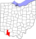
| County | Brown |
| Area | |
• Total | 2.45 sq mi (6.35 km2) |
| • Land | 2.20 sq mi (5.70 km2) |
| • Water | 0.25 sq mi (0.65 km2) |
| Elevation | 942 ft (287 m) |
| Population (2020) | |
• Total | 1,172 |
| • Density | 532.49/sq mi (205.56/km2) |
| Time zone | UTC-5 (Eastern (EST)) |
| • Summer (DST) | UTC-4 (EDT) |
| Area code | 513 |
| FIPS code | 39-41419 [3] |
| GNIS feature ID | 2628918 [2] |
Lake Lorelei is a gated community and census-designated place in Brown County, Ohio, United States, near the village of Fayetteville. [4] [2] As of the 2020 census, it had a population of 1,172. [5]