Lake Waynoka, Ohio

Last updated
Lake Waynoka, Ohio
CDP
Lakewaynoka rocks.jpg
View from dam
USA Ohio location map.svg
Red pog.svg
Lake Waynoka
Coordinates: 38°56′18″N83°46′35″W / 38.93833°N 83.77639°W / 38.93833; -83.77639
Country United States
State Ohio
County Brown
Area
[1]
  Total4.79 sq mi (12.40 km2)
  Land4.27 sq mi (11.05 km2)
  Water0.52 sq mi (1.35 km2)
Elevation
[2]
1,000 ft (300 m)
Population
 (2020)
  Total1,381
  Density323.57/sq mi (124.94/km2)
Time zone UTC-5 (Eastern (EST))
  Summer (DST) UTC-4 (EDT)
ZIP code
45171
Area code(s) 937, 326
FIPS code 39-41657 [3]
GNIS feature ID2628922 [2]

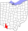
Lake Waynoka is a census-designated place (CDP) and gated community in Brown County, Ohio, United States, located around a similarly named reservoir between Sardinia and Russellville. The population was 1,381 at the 2020 census. [4]

Contents

Demographics

Historical population
CensusPop.Note
2020 1,381
U.S. Decennial Census [5]

History

In 1970, American Realty Service Corporation of Memphis, Tennessee, began the development of Lake Waynoka by buying farm land, damming the headwaters of Straight Creek, a tributary of the Ohio River, and dividing the land into lots roughly one-third of an acre in size. American Realty also created other lake communities.

Over the years, Lake Waynoka has transitioned from a weekend and summer get-away spot to a community of full-time residents with a high rate of continued growth. Migration from Cincinnati and Dayton has helped continue this growth.

Waynoka Reservoir

Lake Waynoka
USA Ohio relief location map.svg
Red pog.svg
Lake Waynoka
Location Brown County, Ohio
Coordinates 38°56′18″N83°46′35″W / 38.93833°N 83.77639°W / 38.93833; -83.77639
Type Reservoir
Basin  countriesUnited States
Surface area300 acres (120 ha)
Surface elevation984 feet (300 m)

Related Research Articles

<span class="mw-page-title-main">Lake Monticello, Virginia</span> Census-designated place in Virginia, United States

Lake Monticello, a private gated community, is a census-designated place (CDP) in Fluvanna County, Virginia, United States. The population was 10,126 at the 2020 census. The community is centered on a lake of the same name, which is formed by a dam on a short tributary of the nearby Rivanna River. Lake Monticello is part of the Charlottesville Metropolitan Statistical Area. Lake Monticello was developed in the 1960s as a summer vacation home community but quickly evolved into a bedroom community of Charlottesville, and to a smaller extent of Richmond. It also has a sizable retirement age population.

<span class="mw-page-title-main">Lewistown, Ohio</span> Census-designated place in Ohio, United States

Lewistown is an unincorporated community and census-designated place (CDP) in central Washington Township, Logan County, Ohio, United States. As of the 2010 census, the population was 222.

Lake Lorelei is a gated community and census-designated place in Brown County, Ohio, United States, near the village of Fayetteville. As of the 2020 census, it had a population of 1,172.

Lake Mohawk is a census-designated place (CDP) in Brown and Harrison townships of Carroll County, Ohio, United States, developed around Lake Mohawk, a reservoir. The population of the CDP was 1,652 as of the 2010 census.

<span class="mw-page-title-main">Pancoastburg, Ohio</span> Census-designated place in Ohio, United States

Pancoastburg is an unincorporated community and census-designated place (CDP) in Madison Township, Fayette County, Ohio, United States. It is located at 39°37′28″N83°15′56″W, along Ohio State Route 207, about 6 miles (10 km) south of Mount Sterling. As of the 2010 census the population of Pancoastburg was 87.

Cinnamon Lake is a census-designated place (CDP) within Jackson Township, Ashland County, Ohio, United States. The population was 1,237 at the 2020 census. It consists of a planned community surrounding a 135-acre (0.55 km2) reservoir also named Cinnamon Lake.

<span class="mw-page-title-main">Lake Tomahawk, Ohio</span> Census-designated place in Ohio, United States

Lake Tomahawk is an unincorporated community and census-designated place in central Middleton Township, Columbiana County, Ohio, United States, surrounding the Lake Tomahawk reservoir. The population was 494 at the 2020 census. It is part of the Salem micropolitan area, 24 miles (39 km) south of Youngstown and 38 miles (61 km) northwest of Pittsburgh. Lake Tomahawk was established in 1966 by the American Realty Service Corporation as a private planned community.

<span class="mw-page-title-main">Cordry Sweetwater Lakes, Indiana</span> Census-designated place in Indiana, United States

Cordry Sweetwater Lakes is a census-designated place (CDP) in Hamblen Township, Brown County, in the U.S. state of Indiana. The population was 1,128 at the 2010 census. Sweetwater Lake is 260 acres in size.

Lake Royale is a census-designated place (CDP) in southeastern Franklin County, North Carolina, United States. The population was 3,392 at the 2020 census.

<span class="mw-page-title-main">Guilford Lake, Ohio</span> Census-designated place in Ohio, United States

Guilford Lake is an unincorporated community and census-designated place in northeastern Hanover Township, Columbiana County, Ohio, United States. It surrounds the eponymous Guilford Lake reservoir. The population was 1,188 at the 2020 census. It is part of the Salem micropolitan area and the greater Youngstown–Warren area.

Lake Viking is an unincorporated community and census-designated place (CDP) in Daviess County, Missouri, United States. The population was 486 at the 2020 census.

Hide-A-Way Hills is a census-designated place (CDP) in Fairfield and Hocking counties in the U.S. state of Ohio. As of the 2010 census, the community had 688 residential units and a year-round population of 794.

<span class="mw-page-title-main">Apple Valley, Ohio</span> Census-designated place in Ohio, United States

Apple Valley is a census-designated place (CDP) in Knox County, in the U.S. state of Ohio. It consists of a planned community surrounding a 511-acre (2.07 km2) reservoir named Apple Valley Lake. As of the 2010 census the CDP had a population of 5,058.

Lake Dunlap is a census-designated place in Guadalupe County, Texas, United States. The population was 1,934 at the 2010 census. It is part of the San Antonio–New Braunfels metropolitan area.

<span class="mw-page-title-main">Smithville-Sanders, Indiana</span> Census-designated place in Indiana, United States

Smithville-Sanders is a census-designated place (CDP) encompassing the communities of Smithville and Sanders in Monroe County, Indiana, United States. Its population was 3,323 as of the 2020 census.

Leisure Lake is an unincorporated community and census-designated place (CDP) in Grundy County, Missouri, United States. As of the 2020 census, the population was 166.

Highland Holiday is an unincorporated community and census-designated place in Highland County, Ohio, United States. Its population was 550 as of the 2010 census.

Rocky Fork Point is an unincorporated community and census-designated place in Highland County, Ohio, United States. Its population was 639 as of the 2010 census.

Doe Valley is an unincorporated community and census-designated place (CDP) in Meade County, Kentucky, United States. Its population was 2,270 as of the 2020 census.

Suffield is an unincorporated community and census-designated place (CDP) in Suffield Township, Portage County, Ohio, United States. The population was 949 at the 2020 census. It was first listed as a CDP prior to the 2020 census.

References

  1. "ArcGIS REST Services Directory". United States Census Bureau. Retrieved September 20, 2022.
  2. 1 2 "US Board on Geographic Names". United States Geological Survey. 2007-10-25. Retrieved 2008-01-31.
  3. "U.S. Census website". United States Census Bureau . Retrieved 2008-01-31.
  4. "Geographic Identifiers: 2010 Demographic Profile Data (G001): Lake Waynoka CDP, Ohio". U.S. Census Bureau, American Factfinder. Archived from the original on February 12, 2020. Retrieved February 21, 2014.
  5. "Census of Population and Housing". Census.gov. Retrieved June 4, 2016.