Fayetteville, Ohio | |
---|---|
Coordinates: 39°11′07″N83°55′55″W / 39.18528°N 83.93194°W | |
Country | United States |
State | Ohio |
County | Brown |
Township | Perry |
Government | |
• Mayor | Jody F. Edwards [1] |
Area | |
• Total | 0.47 sq mi (1.22 km2) |
• Land | 0.47 sq mi (1.22 km2) |
• Water | 0.00 sq mi (0.00 km2) |
Elevation | 945 ft (288 m) |
Population (2020) | |
• Total | 317 |
• Estimate (2023) [4] | 310 |
• Density | 671.61/sq mi (259.06/km2) |
Time zone | UTC-5 (Eastern (EST)) |
• Summer (DST) | UTC-4 (EDT) |
ZIP code | 45118 |
Area code | 513 |
FIPS code | 39-26796 [5] |
GNIS feature ID | 2398868 [3] |
Website | https://www.fayettevilleoh.us/home/ |
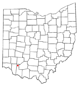
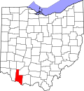
Fayetteville is a village in Perry Township, Brown County, Ohio, United States. The population was 317 at the 2020 census.
Fayetteville was founded in 1818 by an Irish immigrant named Cornelius McGroarty. It was later incorporated in 1868. In 1883, Fayetteville contained two churches, two schools, two hotels, several stores and saloons, and two drug stores. [6]
According to the United States Census Bureau, the village has a total area of 0.52 square miles (1.35 km2), all land. [7] It also rests on a bend of the East Fork Little Miami River.
Census | Pop. | Note | %± |
---|---|---|---|
1850 | 317 | — | |
1860 | 399 | 25.9% | |
1870 | 397 | −0.5% | |
1880 | 390 | −1.8% | |
1900 | 323 | — | |
1910 | 370 | 14.6% | |
1920 | 349 | −5.7% | |
1930 | 330 | −5.4% | |
1940 | 394 | 19.4% | |
1950 | 401 | 1.8% | |
1960 | 389 | −3.0% | |
1970 | 415 | 6.7% | |
1980 | 478 | 15.2% | |
1990 | 393 | −17.8% | |
2000 | 372 | −5.3% | |
2010 | 330 | −11.3% | |
2020 | 317 | −3.9% | |
2023 (est.) | 310 | [4] | −2.2% |
U.S. Decennial Census [8] |
As of the census [9] of 2010, there were 330 people, 128 households, and 85 families living in the village. The population density was 634.6 inhabitants per square mile (245.0/km2). There were 157 housing units at an average density of 301.9 per square mile (116.6/km2). The racial makeup of the village was 99.4% White, 0.3% African American, and 0.3% from other races. Hispanic or Latino of any race were 1.2% of the population.
There were 128 households, of which 39.8% had children under the age of 18 living with them, 49.2% were married couples living together, 11.7% had a female householder with no husband present, 5.5% had a male householder with no wife present, and 33.6% were non-families. 28.9% of all households were made up of individuals, and 12.5% had someone living alone who was 65 years of age or older. The average household size was 2.58 and the average family size was 3.14.
The median age in the village was 36.8 years. 26.4% of residents were under the age of 18; 7.9% were between the ages of 18 and 24; 23.7% were from 25 to 44; 28.2% were from 45 to 64; and 13.9% were 65 years of age or older. The gender makeup of the village was 49.1% male and 50.9% female.
As of the census [5] of 2000, there were 372 people, 142 households, and 93 families living in the village. The population density was 742.4 inhabitants per square mile (286.6/km2). There were 154 housing units at an average density of 307.3 per square mile (118.6/km2). The racial makeup of the village was 99.46% White, 0.27% African American, and 0.27% from two or more races.
There were 142 households, out of which 33.8% had children under the age of 18 living with them, 52.1% were married couples living together, 10.6% had a female householder with no husband present, and 34.5% were non-families. 26.8% of all households were made up of individuals, and 11.3% had someone living alone who was 65 years of age or older. The average household size was 2.62 and the average family size was 3.28.
In the village, the population was spread out, with 29.0% under the age of 18, 10.8% from 18 to 24, 32.0% from 25 to 44, 19.9% from 45 to 64, and 8.3% who were 65 years of age or older. The median age was 32 years. For every 100 females there were 93.8 males. For every 100 females age 18 and over, there were 94.1 males.
The median income for a household in the village was $34,375, and the median income for a family was $50,000. Males had a median income of $35,694 versus $26,667 for females. The per capita income for the village was $18,717. About 7.6% of families and 8.5% of the population were below the poverty line, including 8.6% of those under age 18 and 15.0% of those age 65 or over.
The village is served by Fayetteville-Perry High School. Fayetteville has a public library, a branch of the Brown County Public Library. [10]
Perry County is a county located in the U.S. state of Ohio. As of the 2020 census, the population was 35,408. Its county seat is New Lexington. It was established on March 1, 1818, from parts of Fairfield, Washington and Muskingum counties. The county is named for Oliver Hazard Perry, a hero of the War of 1812. Perry County is included in the Columbus, OH Metropolitan Statistical Area. One of the poorest counties in the state, this is where the lawsuit challenging Ohio's school funding system, DeRolph v. State, began.
Fayetteville is a village on the Kaskaskia River in St. Clair County, Illinois, United States. The population was 384 at the 2000 census.
St. Martin is an unincorporated community and former village in Brown County, Ohio, United States. The community is served by the Fayetteville (45118) post office. The population was 200 at the 2020 census. In November 2011, voters chose to unincorporate St. Martin, and it now falls solely under the jurisdiction of Perry Township.
Leesville is a village in southwestern Carroll County, Ohio, United States. The population was 127 at the 2020 census. It is part of the Canton–Massillon metropolitan area.
Addyston is a village in Miami Township, Hamilton County, Ohio, United States. Located along the Ohio River, it is a western suburb of the neighboring city of Cincinnati. The population was 927 at the 2020 census.
Brinkhaven, once known as Mount Holly and Gann, is a village in Knox County, Ohio, United States. The population was 114 at the 2020 census.
North Perry is a village in Lake County, Ohio, United States. The population was 915 at the 2020 census.
Perry is a village in Lake County, Ohio, United States. The population was 1,602 at the 2020 census.
Hartford is a village in the township of the same name in Licking County, Ohio, United States. The population was 404 at the 2020 census.
Corning is a village in Perry County, Ohio, United States. The population was 488 at the 2020 census.
Glenford is a village in Perry County, Ohio, United States. The population was 165 at the 2020 census.
Junction City is a village in Perry County, Ohio, United States. The population was 721 at the 2020 census.
New Straitsville is a village in Perry County, Ohio, United States. The population was 652 at the 2020 census.
Rendville is a village in Perry County, Ohio, United States. It is an old mining town in southeastern Appalachian Ohio. The population was 28 at the 2020 census, making it the smallest incorporated community in Ohio.
Shawnee is a village in Perry County, Ohio, United States. The population was 505 at the 2020 census. It is 9 miles (14 km) south of the county seat of New Lexington.
Thornville is a village in Perry County, Ohio, United States. It is 20 miles (32 km) north of the county seat of New Lexington. The village had a population of 1,087 as of the 2020 census.
Cloverdale is a village in Perry Township, Putnam County, Ohio, United States. The population was 170 at the 2020 census.
Burkettsville is a village in Darke and Mercer counties in the U.S. state of Ohio. The population was 272 at the 2020 census.
Roseville is a village in Muskingum and Perry counties in the U.S. state of Ohio, along Moxahala Creek. The population was 1,746 at the 2020 census. It is part of the Zanesville micropolitan area. Roseville is served by a branch of the Muskingum County Library System.
New Auburn is a village in Barron and Chippewa counties in the U.S. state of Wisconsin. The population was 562 at the 2020 census. Of these, 537 were in Chippewa County, and 25 were in Barron County. The village is located mostly within the Town of Auburn in Chippewa County. Small portions extend east into the adjacent Town of Bloomer, Chippewa County and north into the Town of Dovre in Barron County.