Higginsport, Ohio

Last updated

Higginsport, Ohio
HigginsportOH2.JPG
Looking east on Columbia Street (U.S. Route 52) in Higginsport
OHMap-doton-Higginsport.png
Location of Higginsport, Ohio
Map of Brown County Ohio Highlighting Higginsport Village.png
Location of Higginsport in Brown County
Coordinates: 38°47′23″N83°58′1″W / 38.78972°N 83.96694°W / 38.78972; -83.96694
Country United States
State Ohio
County Brown
Area
[1]
  Total0.29 sq mi (0.76 km2)
  Land0.25 sq mi (0.65 km2)
  Water0.04 sq mi (0.11 km2)
Elevation
[2]
512 ft (156 m)
Population
 (2020)
  Total213
  Density848.61/sq mi (327.88/km2)
Time zone UTC-5 (Eastern (EST))
  Summer (DST) UTC-4 (EDT)
ZIP code
45131
Area code(s) 937 And 326
FIPS code 39-35168 [3]
GNIS feature ID1064835 [2]

Higginsport is a village in Lewis Township, Brown County, Ohio, United States, along the Ohio River. The population was 213 at the 2020 census.

Contents

History

Higginsport corporation limit sign HigginsportOH1.JPG
Higginsport corporation limit sign

Col. Robert Higgins was a Revolutionary War officer who had received 1,000 acres (400 ha) of land in Brown County, Ohio for his service to his country. He and his family first moved onto the land in 1799, building a small crude cabin near what is now Higginsport. [4] On September 1, 1804, Higgins started surveying a new community named White Haven on his land, and that same month it was platted and recorded in Williamsburg. The community never grew, and after a number of years, was abandoned. [5] On February 28, 1816, Higgins again replatted the community, this time with 114 lots, and renamed it Higginsport. The street layout mostly followed the original White Haven lines. Higgins also donated a small cemetery (his wife the first person buried here) to the town, as well as land in the center of town for a public park, and about 15 acres (6.1 ha) on the edge of town called White Oak Bottom. [5] The first church was organized in 1818, and by 1819, there were 6 cabins here and a population of 6, but the community was growing. In 1828, a small store opened, which was expanded in 1832. In 1835, the first brick house was built in town, by Jesse Dugan, then owner of the store. Located at the corner of Water and Brown Streets, it was still standing in 2013. [5] [4] The Higgingsport Post Office was established on January 24, 1829, [6] with a Mr. Roberts, the town tailor, as Post Master. [5] Two more stores were opened in town in 1835 and 1839.

In 1880, the population was 862, and as of 1883, the community was described as a "thriving village", containing in total five general stores, one clothing store, two drug stores, two tin shops, one hardware store, four fancy stores, one tobacco store, several grocery stores, two blacksmiths, one wagon-maker, one tavern, a grist mill, a distillery, five doctors, and two hotels. [5]

White burley tobacco was first grown near Higginsport in 1864 from seed brought from Kentucky, [7] and by the 1880s, the local economy was largely based on it. In 1883, there were seventeen tobacco warehouses and 32 different tobacco buyers, shipping approx. 2 million pounds annually down the Ohio River to New Orleans. [5]

Two centuries of fires and floods have taken their toll on the communities original homes and businesses along the river front. [4]

Geography

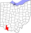
Higginsport is located in the southeastern part of Lewis Township near the mouth of White Oak Creek, at 38°47′23″N83°58′1″W / 38.78972°N 83.96694°W / 38.78972; -83.96694 (38.789585, -83.967055). [8]

According to the United States Census Bureau, the village has a total area of 0.29 square miles (0.75 km2), of which 0.25 square miles (0.65 km2) is land and 0.04 square miles (0.10 km2) is water. [9]

Demographics

Historical population
CensusPop.Note
1840 393
1850 53536.1%
1860 507−5.2%
1870 5304.5%
1880 76243.8%
1890 7640.3%
1900 650−14.9%
1910 417−35.8%
1920 353−15.3%
1930 3745.9%
1940 373−0.3%
1950 3853.2%
1960 4127.0%
1970 383−7.0%
1980 343−10.4%
1990 298−13.1%
2000 291−2.3%
2010 251−13.7%
2020 213−15.1%
U.S. Decennial Census [10]

2010 census

As of the census [11] of 2010, there were 251 people, 104 households, and 65 families living in the village. The population density was 1,004.0 inhabitants per square mile (387.6/km2). There were 138 housing units at an average density of 552.0 per square mile (213.1/km2). The racial makeup of the village was 96.8% White, 0.4% Native American, 0.8% from other races, and 2.0% from two or more races. Hispanic or Latino of any race were 1.2% of the population.

There were 104 households, of which 26.9% had children under the age of 18 living with them, 44.2% were married couples living together, 11.5% had a female householder with no husband present, 6.7% had a male householder with no wife present, and 37.5% were non-families. 32.7% of all households were made up of individuals, and 19.2% had someone living alone who was 65 years of age or older. The average household size was 2.41 and the average family size was 2.94.

The median age in the village was 44.5 years. 19.5% of residents were under the age of 18; 10.5% were between the ages of 18 and 24; 20.4% were from 25 to 44; 31.2% were from 45 to 64; and 18.7% were 65 years of age or older. The gender makeup of the village was 49.0% male and 51.0% female.

2000 census

As of the census [3] of 2000, there were 291 people, 114 households, and 77 families living in the village. The population density was 1,305.0 inhabitants per square mile (503.9/km2). There were 134 housing units at an average density of 600.9 per square mile (232.0/km2). The racial makeup of the village was 99.31% White, and 0.69% from two or more races. Hispanic or Latino of any race were 0.34% of the population.

There were 114 households, out of which 29.8% had children under the age of 18 living with them, 58.8% were married couples living together, 8.8% had a female householder with no husband present, and 31.6% were non-families. 30.7% of all households were made up of individuals, and 13.2% had someone living alone who was 65 years of age or older. The average household size was 2.55 and the average family size was 3.18.

In the village, the population was spread out, with 25.8% under the age of 18, 5.8% from 18 to 24, 27.1% from 25 to 44, 23.7% from 45 to 64, and 17.5% who were 65 years of age or older. The median age was 40 years. For every 100 females, there were 92.7 males. For every 100 females age 18 and over, there were 77.0 males.

The median income for a household in the village was $32,000, and the median income for a family was $37,188. Males had a median income of $30,625 versus $20,000 for females. The per capita income for the village was $10,989. About 9.6% of families and 11.5% of the population were below the poverty line, including 10.5% of those under the age of eighteen and 8.8% of those 65 or over.

Notable person

See also

Related Research Articles

<span class="mw-page-title-main">Rome, Ohio</span> Village in Ohio, United States

Rome, also known as Stout, is a village in Green Township, Adams County, Ohio, United States, along the Ohio River. The population was 83 at the 2020 census.

<span class="mw-page-title-main">Coolville, Ohio</span> Village in Ohio, United States

Coolville is a village located in Troy Township, Athens County, Ohio, United States, in the southeast area of the state. The population was 452 at the 2020 census.

<span class="mw-page-title-main">Powhatan Point, Ohio</span> Village in Ohio, United States

Powhatan Point is a village in southeastern Belmont County, Ohio, United States, along the Ohio River. The population was 1,461 at the 2020 census. It is part of the Wheeling metropolitan area.

<span class="mw-page-title-main">Mechanicsburg, Ohio</span> Village in Ohio, United States

Mechanicsburg is a village in Champaign County, Ohio, United States. The population was 1,681 at the 2020 census.

<span class="mw-page-title-main">Gettysburg, Ohio</span> Village in Ohio, United States

Gettysburg is a village in Darke County, Ohio, United States. The population was 463 at the 2020 census.

<span class="mw-page-title-main">Groveport, Ohio</span> City in Ohio, United States

Groveport is a city in Franklin County, Ohio, United States. It is a suburb of Columbus. The population was 6,009 at the 2020 census.

<span class="mw-page-title-main">Cleves, Ohio</span> City in Ohio, United States

Cleves is a village in Miami Township, Hamilton County, Ohio, United States, located along the Ohio River. The population was 3,414 at the 2020 census. Founded in 1818, it is named for John Cleves Symmes who lived here, laid out the original town site, and sold lots.

<span class="mw-page-title-main">Mowrystown, Ohio</span> Village in Ohio, United States

Mowrystown is a village in Highland County, Ohio, United States. The population was 385 at the 2020 census.

<span class="mw-page-title-main">St. Louisville, Ohio</span> Village in Ohio, United States

St. Louisville is a village in Licking County, Ohio, United States, along the North Fork of the Licking River. The population was 352 at the 2020 census.

<span class="mw-page-title-main">Mount Sterling, Ohio</span> Village in Ohio, United States

Mount Sterling is a village in Madison County, Ohio, United States. The population was 1,945 at the 2020 census. It is a part of the Columbus, Ohio Metropolitan Statistical Area.

<span class="mw-page-title-main">Republic, Ohio</span> Village in Ohio, United States

Republic is a village in Seneca County, Ohio, United States. The population was 549 at the 2010 census.

<span class="mw-page-title-main">Port Jefferson, Ohio</span> Village in Ohio, United States

Port Jefferson is a village in Salem Township, Shelby County, Ohio, United States. The population was 371 at the 2010 census.

<span class="mw-page-title-main">McDonald, Ohio</span> Village in Ohio, United States

McDonald is a village in southern Trumbull County, Ohio, United States, along the Mahoning River. The population was 3,172 at the 2020 census. It is a suburb of the Youngstown–Warren metropolitan area.

<span class="mw-page-title-main">Middle Point, Ohio</span> Village in Ohio, United States

Middle Point is a village in Van Wert County, Ohio, United States. The population was 576 at the 2010 census. It is included within the Van Wert, Ohio Micropolitan Statistical Area.

<span class="mw-page-title-main">Ohio City, Ohio</span> Village in Ohio, United States

Ohio City is a village in Liberty Township, Van Wert County, Ohio, United States. The population was 705 at the 2010 census. It is included within the Van Wert, Ohio Micropolitan Statistical Area.

<span class="mw-page-title-main">Waynesville, Ohio</span> Village in Ohio, United States

Waynesville is a village in Wayne Township, Warren County, Ohio, United States. The population was 2,669 at the 2020 census. It is named for General "Mad" Anthony Wayne. The village, located at the crossroads of U.S. Route 42 and State Route 73, is known for its antique stores and its annual sauerkraut festival. Caesar Creek State Park is located 5 miles (8.0 km) east of the village.

<span class="mw-page-title-main">Matamoras, Ohio</span> Village in Ohio, United States

Matamoras, also known as New Matamoras, is a village in Washington County, Ohio, United States, along the Ohio River. The population was 702 at the 2020 census. It is part of the Marietta micropolitan area.

Eagleton Village is a census-designated place (CDP) in Blount County, Tennessee. The population was 5,393 at the 2020 census. It is included in the Knoxville, Tennessee Metropolitan Statistical Area.

<span class="mw-page-title-main">Beech Bottom, West Virginia</span> Village in West Virginia, United States

Beech Bottom is a village in Brooke County, West Virginia, United States, situated along the Ohio River. The population was 523 at the 2010 census. It is part of the Weirton–Steubenville metropolitan area.

<span class="mw-page-title-main">Gratiot, Ohio</span> Village in Ohio, United States

Gratiot is a village in Licking and Muskingum counties in the U.S. state of Ohio. The population was 215 at the 2020 census.

References

  1. "ArcGIS REST Services Directory". United States Census Bureau. Retrieved September 20, 2022.
  2. 1 2 "US Board on Geographic Names". United States Geological Survey. October 25, 2007. Retrieved January 31, 2008.
  3. 1 2 "U.S. Census website". United States Census Bureau . Retrieved January 31, 2008.
  4. 1 2 3 Karle, Tina (2010). 120 Waterfall Hikes Around Cincinnati Ohio. Lulu.com. p. 14. ISBN   9780557378647 . Retrieved November 27, 2013.
  5. 1 2 3 4 5 6 The History of Brown County, Ohio: Containing a History of the County, Its Townships, Towns, Churches, Schools, Etc. Higginson Book Company. 1883. p. 472.
  6. U.S. Geological Survey Geographic Names Information System: Higginsport Post Office
  7. Federal Writers' Project (1996). The WPA Guide to Kentucky. University Press of Kentucky. p. 51. ISBN   0813108659 . Retrieved November 24, 2013.
  8. "US Gazetteer files: 2010, 2000, and 1990". United States Census Bureau. February 12, 2011. Retrieved April 23, 2011.
  9. "US Gazetteer files 2010". United States Census Bureau. Archived from the original on January 25, 2012. Retrieved January 6, 2013.
  10. "Census of Population and Housing". Census.gov. Retrieved June 4, 2015.
  11. "U.S. Census website". United States Census Bureau . Retrieved January 6, 2013.