Arnold Creek (West Virginia)

Last updated
Arnold Creek
Arnold Creek Doddridge County WV.jpg
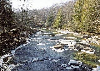
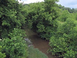
Arnold Creek in Doddridge County
Arnold Creek WV map.png
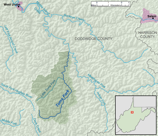
A map of Arnold Creek and its watershed
Location
Country United States
State West Virginia
Counties Doddridge, Tyler
Physical characteristics
SourceLeft Fork Arnold Creek
 - locationwest-northwest of Middle Point, Doddridge County
 - coordinates 39°12′46″N80°47′16″W / 39.2128626°N 80.7878823°W / 39.2128626; -80.7878823 [1]
 - length4.9 miles (7.9 km)
 - elevation1,100 ft (340 m) [2]
2nd sourceRight Fork Arnold Creek
 - locationnortheast of Oxford, Doddridge County
 - coordinates 39°13′10″N80°49′48″W / 39.2195282°N 80.8301056°W / 39.2195282; -80.8301056 [3]
 - length4.6 miles (7.4 km)
 - elevation1,045 ft (319 m) [2]
Source confluence 
 - locationsouthwest of West Union, Doddridge County
 - coordinates 39°16′16″N80°48′26″W / 39.2711943°N 80.8073276°W / 39.2711943; -80.8073276 [1] [3]
 - elevation827 ft (252 m) [1] [3]
Mouth Middle Island Creek
 - location
east-northeast of Deep Valley
 - coordinates
39°20′36″N80°49′45″W / 39.3434149°N 80.8292723°W / 39.3434149; -80.8292723 Coordinates: 39°20′36″N80°49′45″W / 39.3434149°N 80.8292723°W / 39.3434149; -80.8292723 [4]
 - elevation
728 ft (222 m) [4]
Length10.9 mi (17.5 km)
Basin size34.7 sq mi (90 km2)
Basin features
Hydrologic Unit Code 050302010405 (USGS)

Arnold Creek is a tributary of Middle Island Creek, 10.9 miles (17.5 km) long, [5] in West Virginia in the United States. Via Middle Island Creek and the Ohio River, it is part of the watershed of the Mississippi River, draining an area of 34.7 square miles (90 km2) [6] in a rural region on the unglaciated portion of the Allegheny Plateau.

Tributary stream or river that flows into a main stem river or lake

A tributary or affluent is a stream or river that flows into a larger stream or main stem river or a lake. A tributary does not flow directly into a sea or ocean. Tributaries and the main stem river drain the surrounding drainage basin of its surface water and groundwater, leading the water out into an ocean.

Middle Island Creek river in the United States of America

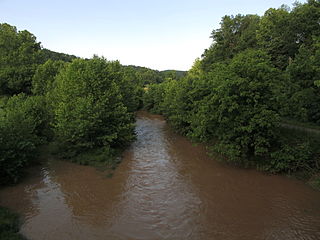
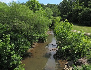
Middle Island Creek is a river, 77 miles (124 km) long, in northwestern West Virginia in the United States. It is a tributary of the Ohio River, draining an area of 565 square miles (1,463 km²) on the unglaciated Allegheny Plateau. It was named by late 18th century pioneering travelers on the Ohio River, who noted the location of the Creek's mouth opposite Middle Island in the larger river.

West Virginia State of the United States of America

West Virginia is a state located in the Appalachian region in the Southern United States and is also considered to be a part of the Middle Atlantic States. It is bordered by Pennsylvania to the north, Maryland to the east and northeast, Virginia to the southeast, Kentucky to the southwest, and Ohio to the northwest. West Virginia is the 41st largest state by area, and is ranked 38th in population. The capital and largest city is Charleston.

Contents

Arnold Creek is formed in western Doddridge County, approximately 2.4 miles (3.9 km) southwest of West Union, by the confluence of its left and right forks:

Doddridge County, West Virginia County in the United States

Doddridge County is a county in the U.S. state of West Virginia. Its county seat is West Union.

West Union, West Virginia Town in West Virginia, United States

West Union, incorporated July 20, 1881, is a town in Doddridge County, West Virginia, United States. The population was 825 at the 2010 census. It is the county seat of Doddridge County. The mayor is Joseph Thorpe as of 2013. The town is located along Middle Island Creek at the junction of U.S. Route 50 and West Virginia Route 18; the North Bend Rail Trail also passes through the town.

Middle Point, West Virginia Unincorporated community in West Virginia, United States

Middle Point is an unincorporated community in Doddridge County, West Virginia, United States.

Oxford, West Virginia Unincorporated community in West Virginia, United States

Oxford is an unincorporated community in Doddridge County, West Virginia, United States. Its post office is closed

From this confluence, Arnold Creek flows generally northward through western Doddridge County. Near its mouth, it flows into southern Tyler County for a short distance, returns to Doddridge County, and flows into Middle Island Creek from the south on the boundary of Doddridge and Tyler counties, approximately 0.9 miles (1.4 km) east-northeast of the unincorporated community of Deep Valley. [7] [8]

Tyler County, West Virginia County in the United States

Tyler County is a county in the U.S. state of West Virginia. As of the 2010 census, the population was 9,208. Its county seat is Middlebourne. The county was founded in 1814 and is named after John Tyler, Sr., father of President John Tyler.

According to the Geographic Names Information System, the creek has also been known historically by the spelling "Arnolds Creek." [4]

Geographic Names Information System geographical database

The Geographic Names Information System (GNIS) is a database that contains name and locative information about more than two million physical and cultural features located throughout the United States of America and its territories. It is a type of gazetteer. GNIS was developed by the United States Geological Survey in cooperation with the United States Board on Geographic Names (BGN) to promote the standardization of feature names.

Tributaries

This is a list of named streams in Arnold Creek's watershed. By default, the list is ordered from the mouth of Arnold Creek to its source.

NameFlows intoLength [5] Mouth coordinates [9] Source coordinates [9]
1Short Run [10] Arnold Creek2.4 miles (3.9 km) 39°20′22″N80°50′19″W / 39.339526°N 80.838717°W / 39.339526; -80.838717 39°19′23″N80°53′20″W / 39.323136°N 80.888996°W / 39.323136; -80.888996
2Long Run [11] Arnold Creek4.1 miles (6.6 km) 39°19′32″N80°49′57″W / 39.325637°N 80.832606°W / 39.325637; -80.832606 39°17′39″N80°53′08″W / 39.294248°N 80.885663°W / 39.294248; -80.885663
3Mudlick Run [12] Long Run1.6 miles (2.6 km) 39°18′37″N80°51′18″W / 39.310359°N 80.855106°W / 39.310359; -80.855106 39°19′01″N80°53′18″W / 39.317025°N 80.88844°W / 39.317025; -80.88844
4Hugle Run [13] Long Run1.4 miles (2.3 km) 39°18′21″N80°51′21″W / 39.305915°N 80.85594°W / 39.305915; -80.85594 39°17′54″N80°53′14″W / 39.298415°N 80.887329°W / 39.298415; -80.887329
5Lick Run [14] Arnold Creek1.3 miles (2.1 km) 39°18′41″N80°49′51″W / 39.311471°N 80.830939°W / 39.311471; -80.830939 39°18′22″N80°50′52″W / 39.306111°N 80.847778°W / 39.306111; -80.847778
6Rock Run [15] Arnold Creek1.5 miles (2.4 km) [16] 39°18′23″N80°49′25″W / 39.306471°N 80.823717°W / 39.306471; -80.823717 39°18′24″N80°48′22″W / 39.306667°N 80.806111°W / 39.306667; -80.806111
7Wilhelm Run [17] Arnold Creek3.5 miles (5.6 km) 39°17′42″N80°49′18″W / 39.295082°N 80.821772°W / 39.295082; -80.821772 39°16′08″N80°52′00″W / 39.268889°N 80.866667°W / 39.268889; -80.866667
8Claylick Run [18] Arnold Creek3.7 miles (6.0 km) 39°16′49″N80°48′51″W / 39.280361°N 80.814272°W / 39.280361; -80.814272 39°15′43″N80°51′38″W / 39.261944°N 80.860556°W / 39.261944; -80.860556
9Pritchard Run [19] Arnold Creek2.0 miles (3.2 km) 39°16′38″N80°48′44″W / 39.277305°N 80.812328°W / 39.277305; -80.812328 39°16′05″N80°47′27″W / 39.268056°N 80.790833°W / 39.268056; -80.790833
10Middle Run [20] Arnold Creek2.1 miles (3.4 km) 39°16′19″N80°48′44″W / 39.272028°N 80.812328°W / 39.272028; -80.812328 39°14′22″N80°50′44″W / 39.239528°N 80.845662°W / 39.239528; -80.845662
11Right Fork Arnold Creek [3] Arnold Creek4.6 miles (7.4 km) 39°16′16″N80°48′26″W / 39.271194°N 80.807328°W / 39.271194; -80.807328 39°13′10″N80°49′48″W / 39.219528°N 80.830106°W / 39.219528; -80.830106
12Left Fork Arnold Creek [1] Arnold Creek4.9 miles (7.9 km) 39°16′16″N80°48′26″W / 39.271194°N 80.807328°W / 39.271194; -80.807328 39°12′46″N80°47′16″W / 39.212863°N 80.787882°W / 39.212863; -80.787882

See also

Related Research Articles

Dry Fork (Cheat River tributary) tributary of the Black Fork of the Cheat River in West Virginia, USA

The Dry Fork is a 39.1-mile-long (62.9 km) tributary of the Black Fork of the Cheat River in the Allegheny Mountains of eastern West Virginia, USA. Via the Black Fork, the Cheat, and the Monongahela and Ohio rivers, it is part of the watershed of the Mississippi River. The Dry Fork flows for much of its length in the Monongahela National Forest and drains mostly rural and forested areas. It was traditionally considered one of the five Forks of Cheat.

Sleepy Creek river in the United States of America

Sleepy Creek is a 44.0-mile-long (70.8 km) tributary of the Potomac River in the United States, belonging to the Chesapeake Bay's watershed. The stream rises in Frederick County, Virginia, and flows through Morgan County, West Virginia before joining the Potomac near the community of Sleepy Creek.

Catoctin Creek is a 14.1-mile-long (22.7 km) tributary of the Potomac River in Loudoun County, Virginia, with a watershed of 59,000 acres (240 km2). Agricultural lands make up 67 percent and forests 30 percent of Catoctin Creek's watershed. It is the main drainage system for the northern Loudoun Valley, including all of the Catoctin Valley.

Lunice Creek is a 7.3-mile-long (11.7 km) tributary of the South Branch Potomac River, belonging to the Potomac River and Chesapeake Bay watersheds. The creek is located in Grant County, West Virginia. Lunice Creek is created by its North and South Forks and empties into the South Branch at Petersburg.

San Jacinto River (California)

The San Jacinto River is a 42-mile-long (68 km) river in Riverside County, California. The river's headwaters are in San Bernardino National Forest, but the lower portion of the 765-square-mile (1,980 km2) watershed is urban and agricultural land. As a partially endorheic watershed that is contiguous with other Great Basin watersheds, the western side of the San Jacinto Basin is a portion of the Great Basin Divide.

Glady Fork river in the United States of America

Glady Fork is a 31.9-mile-long (51.3 km) river in the Allegheny Mountains of eastern West Virginia, USA. It is considered one of the five principal headwaters tributaries of the Cheat River — known as the Forks of Cheat.

Middle Fork River river in the United States of America

The Middle Fork River is a 35.4-mile-long (57.0 km) tributary of the Tygart Valley River in north-central West Virginia, USA. Via the Tygart Valley, Monongahela and Ohio rivers, it is part of the watershed of the Mississippi River, draining an area of 152 square miles (390 km2) on the easternmost part of the unglaciated portion of the Allegheny Plateau. According to the Geographic Names Information System, the Middle Fork River has also been known simply as "Middle Fork" and as "Middlefork."

Satsop River river in the United States of America

The Satsop River is a stream in the U.S. state of Washington. It has three main tributary forks, the East Fork, West Fork, and Middle Fork Satsop Rivers. The main stem Satsop River is formed by the confluence of the West and East Forks. The Middle Fork is a tributary of the East Fork. The three forks are much longer than the main stem Satsop itself, which flows south from the confluence only a few miles to join the Chehalis River near Satsop, Washington. Other significant tributaries include the Canyon River and Little River, both tributaries of the West Fork Satsop, and Decker Creek, a tributary of the East Fork Satsop River. The Satsop River's major tributaries originate in the Olympic Mountains and its southern foothills, the Satsop Hills, within Grays Harbor and Mason counties. Most of the Satsop River's watershed consists of heavily wooded hill lands. The upper tributaries extend into Olympic National Forest, approaching but not quite reaching Olympic National Park.

Armstrong Creek (West Virginia) river in the United States of America

Armstrong Creek is a tributary of the Kanawha River, 8.6 miles (13.8 km) long, in southern West Virginia in the United States. Via the Kanawha and Ohio rivers, it is part of the watershed of the Mississippi River, draining an area of 22.8 square miles (59 km2) on the unglaciated portion of the Allegheny Plateau. The creek flows for its entire length in western Fayette County; its tributaries additionally drain a small portion of eastern Kanawha County.

Buckeye Creek (West Virginia) river in the United States of America

Buckeye Creek is a tributary of Middle Island Creek, 12.7 miles (20.4 km) long, in north-central West Virginia in the United States. Via Middle Island Creek and the Ohio River, it is part of the watershed of the Mississippi River, draining an area of 39.1 square miles (101 km2) in a rural region on the unglaciated portion of the Allegheny Plateau.

Meathouse Fork river in the United States of America

The Meathouse Fork is a tributary of Middle Island Creek, 19.7 miles (31.7 km) long, in north-central West Virginia in the United States. Via Middle Island Creek and the Ohio River, it is part of the watershed of the Mississippi River, draining an area of 64.6 square miles (167 km2) in a rural region on the unglaciated portion of the Allegheny Plateau.

Toms Fork river in the United States of America

Toms Fork is a tributary of the Meathouse Fork, 9.3 miles (15.0 km) long, in north-central West Virginia in the United States. Via the Meathouse Fork, Middle Island Creek, and the Ohio River, it is part of the watershed of the Mississippi River, draining an area of 15.5 square miles (40 km2) in a rural region on the unglaciated portion of the Allegheny Plateau.

McElroy Creek river in the United States of America

McElroy Creek is a tributary of Middle Island Creek, 22.1 miles (35.6 km) long, in northern West Virginia in the United States. Via Middle Island Creek and the Ohio River, it is part of the watershed of the Mississippi River, draining an area of 106.2 square miles (275 km2) in a rural region on the unglaciated portion of the Allegheny Plateau.

Flint Run (West Virginia) river in the United States of America

Flint Run is a tributary of McElroy Creek, 7.5 miles (12.1 km) long, in northern West Virginia in the United States. Via McElroy Creek, Middle Island Creek, and the Ohio River, it is part of the watershed of the Mississippi River, draining an area of 25.6 square miles (66 km2) in a rural region on the unglaciated portion of the Allegheny Plateau.

Indian Creek (Middle Island Creek tributary) river in the United States of America

Indian Creek is a tributary of Middle Island Creek, 14.8 miles (23.8 km) long, in northern West Virginia in the United States. Via Middle Island Creek and the Ohio River, it is part of the watershed of the Mississippi River, draining an area of 32.3 square miles (84 km2) in a rural region on the unglaciated portion of the Allegheny Plateau.

Point Pleasant Creek river in the United States of America

Point Pleasant Creek is a tributary of Middle Island Creek, 10.4 miles (16.7 km) long, in northwestern West Virginia in the United States. Via Middle Island Creek and the Ohio River, it is part of the watershed of the Mississippi River, draining an area of 60.5 square miles (157 km2) in a rural region on the unglaciated portion of the Allegheny Plateau.

Elk Fork (Point Pleasant Creek tributary) tributary of Point Pleasant Creek in West Virginia, United States of America

The Elk Fork is a tributary of Point Pleasant Creek, 14.8 miles (23.8 km) long, in northwestern West Virginia in the United States. Via Point Pleasant Creek, Middle Island Creek, and the Ohio River, it is part of the watershed of the Mississippi River, draining an area of 21.1 square miles (55 km2) in a rural region on the unglaciated portion of the Allegheny Plateau.

Sugar Creek (Middle Island Creek) river in the United States of America

Sugar Creek is a tributary of Middle Island Creek, 15 miles (24 km) long, in northwestern West Virginia in the United States. Via Middle Island Creek and the Ohio River, it is part of the watershed of the Mississippi River, draining an area of 22.1 square miles (57 km2) in a rural region on the unglaciated portion of the Allegheny Plateau.

McKim Creek (West Virginia) river in the United States of America

McKim Creek is a tributary of Middle Island Creek, 20.4 miles (32.8 km) long, in northwestern West Virginia in the United States. Via Middle Island Creek and the Ohio River, it is part of the watershed of the Mississippi River, draining an area of 37.3 square miles (97 km2) in a rural region on the unglaciated portion of the Allegheny Plateau.

References

  1. 1 2 3 4 5 Geographic Names Information System. "Geographic Names Information System entry for Left Fork Arnold Creek (Feature ID #1541622)" . Retrieved 2013-07-19.
  2. 1 2 The National Map elevation for GNIS source coordinates. Retrieved 2013-07-19.
  3. 1 2 3 4 5 Geographic Names Information System. "Geographic Names Information System entry for Right Fork Arnold Creek (Feature ID #1545606)" . Retrieved 2013-07-19.
  4. 1 2 3 Geographic Names Information System. "Geographic Names Information System entry for Arnold Creek (Feature ID #1535021)" . Retrieved 2013-07-19.
  5. 1 2 3 4 United States Environmental Protection Agency. "West Virginia, Little Muskingum-Middle Island Watershed". Archived from the original on 2011-10-15. Retrieved 2013-07-19.
  6. U.S. Geological Survey. National Hydrography Dataset. Area data for Arnold Creek watershed, 12-digit Hydrologic Unit Code 050302010405. The National Map Archived 2012-04-05 at WebCite , retrieved 2013-07-19
  7. The National Map Archived 2012-04-05 at WebCite , accessed 2013-07-19
  8. West Virginia Atlas & Gazetteer. Yarmouth, Me.: DeLorme. 1997. pp. 24, 35. ISBN   0-89933-246-3.
  9. 1 2 Coordinates given in the GNIS records cited in "Name" column.
  10. U.S. Geological Survey Geographic Names Information System: Short Run
  11. U.S. Geological Survey Geographic Names Information System: Long Run
  12. U.S. Geological Survey Geographic Names Information System: Mudlick Run
  13. U.S. Geological Survey Geographic Names Information System: Hugle Run
  14. U.S. Geological Survey Geographic Names Information System: Lick Run
  15. U.S. Geological Survey Geographic Names Information System: Rock Run
  16. U.S. Geological Survey. National Hydrography Dataset high-resolution flowline data. The National Map Archived 2012-04-05 at WebCite , retrieved 2014-01-10.
  17. U.S. Geological Survey Geographic Names Information System: Wilhelm Run
  18. U.S. Geological Survey Geographic Names Information System: Claylick Run
  19. U.S. Geological Survey Geographic Names Information System: Pritchard Run
  20. U.S. Geological Survey Geographic Names Information System: Middle Run