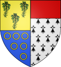
Arrou | |
|---|---|
Part of Commune nouvelle d'Arrou | |
 | |
 Location of Arrou | |
| Coordinates: 48°06′05″N1°07′26″E / 48.1014°N 1.1239°E | |
| Country | France |
| Region | Centre-Val de Loire |
| Department | Eure-et-Loir |
| Arrondissement | Châteaudun |
| Canton | Brou |
| Commune | Commune nouvelle d'Arrou |
Area 1 | 64.98 km2 (25.09 sq mi) |
| Population (2018) [1] | 1,432 |
| • Density | 22.04/km2 (57.08/sq mi) |
| Time zone | UTC+01:00 (CET) |
| • Summer (DST) | UTC+02:00 (CEST) |
| Postal code | 28290 |
| Elevation | 138–220 m (453–722 ft) (avg. 164 m or 538 ft) |
| 1 French Land Register data, which excludes lakes, ponds, glaciers > 1 km2 (0.386 sq mi or 247 acres) and river estuaries. | |
Arrou is a former commune in the Eure-et-Loir department in northern France. On 1 January 2017, it was merged into the new commune Commune nouvelle d'Arrou. [2]


