Ash Fork station

Last updated
Ash Fork
Former ATSF station
The Escalante, Ash Fork, Ariz (NYPL b12647398-68974).tiff
The Escalante, early 20th century postcard
General information
LocationBusiness Loop 40.svg BL 40 (Lewis Avenue)
Ash Fork, Arizona
Coordinates 35°13′33″N112°29′17″W / 35.225828°N 112.488155°W / 35.225828; -112.488155
Owned by BNSF Railway
Line(s)Main Line (1882–1960)
Santa Fe, Prescott and Phoenix Railway (Phoenix Branch)
Tracks2
Construction
Structure typeat-grade
History
Opened1893 (first station), 1907 (second station)
Closed1905 (first station), 1969 (second station)
Former services
Preceding station Atchison, Topeka and Santa Fe Railway Following station
Seligman
toward Los Angeles
Main Line Williams
toward Chicago
Terminus Santa Fe, Prescott and Phoenix Railway Drake
toward Phoenix

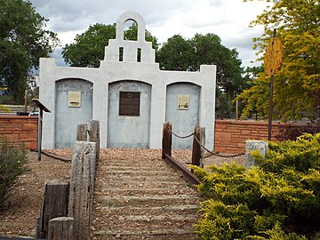
Ash Fork Station is a former railway station of the Atchison, Topeka and Santa Fe Railway, located in Ash Fork, Yavapai County, Arizona. The large and "grand" Harvey House Escalante Hotel and restaurant were part of the station complex. [1]

Contents

Service to Ash Fork began in the early 1880s when the Atlantic and Pacific Railroad (predecessor of the Santa Fe) built through town, then in the Arizona Territory. After the completion of a line in 1895—the Santa Fe, Prescott and Phoenix Railway—to Phoenix, Ash Fork became an important junction point for the Santa Fe. [2]

History

The first station in Ash Fork was an 1893 structure made out of red Coconino sandstone, and built in the same style as the current Flagstaff station. [3] :16 The structure was one of the first built by the railroad and became too small to handle the number of passengers at Ash Fork. It was destroyed in a 1905 fire. [2] [3] :16

Built in 1907, the second station was built as part of the famous Escalante hotel and restaurant. It was one of the renowned Fred Harvey Company rail passenger Harvey House complexes, built after the founder Fred Harvey died. [4] [5] The cost of construction was $150,000 (equivalent to $4.91 million in 2023 adjusted for inflation). [6] Ash Fork was a restaurant stop Harvey House, all passenger trains stopped so travelers could eat in the Escalante Dining Room or at the Lunch Counter, and shop in the Escalante's Indian Gift Shop. [1] [2]

Decline and closure

The Escalante Harvey House closed in 1948. [7]

Ash Fork Station's service on the Southern Transcon main line lasted until December 1960, when the Santa Fe completed the Crookton Cutoff around Ash Fork. This was done to avoid the steep Johnson Canyon, west of Ash Fork. [8] The junction point shifted to Williams Junction and the line to Phoenix became the only service through the town. [9] [3] :8 The former main line west of Ash Fork was abandoned. [10] This, combined with I-40 bypassing the town, began the decline of Ash Fork. [4]

The final regular passenger service to Ash Fork ended in April 1969, when train number 42, the Hassayampa Flyer , was discontinued. [9] [11] The Escalante Harvey House building was demolished in the 1960s. [7] The former freight house is the only still standing structure on the site.

See also

Related Research Articles

<span class="mw-page-title-main">Ash Fork, Arizona</span> CDP in Yavapai County, Arizona

Ash Fork is a census-designated place in Yavapai County, Arizona, United States. Its population was 396 at the 2010 U.S. Census, down from 457 in 2000.

<span class="mw-page-title-main">Seligman, Arizona</span> CDP in Yavapai County, Arizona

Seligman is a census-designated place (CDP) on the northern border of Yavapai County, in northwestern Arizona, United States. The population was 456 at the 2020 census. It is one of the stops on historic U.S. Route 66.

<span class="mw-page-title-main">Fred Harvey (entrepreneur)</span> American businessman

Frederick Henry Harvey was an entrepreneur who developed the Harvey House lunch rooms, restaurants, souvenir shops, and hotels, which served rail passengers on the Atchison, Topeka and Santa Fe Railway, the Gulf Colorado and Santa Fe Railway, the Kansas Pacific Railway, the St. Louis-San Francisco Railway, and the Terminal Railroad Association of St. Louis.

<span class="mw-page-title-main">Fred Harvey Company</span> Owner of the Harvey House chain of rail hospitality establishments

The Fred Harvey Company was the owner of the Harvey House chain of restaurants, hotels and other hospitality industry businesses alongside railroads in the Western United States. It was founded in 1876 by Fred Harvey to cater to the growing number of train passengers.

<span class="mw-page-title-main">Grand Canyon Railway</span> Historic railway to Grand Canyon National Park in Arizona

The Grand Canyon Railway is a heritage railroad which carries passengers between Williams, Arizona, and the South Rim of Grand Canyon National Park.

The California, Arizona and Santa Fe Railway was a non-operating subsidiary of Atchison, Topeka and Santa Fe Railway (ATSF). It was incorporated in 1911, and was merged into the ATSF in 1963.

The Bradshaw Mountain Railroad was a subsidiary of the Santa Fe, Prescott and Phoenix Railway (SFP&P) in Arizona. The 35.65-mile (57.37 km) railroad was built to serve the mines in the Bradshaw Mountains. The railroad built from a connection at Poland Junction and at Mayer with the Prescott and Eastern Railroad. The Prescott and Eastern was also operated by the SFP&P.

The Prescott and Eastern Railroad (P&E) was a non-operating subsidiary of the Santa Fe, Prescott and Phoenix Railway (SFP&P) in Arizona. The 26.4 mile (42.5 km) common carrier railroad was built to serve the mines in the region. The railroad built from a connection with the SFP&P at Entro and extended south to Poland Junction and terminated at Mayer. At Poland Junction and Mayer the P&E connected with the Bradshaw Mountain Railroad, also a non-operating subsidiary of the SFP&P. After various mergers the P&E was merged into the Atchison, Topeka and Santa Fe Railway. The line was later abandoned by the Santa Fe Railway.

<span class="mw-page-title-main">Santa Fe, Prescott and Phoenix Railway</span> Former railway in Arizona

The Santa Fe, Prescott and Phoenix Railway (SFP&P) was a common carrier railroad that later became an operating subsidiary of the Atchison, Topeka and Santa Fe Railway in Arizona. At Ash Fork, Arizona, the SFP&P connected with Santa Fe's operating subsidiary, the Atlantic & Pacific Railroad mainline, that ran from California to Chicago. The SFP&P's 195-mile (314 km) line extended the Santa Fe Railway south into Phoenix. The SFP&P extended another 100 miles (160 km) to the east from Phoenix to Florence and Winkelman via the Phoenix and Eastern Railroad. The SFP&P also served several mines in the Prescott area, including the Derby Mine by way of the Summit (flag) Station at 'Prieta' in the Sierra Prieta range, through its various subsidiary railroads.

<span class="mw-page-title-main">U.S. Route 66 in Arizona</span> Former designated US Numbered Highway section

U.S. Route 66 also known as the Will Rogers Highway, was a major United States Numbered Highway in the state of Arizona from November 11, 1926, to June 26, 1985. US 66 covered a total of 385.20 miles (619.92 km) through Arizona. The highway ran from west to east, starting in Needles, California, through Kingman and Seligman to the New Mexico state line. Nationally, US 66 ran from Santa Monica, California, to Chicago, Illinois. In its height of popularity, US 66 was one of the most popular highways in the state of Arizona, sometimes carrying over one million cars a year.

<span class="mw-page-title-main">Williams Junction station</span> Former train station in Williams Junction, Coconino County, Arizona

Williams Junction station was an Amtrak train station on the Southwest Chief route, located three miles (4.8 km) southeast of Williams, Arizona in the Kaibab National Forest. The station primarily served passengers travelling to the Grand Canyon via the Grand Canyon Railway.

<span class="mw-page-title-main">Williams Depot</span> Train station in Williams, Coconino County, Arizona

Williams Depot is a privately owned train station in Williams, Arizona. It is the southern terminus of the Grand Canyon Railway line.

<span class="mw-page-title-main">Fullerton Transportation Center</span> Passenger rail and bus station in Fullerton, California

The Fullerton Transportation Center is a passenger rail and bus station located in Fullerton, California, United States.

Jerome Junction is a ghost town in Yavapai County, Arizona, United States. Established in 1894, the community served as a railroad transfer stop between the town of Prescott and the town of Jerome. It served as a transfer point between the Santa Fe, Prescott and Phoenix Railway (SFP&P) and the narrow-gauge United Verde & Pacific Railway for 25 years. The narrow-gauge line was built precariously on the side of Woodchute Mountain by William A. Clark after he bought the United Verde Copper Company. In 1917 it had a population of 150. When it was replaced by standard-gauge line on the east side of the mountain from Jerome to Clarkdale in 1920, Jerome Junction became a ghost town, and in 1923, the activities of the former town were absorbed by Chino Valley.

<span class="mw-page-title-main">Southern Transcon</span> Rail corridor owned by BNSF Railway

The Southern Transcon is a main line of the BNSF Railway comprising 11 subdivisions between Southern California and Chicago, Illinois. Completed in its current alignment in 1908 by the Atchison, Topeka and Santa Fe Railway, when it opened the Belen Cutoff in New Mexico and bypassed the steep grades of Raton Pass, it now serves as a mostly double-tracked intermodal corridor.

<span class="mw-page-title-main">Arizona and California Railroad</span> Short line railroad in the Southwestern United States

The Arizona and California Railroad is a class III short line railroad that was a subdivision of the Atchison, Topeka and Santa Fe Railway (ATSF). The ARZC began operations on May 9, 1991, when David Parkinson of the ParkSierra RailGroup purchased the line from the Santa Fe Railway. ParkSierra Railgroup was purchased in January 2002 by shortline railroad holding company RailAmerica. The Genesee & Wyoming shortline railroad holding company purchased RailAmerica in December 2012. ARZC's main commodities are petroleum gas, steel, and lumber; the railroad hauls around 12,000 carloads per year.

<span class="mw-page-title-main">Galesburg station (Atchison, Topeka and Santa Fe Railway)</span>

Galesburg Santa Fe Station was a railway station in the west central Illinois town of Galesburg. The station was along the Atchison, Topeka and Santa Fe Railway's main line and served trains such as the Super Chief and El Captain. After Amtrak took over intercity rail in the United States, it was served by trains such as the Lone Star (1971–1979) and the Southwest Chief (1971–1996).

<span class="mw-page-title-main">United Verde & Pacific Railway</span> Former railroad in Yavapai County, Arizona

The United Verde and Pacific Railway was a 3 ft narrow gauge railroad that operated from 1895 to 1920 in what became Yavapai County in the U.S. state of Arizona. William A. Clark built the 26-mile (42 km) line to link his copper mine and smelter in Jerome to an existing branch of the Santa Fe Railway system. Clark eventually replaced the line with three 4 ft 8+12 instandard gauge rail lines after building a new smelter and company town in Clarkdale.

The Hassayampa Flyer, also known as the Hassayampa Chief, was a passenger train operated by the Atchison, Topeka and Santa Fe Railway between Ash Fork and Phoenix in Arizona, United States.

The Phoenix Subdivision is a railroad line in the U.S. state of Arizona owned by the BNSF Railway. It runs from Phoenix in the south to Williams Junction in the north where it connects to the Seligman Subdivision and Southern Transcon. As of 2018 about eight trains daily operate over the line with top speeds of up to 49 miles per hour (79 km/h). The line is part of a system of proposed commuter rail lines in the Phoenix metropolitan area.

References

  1. 1 2 Ashforkrt66museum.com: History of Ash Fork Archived 2010-03-25 at the Wayback Machine , with vintage photos of the Ash Fork Station−Escalante Hotel facade & interiors.
  2. 1 2 3 "Finest Station on the Santa Fe System". Arizona Journal-Miner. Prescott, Arizona. August 2, 1905. Retrieved October 9, 2011.
  3. 1 2 3 Trimble, Marshall (2008). Ash Fork. Arcadia Publishing. ISBN   978-0-7385-4832-6.
  4. 1 2 Trimble, Marshall (2001). Ash Fork . Retrieved October 9, 2011.
  5. Griswold, P.R. (1992). Arizona's railroads: exploring the state by rail. Renaissance House Publishing. p. 13. ISBN   1-55838-131-7.
  6. Melzer, Richard (2008). Harvey Houses of the Southwest. Arcadia Publishing. pp. 86, 87. ISBN   978-0-7385-5631-4.
  7. 1 2 Witzel, Michael Karl; Young-Witzel, Gyvel (2007). Legendary Route 66: A Journey Through Time Along America's Mother Road. Voyageur Press. p. 49. ISBN   978-0-7603-2978-8.
  8. Burton, David P. (September 1992). "The Crookton Line Change". Pacific RailNews . p. 21. Retrieved April 2, 2020.
  9. 1 2 Schwieterman, Joseph P. (2004). When the Railroad Leaves Town: American Communities in the Age of Rail Line Abandonment, Western United States. Kirksville, Missouri: Truman State University Press. p. 10. ISBN   978-1-931112-13-0.
  10. Microsoft; Nokia. "Ash Fork, AZ" (Map). Bing Maps . Microsoft. Retrieved October 9, 2011.
  11. "A Brief History Of Public Transportation in Metro Phoenix". Arizona Rail Passenger Association. Archived from the original on September 27, 2011. Retrieved October 9, 2011.