Atoka Municipal Airport | |||||||||||
|---|---|---|---|---|---|---|---|---|---|---|---|
| Summary | |||||||||||
| Airport type | Public | ||||||||||
| Owner | City of Atoka | ||||||||||
| Serves | Atoka, Oklahoma | ||||||||||
| Elevation AMSL | 590 ft / 180 m | ||||||||||
| Coordinates | 34°23′54″N096°08′53″W / 34.39833°N 96.14806°W | ||||||||||
| Map | |||||||||||
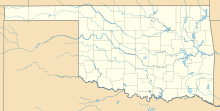 AQR  AQR | |||||||||||
 | |||||||||||
| Runways | |||||||||||
| |||||||||||
| Statistics (2009) | |||||||||||
| |||||||||||
Source: Federal Aviation Administration [1] | |||||||||||
Atoka Municipal Airport( ICAO : KAQR, FAA LID : AQR) is a mile north of Atoka, in Atoka County, Oklahoma. [1] The National Plan of Integrated Airport Systems for 2021-2025 categorized it as a general aviation airport. [2]
Contents
Most U.S. airports use the same three-letter location identifier for the FAA and IATA, but this airport is AQR to the FAA [1] and has no IATA code. [3] [4]