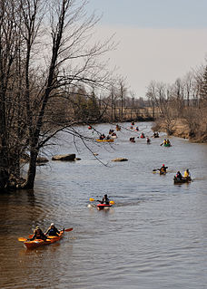
The Raisin River is a river in South Stormont and South Glengarry, United Counties of Stormont, Dundas and Glengarry in eastern Ontario, Canada, with the watershed encompassing portions of North Stormont, North Glengarry and the city of Cornwall as well. It empties into Lake Saint Francis on the Saint Lawrence River near the community of Lancaster.

The South Nation River is a river in Eastern Ontario, Canada. It springs from forests and marshes located north of Brockville and it flows 175 kilometres (109 mi) northeast to empty into the Ottawa River north of Plantagenet. Its watershed covers 3,900 square kilometres (1,500 sq mi).
The Nith River is a river in Brant, Oxford and Perth Counties and the Regional Municipality of Waterloo in Southwestern Ontario, Canada. The Nith River is approximately 125km in length and empties into the Grand River at the town of Paris. It is named after the River Nith in Scotland.

The Sauble River is a river in Bruce County and Grey County in southwestern Ontario, Canada that flows from its headwaters in the township of Chatsworth to Lake Huron at the community of Sauble Beach.
The Bayfield River is a river in Huron and Perth Counties in southwestern Ontario, Canada, that empties into Lake Huron at the community of Bayfield in the municipality of Bluewater.

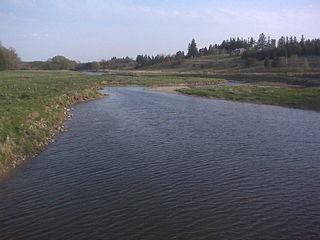
The Maitland River is a river in Huron County, Perth County and Wellington County in Southwestern Ontario, Canada. The river is in the Great Lakes Basin and empties into Lake Huron at the town of Goderich. It is 150 kilometres (93 mi) long, and is named after Sir Peregrine Maitland, Lieutenant-Governor of Upper Canada from 1818 to 1828. It was formerly known as the Menesetung River.

The Jock River, known locally as the Mighty Jock, is a river in Ottawa and Lanark County in Eastern Ontario, Canada. It is in the Saint Lawrence River drainage basin and is a left tributary of the Rideau River. The river is named after Jacques, a French man who drowned in it in the early 19th century, and it was once known as the Goodwood River. The River is supported by a community-volunteer organization known as the Friends of the Jock River.
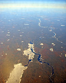
The Albany River is a river in Northern Ontario, Canada, which flows northeast from Lake St. Joseph in Northwestern Ontario and empties into James Bay. It is 982 kilometres (610 mi) long to the head of the Cat River, tying it with the Severn River for the title of longest river in Ontario. Major tributaries include the Kenogami River and Ogoki River.

The Tay River is a river in Lanark County in Eastern Ontario, Canada. It is in the Saint Lawrence River drainage basin and is a left tributary of the Rideau River.

The Township of Perth East is a municipality in Perth County, Ontario, Canada and situated north of Stratford. It was created in 1998 when the Ontario government amalgamated the village of Milverton with the surrounding former townships of Ellice, Mornington, North Easthope and South Easthope.
The Thames River is located in southwestern Ontario, Canada.
Amulree is a community in the township of Perth East, Perth County, Ontario, Canada. It lies 13 kilometres (8 mi) northeast of Stratford and 28 kilometres (17 mi) west of Kitchener. Silver Creek runs past the community. The settlement was named after the hamlet of Amulree in Perthshire, Scotland, and a number of its early settlers were from Perthshire.
Avonbank is a community on the Avon River in the township of Perth South, Perth County in Southwestern Ontario Ontario, Canada. It lies on 16th Line west of Perth Road 130, about 12 kilometres (7 mi) southwest of Stratford and 8 kilometres (5 mi) north of St. Marys.
Medway Creek is a tributary of the Thames River in southwestern Ontario, Canada, draining into the North branch of the Thames at the University of Western Ontario.
The Beatty Saugeen River is a river in the Saugeen River and Lake Huron drainage basins in Grey County, southwestern Ontario, Canada. It is a tributary of the South Saugeen River.
The Carp River is a river in the city of Ottawa, Ontario, Canada. It is 42 kilometres long and its watershed drains an area of approximately 306 km2 spread across Stittsville, Kanata, and West Carleton-March. The headwaters originate as the upper Carp River, which runs southwest from Appaloosa Park under Eagleson Road through Glen Cairn where it empties into the marshes and storm water ponds south of the Canadian Tire Centre. From there it flows north through West Carleton-March into the Ottawa River at Fitzroy Harbour. The Carp River has four major tributaries: Poole Creek, Feedmill Creek, Huntley Creek, and Corkery Creek. The watershed is administered by the Mississippi Valley Conservation Authority.
Silver Creek is a river in the municipality of Huron East, Huron County, Ontario, Canada and a right tributary of the Bayfield River.
Buttermilk Creek is a creek in the town of Petrolia, Lambton County, Ontario, Canada.
Peterson Creek is a river in the Lake Ontario and Cataraqui River drainage basins in South Frontenac, Frontenac County and Rideau Lakes, Leeds and Grenville United Counties in eastern Ontario, Canada. It flows 6.5 kilometres (4.0 mi) from Upper Peterson Lake to its mouth at Hart Lake.
Ellice Swamp is a large woodlot in Perth County, Ontario. The swamp covers approximately 856 hectares. It is located between Stratford and Milverton in the northeastern portion of the Thames River Watershed, between the North Branch of the Thames and the Nith River.


