Coordinates: 40°00′N48°52′E / 40.000°N 48.867°E
A geographic coordinate system is a coordinate system that enables every location on Earth to be specified by a set of numbers, letters or symbols. The coordinates are often chosen such that one of the numbers represents a vertical position and two or three of the numbers represent a horizontal position; alternatively, a geographic position may be expressed in a combined three-dimensional Cartesian vector. A common choice of coordinates is latitude, longitude and elevation. To specify a location on a plane requires a map projection.
Bürvənd | |
---|---|
Coordinates: 40°00′N48°52′E / 40.000°N 48.867°E | |
Country | |
Rayon | Hajigabul |
Municipality | Ələtli |
Time zone | AZT (UTC+4) |
• Summer (DST) | AZT (UTC+5) |
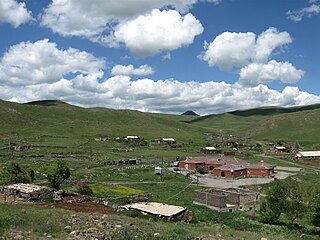
Bürvənd (also, Burvənd, Burvend, and Burvit) is a village in the Hajigabul Rayon of Azerbaijan. The village forms part of the municipality of Ələtli. [1]
Azerbaijan, officially the Republic of Azerbaijan, is a country in the South Caucasus region of Eurasia at the crossroads of Eastern Europe and Western Asia. It is bounded by the Caspian Sea to the east, Russia to the north, Georgia to the northwest, Armenia to the west and Iran to the south. The exclave of Nakhchivan is bounded by Armenia to the north and east, Iran to the south and west, and has an 11 km long border with Turkey in the northwest.
Ələtli is a village and municipality in the Hajigabul Rayon of Azerbaijan. It has a population of 380. The municipality consists of the villages of Ələtli and Bürvənd.
Karmrakar is a village in the Shirak Province of Armenia.
Kürdlər is a village in the Agdam Rayon of Azerbaijan.
Uqah is a village in the Davachi Rayon of Azerbaijan. The village forms part of the municipality of Çaraq.
Ləcədi is a village in the Davachi Rayon of Azerbaijan. The village forms part of the municipality of Qələgah.
Mulux is a village in the Ismailli Rayon of Azerbaijan. The village forms part of the municipality of Cülyan.
Dahar is a village in the Ismailli Rayon of Azerbaijan. The village forms part of the municipality of Cülyan. According to Azerbaijan's State Statistics Committee, only five people lived in the village as of 2014.
Velyadi is a village in the Lankaran Rayon of Azerbaijan. The village forms part of the municipality of Gərmətük.
Kirabin is a village in the Lerik Rayon of Azerbaijan.
Babalı is a village in the Khachmaz Rayon of Azerbaijan. The village forms part of the municipality of Xaspoladoba.
Khanlykh-Dzhevat is a village in the Imishli Rayon of Azerbaijan.
Xoltəzəkənd is a village in the Neftchala Rayon of Azerbaijan. The village forms part of the municipality of Xol Qarabucaq.
Khirek is a village in the Khizi Rayon of Azerbaijan.
Gərsavan is a village in the Yardymli Rayon of Azerbaijan. The village forms part of the municipality of Kürəkçi.
Çullu is a village in the Agdam Rayon of Azerbaijan.
Küman is a village and municipality in the Lerik Rayon of Azerbaijan. It has a population of 186.
Jidi is a village in the municipality of Gəgiran in the Lankaran Rayon of Azerbaijan.
Məşədiqaralar is a village and municipality in the Goranboy Rayon of Azerbaijan. It has a population of 595.
Bala Şahağac is a village and municipality in the Astara Rayon of Azerbaijan. It has a population of 1,379. The municipality consists of the villages of Bala Şahağac and Qamışovka.
Kosalı is a village in the municipality of Çələbixan in the Shaki Rayon of Azerbaijan.
Məşədihüseynli is a village and municipality in the Shamkir Rayon of Azerbaijan. It has a population of 1,883.
This Hajigabul Rayon location article is a stub. You can help Wikipedia by expanding it. |