
NATO Dispersed Operating Bases (DOBs) were developed to improve air power survival when NATO began planning for tactical air bases and aircraft in western Europe during the early Cold War years of the 1950s.

The Calore Lucano is a river in Campania, southern Italy, whose course is entirely included in the province of Salerno, within Cilento, for a total of about 63 kilometres (39 mi). It is an important left tributary of the Sele. In ancient times it was known as Calor.
Luxembourg-Cents is a residential area in the east of Luxembourg city which is also famous for a football stadium. Cents is a quarter of Luxembourg City, in southern Luxembourg. It is currently the home stadium of FC RM Hamm Benfica which has a capacity of 2,800.

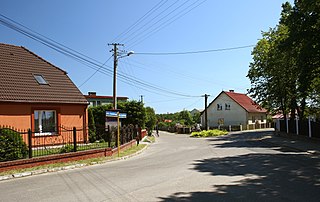
Juszczyn is a village in the administrative district of Gmina Środa Śląska, within Środa Śląska County, Lower Silesian Voivodeship, in south-western Poland. Prior to 1945 it was in Germany.

Gez-Agzy is a village in the Sabirabad Rayon of Azerbaijan.
Ulubab, also Urakhach, is a village offically being parto of the Khojali Rayon of Azerbaijan, but since 1992 occupied by Armenian Armed Forces, making it de facto being located in the Republic of Artsakh.
Roztoki Górne is a village in the administrative district of Gmina Cisna, within Lesko County, Subcarpathian Voivodeship, in south-eastern Poland, close to the border with Slovakia. It lies approximately 7 kilometres (4 mi) south of Cisna, 36 km (22 mi) south of Lesko, and 101 km (63 mi) south of the regional capital Rzeszów.
The Canton of Notre-Dame-de-Bondeville is a canton situated in the Seine-Maritime département and in the Normandy region of northern France.
Brzezówka is a village in the administrative district of Gmina Hyżne, within Rzeszów County, Subcarpathian Voivodeship, in south-eastern Poland.
Gocłowo is a village in the administrative district of Gmina Bulkowo, within Płock County, Masovian Voivodeship, in east-central Poland.
Dębogóra is a settlement in the administrative district of Gmina Wronki, within Szamotuły County, Greater Poland Voivodeship, in west-central Poland.
Odry is a village in the administrative district of Gmina Czersk, within Chojnice County, Pomeranian Voivodeship, in northern Poland. It lies approximately 12 kilometres (7 mi) north of Czersk, 38 km (24 mi) north-east of Chojnice, and 67 km (42 mi) south-west of the regional capital Gdańsk.
Bajdyty is a village in the administrative district of Gmina Bartoszyce, within Bartoszyce County, Warmian-Masurian Voivodeship, in northern Poland, close to the border with the Kaliningrad Oblast of Russia. It lies approximately 16 kilometres (10 mi) south-east of Bartoszyce and 52 km (32 mi) north-east of the regional capital Olsztyn.
Wólka is a village in the administrative district of Gmina Kętrzyn, within Kętrzyn County, Warmian-Masurian Voivodeship, in northern Poland.
Bermudian is an unincorporated community in Adams and York counties, Pennsylvania, United States.

Alma Lake is an unincorporated community in southeastern Jackson Township, Parke County, in the U.S. state of Indiana.
Zimný štadión Banská Bystrica is an indoor ice hockey arena in Banska Bystrica, Slovakia.
Soudersburg is a census-designated place located in East Lampeter and Leacock Townships in Lancaster County in the state of Pennsylvania. It is located along US 30 between the city of Lancaster and the community of Paradise. As of the 2010 census the population was 540 residents.

Londonderry is an unincorporated community in Londonderry Township, Guernsey County, Ohio, United States.
Delisle is an unincorporated community in Darke County, in the U.S. state of Ohio.


