Bad Kissingen is a Landkreis (district) in Bavaria, Germany. It is bounded by the district Main-Kinzig and Fulda in Hesse, and the districts of Rhön-Grabfeld, Schweinfurt and Main-Spessart.
Main-Spessart is a Landkreis (district) in the northwest of Bavaria, Germany. It is located in Lower Franconia and derives its name from the river Main and the wooded hills of the Spessart.

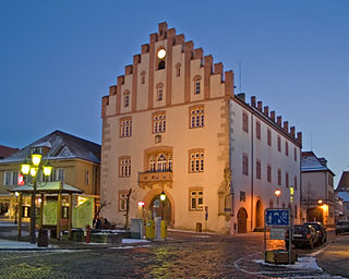
Münnerstadt is a town in the district of Bad Kissingen in Bavaria, Germany. It has a population of around 7,600.

The Franconian Saale is a 140 km long river in Bavaria, Germany. It is a right-bank tributary of the Main, in Lower Franconia. It should not be confused with the larger Saxon Saale, which is a tributary of the Elbe River.

Bad Königshofen im Grabfeld is a small spa town in the German state of Bavaria, located in the Rhön-Grabfeld district in northeast Lower Franconia, Bavaria, Germany. According to the Bavarian State Office for Statistics and Data, Bad Königshofen had a population of 5,995 in 2017. The Franconian Saale flows through the town.

Bad Brückenau is a spa town in Bad Kissingen district in northwestern Bavaria in the Rhön Mountains.
Hammelburg is a town in Bavaria, Germany. It sits in the district of Bad Kissingen, in Lower Franconia. It lies on the river Franconian Saale, 25 km west of Schweinfurt. Hammelburg is the oldest winegrowing town (Weinstadt) in Franconia.

Bad Neustadt an der Saale, officially Bad Neustadt a. d. Saale and often simply called Bad Neustadt, is a town in northern Bavaria, Germany. It is the capital of the Rhön-Grabfeld district in Lower Franconia. It is situated on the rivers Franconian Saale and Brend, near the Rhön Mountains, 30 km north of Schweinfurt, and 47 km southeast of Fulda.

Gemünden am Main is a town in the Main-Spessart district in the Regierungsbezirk of Lower Franconia (Unterfranken) in Bavaria, Germany and lies roughly 40 km down the Main from Würzburg. Gemünden has around 10,000 inhabitants.

Röttingen is a town in the district of Würzburg, in Bavaria, Germany. It is situated 30 kilometres (19 mi) south of Würzburg, and 15 kilometres (9 mi) east of Bad Mergentheim.

Aura an der Saale is a municipality in the district of Bad Kissingen in Bavaria in Germany.

Elfershausen is a municipality in the district of Bad Kissingen in Bavaria in Germany.

Euerdorf is a municipality in the district of Bad Kissingen in Bavaria, Germany.
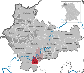
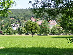
Fuchsstadt is a municipality in the district of Bad Kissingen in Bavaria in Germany.

Maßbach is a market town and municipality in the district of Bad Kissingen in Bavaria in Germany.

Nüdlingen is a municipality in the district of Bad Kissingen in Bavaria in Germany.

Oberthulba is a municipality in the district of Bad Kissingen in Bavaria in Germany.

Neustadt am Main is a community in the Main-Spessart district in the Regierungsbezirk of Lower Franconia (Unterfranken) in Bavaria, Germany and a member of the Verwaltungsgemeinschaft Lohr am Main.
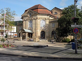
The Kurtheater Bad Kissingen is a theatre in the spa town Bad Kissingen in Bavaria, Germany.

The Battle of Kissingen was a battle between Bavarian and Prussian troops on 10 July 1866 during the Austrian-Prussian War in and around the town of Kissingen in Bavaria. It was part of the campaign of the Main and ended with a victory of the Prussians.