
Dubbo is a city in the Orana Region of New South Wales, Australia. It is the largest population centre in the Orana region, with a population of 43,516 at June 2021.

Port Augusta is a small coastal city in South Australia about 310 kilometres (190 mi) by road from the state capital, Adelaide. Most of the city is on the eastern shores of Spencer Gulf, immediately south of the gulf's head, comprising the city's centre and surrounding suburbs, Stirling North, and seaside homes at Commissariat Point, Blanche Harbor and Miranda. The suburb of Port Augusta West is on the western side of the gulf on the Eyre Peninsula. Together, these localities had a population of 13,515 people in the 2021 census.

Cobar is a town in central western New South Wales, Australia whose economy is based mainly upon base metals and gold mining. The town is 712 km (442 mi) by road northwest of the state capital, Sydney. It is at the crossroads of the Kidman Way and Barrier Highway. The town and the local government area, the Cobar Shire, are on the eastern edge of the outback. At the 2016 census, the town of Cobar had a population of 3,990. The Shire has a population of approximately 4,700 and an area of 44,065 square kilometres (17,014 sq mi).

The Macquarie River or Wambuul is part of the Macquarie–Barwon catchment within the Murray–Darling basin, is one of the main inland rivers in New South Wales, Australia.

Mitchell is a rural town and locality in the Maranoa Region, Queensland, Australia. The town services the local area, a cattle and sheep farming district. In the 2016 census, the locality of Mitchell had a population of 1,031 people.

Wongarbon is a village approximately 18 kilometres east of Dubbo on the Mitchell Highway between Dubbo and Wellington, New South Wales, Australia. The name is also applied to the surrounding area for postal and statistical purposes. At the 2016 census, Wongarbon had a population of 766.
Mitchells Creek is a creek in central New South Wales, Australia. Rising north-east of Wellington, New South Wales, Mitchells Creek flows generally northward and joins the Talbragar River about 5 km south-west of Ballimore. The direct distance from its source to its outlet is 31 kilometres, longer via the twists and turns of the watercourse.
Elong Elong is a locality on the Golden Highway in New South Wales, Australia.

Port Kembla is a man-made cargo port or artificial harbour, with an outer harbour protected by breakwaters and an inner harbour constructed by dredging, located in the Illawarra region of New South Wales, Australia.

The Dubbo Regional Council is a local government area located in the Central West and Orana regions of New South Wales, Australia. The council was formed on 12 May 2016 through a merger of the City of Dubbo and Wellington Council as part of a widespread council amalgamation program. It was initially named Western Plains Regional Council for almost four months, and its name was changed to Dubbo Regional Council on 7 September 2016.
Shuttleton is an Australian ghost town located in the Parish of Hume, County of Mouramba, New South Wales. The former village site is 29 km west-south-west of Nymagee. The area in which it lies is treated as part of Nymagee for postal and statistical purposes.

Canbelego is a village in the Orana region of New South Wales, Australia. It is now virtually a ghost town but was once a much larger settlement associated with the Mount Boppy Gold Mine. The name also refers to the surrounding rural locality identified for postal and statistical purposes. At the 2021 census, the population of Canbelego, including its surrounding area, was 54, up from 39 in 2016, but the village itself had only four residents in early 2020. Between 1907 and 1917, the population was around 2,000.
Bobadah was a mining village, now a locality, in the Orana region of New South Wales, Australia. It was also known as Carpina, its official name, although that name was rarely used. It is now a ghost town, with its community hall being its last remaining building. Its population in 2016, including the surrounding area, was 10. It was once a larger settlement associated with the nearby Overflow Mine.

Illewong was a mining village, now a ghost town, in the Orana region of New South Wales, Australia. Prior to 1906, it was known as Bee Mountain. The area, in which Illewong once lay, is now part of Cobar, for postal and statistical purposes.
Torbane was a privately-owned village lying within the area now known as Capertee, in the Local Government Area of the City of Lithgow, within the Central West region of New South Wales, Australia. There was also another village, Airly, nearby. Both villages were associated with the mining of oil shale. The mine associated with Torbane was known as the New Hartley Mine. and that associated with Airly was known as the Genowlan Mine. There were retorts that produced crude shale oil at Torbane. Both Torbane and Airly are now ghost towns.
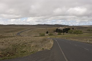
Rock Flat is a rural locality in the Snowy Monaro Regional Council local government area of New South Wales, Australia. It is located south of Cooma, on either side of the Monaro Highway.

Mount Boppy Gold Mine was a gold mine at Canbelego, New South Wales, Australia. The original Mount Boppy Gold Mine operated from 1901 to 1922. It was, at the time, regarded as being the largest gold producer in New South Wales.
James Samuels (1835-1927), also known as the Grand Old Man, was an early immigrant to the then village of Dubbo, New South Wales. Born in Bristol, United Kingdom, in 1835 he moved to Melbourne in 1850 before making his way to Dubbo in 1856. He enjoyed much success west of the divide and lead a public life; including his key role in the proclamation of the town of Dubbo in 1872 and as Dubbo's first mayor. Samuels' efforts both publicly and privately were foundational to many Dubbo institutions. His long philanthropic life had an enduring influence in the development of the central west. Although his name no longer adorns a wing at the Dubbo Hospital. potential for future memorialisation includes a proposed third bridge across the Macquarie River, adjacent to his historic homestead of Macquarie View on River St.
Australian Kerosene Oil Company or 'A.K.O' mined and processed oil shale to produce kerosene, paraffin wax and candles, lubricating oil and greases, and other petroleum-based products, in New South Wales Australia. It is particularly associated with the site of its mine and works, at Joadja. At times, it also had other mining operations, at Airly and near Katoomba, and a soap and candle factory at Camellia. The company used the brand name 'Southern Cross' for its kerosene products.

Wrightville was a mining village in the Orana region of New South Wales, Australia. Once it was a significant settlement, with its own municipal government, public school, convent school, post office, police station, four hotels, and railway connection. At its peak, around 1907, its population probably reached 2,000 people. Its site and that of the adjacent former village of Dapville are now an uninhabited part of Cobar.
