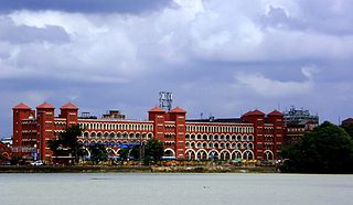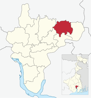
Howrah is an important city of Kolkata Metropolis in the Indian state of West Bengal. Howrah is located on the western bank of the Hooghly River, opposite its twin city of Kolkata. Administratively Howrah city lies within Howrah district and is the headquarters of the Howrah Sadar subdivision. Howrah city also falls under Kolkata Metropolitan Development Authority. Howrah station is an famous transportation hub and also a gateway to Kolkata’s oldest CBD viia Kolkata Metro Rail’s Green line and Howrah Bridge. Howrah Rail Junction is the largest railway station of India and it is extensively connected to every part of India.

Shibpur or Sibpur is a neighbourhood in Howrah city of Howrah district in the Indian state of West Bengal. It is a part of the area covered by Kolkata Metropolitan Development Authority (KMDA).

Uttarpara or Uttarpara Kotrung is a city and a municipality of Hooghly district in the Indian state of West Bengal. It is a part of the area covered by Kolkata Metropolitan Development Authority (KMDA). Uttarpara is located at 22.67°N 88.35°E, within 10 km from Kolkata, the capital of the state of West Bengal. It is located along the Hooghly river, across from the Dakshineswar Kali Temple. Uttarpara is home to the Uttarpara Jayakrishna Public Library, Asia's oldest free public library.

Neamatpur is a neighbourhood in Asansol of Paschim Bardhaman district in the Indian state of West Bengal. It is governed by Asansol Municipal Corporation.
Chittaranjan is a census town in the Salanpur CD block in the Asansol Sadar subdivision of Paschim Bardhaman district in the state of West Bengal, India. It is popularly known for the Chittaranjan Locomotive Works.

Andul is a census town in Sankrail CD Block of Howrah Sadar subdivision in Howrah district in the Indian state of West Bengal. It is a part of Kolkata Urban Agglomeration.

Konnagar is a town and municipality of Hooghly district in West Bengal, India. A railway station connects Konnagar with the city of Howrah. The town is under the jurisdiction of the Uttarpara police station in Serampore subdivision and the Kolkata Metropolitan Development Authority (KMDA).
Ghoshpara is a neighbourhood of Bally Jagachha CD block, in Howrah district in the state of West Bengal.

Howrah Sadar subdivision is a subdivision of the Howrah district in the state of West Bengal, India. It consists of Howrah municipal corporation and five community development blocs: Bally Jagacha, Domjur, Panchla, Sankrail and Jagatballavpur. The five blocks contain 67 gram panchayats and 44 census towns. The subdivision has its headquarters at Howrah.
Bally, sometimes spelled Bāli, is a census town in Bally Jagachha CD Block of Howrah Sadar subdivision in Howrah district in the Indian state of West Bengal. It is a part of Kolkata Urban Agglomeration.

Bally Jagachha is a community development block that forms an administrative division in Howrah Sadar subdivision of Howrah district in the Indian state of West Bengal.

Domjur is a community development block that forms an administrative division in Howrah Sadar subdivision of Howrah district in the Indian state of West Bengal.

Sankrail is a community development block that forms an administrative division in Howrah Sadar subdivision of Howrah district in the Indian state of West Bengal.

Uluberia II is a community development block that forms an administrative division in Uluberia subdivision of Howrah district in the Indian state of West Bengal.

Howrah City Police established in 2011, is a city police force with primary responsibilities in law enforcement and investigation in Howrah city and some of its adjacent areas in Howrah district. The Commissionerate is part of the West Bengal Police and is under the administrative control of Home Ministry of West Bengal. It was formed after the bifurcation of the Howrah Police District and has eighteen police stations under its jurisdiction as of now. Presently, P. K. Tripathi, IPS is appointed as the Commissioner of the Howrah Police Commissionerate.

Kulgachia is a village of Howrah district in the state West Bengal, India. The rail station located at the center of the town is only 40 km from howrah station and NH6 is only about 500 meter from the station area. Over the last five years it has been changed, developed and grown drastically to a town from village life though it is under panchayet raj administrative system yet. Populations are dramatically increased here nowadays due to the good communication with Kolkata, Kharagpur and other economically important parts of the state West Bengal.

Howrah Municipal Corporation is the local government of the city of Howrah, West Bengal, India. It is the second largest municipal corporation and urban area in the state. This civic administrative body administers an area of 63.55 square kilometres (24.54 sq mi) now.

Nimta is a Census Town in North Dumdum Municipality of Barrackpore II CD block in the Barrackpore subdivision of North 24 Parganas district in the Indian state of West Bengal. It is a part of the area covered by Kolkata Metropolitan Development Authority (KMDA).


