The Arctic Archipelago, also known as the Canadian Arctic Archipelago, is an archipelago lying to the north of the Canadian continental mainland, excluding Greenland.
Balnamore is a small village in County Antrim, Northern Ireland. It is within the townland of Ballynacree-Skein and lies 3 km west of Ballymoney. It is part Causeway Coast and Glens District Council. Historically it was known as Ballinamore.

Boudh District is an administrative and a municipal district, one of the thirty in the Odisha, India. The district headquarters of the Boudh District is the city of Boudh.

Boudh is a town and a Notified Area Council in Boudh district in the state of Odisha, India. It is the district headquarters of Boudh district. It is located on the bank of Mahanadi, the largest river of the state of Odisha.

This is a list of the extreme points of Azerbaijan, the points that are farther north, south, east or west than any other location.

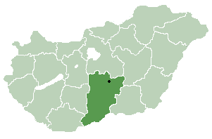
Szakmár is a village in Bács-Kiskun county, in the Southern Great Plain region of southern Hungary.
German submarine U-88 was a Type VIIC U-boat of Nazi Germany's Kriegsmarine during World War II.

Inzá is a town and municipality in the Cauca Department, Colombia.
Al-Mahmudiya (المحمودية) is a district in Baghdad Governorate, Iraq. Its seat is Mahmoudiyah.

Levakend is a village in the Dashkasan Rayon of Azerbaijan. Levakend is approximately 3.2 km away from the capital of Dashkasan Rayon, Yukhary-Dashkesan in a straight line. It is also approximately 325 km west of Azerbaijan's capital, Baku in a straight line.

Pielnia is a village in the administrative district of Gmina Zarszyn, within Sanok County, Subcarpathian Voivodeship, in south-eastern Poland. It lies approximately 6 kilometres (4 mi) south-east of Zarszyn, 11 km (7 mi) west of Sanok, and 54 km (34 mi) south of the regional capital Rzeszów.

Djebel Oust is a town and commune in the Zaghouan Governorate, Tunisia. As of 2004 it had a population of 3,830.
Bendalgatti is a village in Dharwad district of Karnataka, India.
The Harihara Deula or Twin Temples are dedicated to Lord Shiva and Lord Vishnu. They are situated near the bank of Mahanadi river, at Gandharadi village in Boudh district of Odisha, India.
Bhuvaneshwar Temple is located in Malipara in the Boudh township of Odisha, India, on the left side of road leading from Boudh to Sonepur, it is situated on the right bank of Mahanadi. It can be assigned to 10th Century, during Somavamsi rule. Decorated with architectural motifs like – khakharamundis, divine figures like Ganesha and Jaina Tirthankaras, semi-divine figures, nayikas, image of Linga puja, human figures both male and female, bharabahaka, decorative motifs like scroll work, beaded border, lattice pattern, padmaprosta motifs, mohanty design, vajramundi, animals, mithuna and maithuna. Nataraja and Brahma idols are also found. It can be categorized as Rekha deula of South Kosalan style. Shivaratri, Shitalasasthi and all Purnimas are important days here.
Padesur is a village in Dharwad district of Karnataka, India.
Tumarikoppa is a village in Dharwad district of Karnataka, India.
Mavinakoppa is a village in Dharwad district of Karnataka, India.

Qura al-Assad is a Syrian village in the Qudsaya District of the Rif Dimashq Governorate. According to the Syria Central Bureau of Statistics (CBS), Qura al-Assad had a population of 1,067 in the 2004 census.


