Kurnool is a city in the state of Andhra Pradesh, India. It formerly served as the capital of Andhra State (1953–1956). The city is often referred to as "The Gateway of Rayalaseema". Kurnool is also famous for Diamond hunting as diamonds can be found in the barren land of Kurnool after the top layers of soil are washed away by the monsoon rains. It also serves as the district headquarters of its Kurnool district. As of 2011 census, it is the fifth most populous city in the state with a population of 484,327. It is located on the banks of the Tungabhadra river. Although the area has been inhabited for thousands of years, modern Kurnool was founded in the 16th century CE with the construction of the Konda Reddy Fort.
Nawab Faiz Ali Khan Bahadur, was a ruler of the princely state of Banganapalle, including the Chenchelimala territory.

Kadapa district is one of the twenty six districts in the Indian state of Andhra Pradesh. In the 2022 reorganisation of Andhra Pradesh districts, the district boundary was largely restricted to the Kadapa parliamentary constituency area. It is one of the eight districts in the Rayalaseema region. Kadapa is the administrative headquarters for this district.
Kurnool district is one of the eight districts in the Rayalaseema region of the Indian state of Andhra Pradesh after the districts are reorganised in April 2022. It is located in the north western part of the state and is bounded by Nandyal district in the east, Anantapur district in the south, Raichur district of Karnataka in the northwest, Bellary district of Karnataka in the west, and Jogulamba Gadwal district of Telangana in the north. It has a population of 2,271,686 based on the 2011 census. The city of Kurnool is the headquarters of the district. Konda Reddy Fort, Mantralayam and Orvakal Rock Garden, Kurnool are tourist places of interest in the district.
Nandyal, commonly called as Nandyala, is a city and the district headquarters of Nandyal district of the Indian state of the Andhra Pradesh. It is a Municipal corporation and the headquarters of Nandyal mandal in Nandyal revenue division.

Markapuram is a town in Prakasam district of the Indian state of Andhra Pradesh. It is a municipality and is the headquarters of Markapuram Municipality in Markapuram revenue division. Markapuram is notable for the Chennakesava Swamy Temple, built by King Sri Krishnadevaraya. During Ratha Yatra there occurs a popular carnival; the town is also famous for Chenna Kesavaswamy on the day of Rathsapthami, which is attended by thousands of people coming from different parts of the state. It is the second-largest town in Prakasam district after Ongole and it is the main place within West Prakasam district to avail all facilities.
Narasaraopeta is a city and district headquarters of Palnadu District of the Indian state of Andhra Pradesh. The town is a municipality and mandal headquarters of Narasaraopet mandal and Headquarters of Narasaraopet revenue division. The town also is the seat of the court of Additional District Judge. Kotappakonda in Narasaraopeta was famous for Kotappakonda Tirunalla. The town is also referred as the 'Gateway of Palnadu'. The main offices of Nagarjuna Sagar Jawahar Canal Operation & Maintenance Lingamguntla Circle are located in this town. Also it is considered as holy place.
Rayachoti is a Municipality and District headquarters of Annamayya district which is formed after Rajampet of the Indian state of Andhra Pradesh. Rayachoti is the headquarters of Rayachoti revenue division and is one of the oldest towns in Andhra Pradesh.
Nandikotkur is a municipality and capital of Nandikotkur mandal in Nandyal district of Andhra Pradesh, India.

Dhone or Dronachalam is a town in Nandyal district of the Indian state of Andhra Pradesh. It is a municipality located in Dhone mandal, and it is the headquarters of Dhone revenue division.

Allagadda is a town in Nandyal district of the Indian state of Andhra Pradesh. It is located in Nandyal Revenue division. The town is located at 15°08′00″N78°31′00″E.

Koilakuntla is a town in Nandyal district of the Indian state of Andhra Pradesh. It is Head quarter of Koilakuntla mandal. It is in Dhone revenue division.
Aluru (ah-LOO-roo) is a town in Alur Mandal in the Kurnool district of Andhra Pradesh in India. Alur Assembly Segment is a part of Kurnool Parliamentary segment.
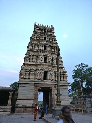
Yaganti Temple or Sri Yaganti Uma Maheswara Temple is a temple of Shiva in Nandyal district in the India state of Andhra Pradesh. It was built according to Vaishnavaite traditions.

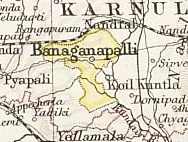
Banganapalle mangoes is a mango variety produced in Banganapalle of Nandyal District in the Indian state of Andhra Pradesh. It alone occupies 70% percent of total mango cultivable area of the state and was first introduced by the farmers of Banaganapalli. It was registered as one of the geographical indication from Andhra Pradesh on 3 May 2017, under horticultural products by Geographical Indication Registry. It is also grown in the other parts of India and Pakistan. The fruit is described as obliquely oval in shape, around 20cm in length, with yellow flesh and a thin, smooth yellow skin. The flesh is of a firm, meaty texture and is sweet and lacks fibre. The cultivar is the most sought after in Andhra Pradesh. It is a very late-season variety that is good for canning. This cultivar is a source of vitamin A & C and is also called king of Mangoes.

Banganapalle State was one of the princely states of India during the period of the British Raj. The state was founded in 1665 and had its capital in Banganapalle. Its rulers were Shia Muslims and the last one signed the accession to the Indian Union on 23 February 1948.

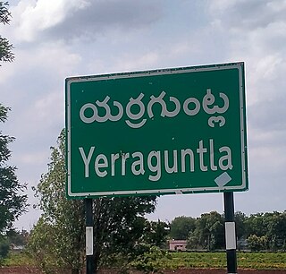
Nandyal–Yerraguntla section connects Nandyal of Nandyal district and Yerraguntla of Kadapa district in the Indian state of Andhra Pradesh. Further, this section converges with Nallapadu–Nandyal section at Nandyal. It is administered under Guntakal railway division of South Central Railway zone, except the Nandyal railway station which is under Guntur railway division. The total length of the section extends to a length of 123 km (76 mi). Banaganapalle,Koilakuntla,Jammalamadugu and Proddatur are the major towns through which the line passes.

Nandyal district is a district in the Indian state of Andhra Pradesh with Nandyal as its administrative headquarters, it was formed on 4 April 2022 to become one of the resultant 26 districts. It is part of the Rayalaseema region. The district consists of Nandyal revenue division and a newly formed Dhone revenue division and Atmakur revenue division from Kurnool district.
Yerragundla is a village midway between Kurnool and Kadapa on National Highway-40 in Sirivella mandal of Nandyal District of Andhra Pradesh, India.