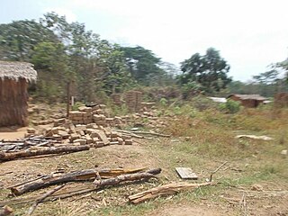
Djemah is a town and sub-prefecture in the Haut-Mbomou Prefecture of the south-eastern Central African Republic. It is the least-populous sub-prefecture in the country. The town is largely neglected by the central government since the country gained independence from France in 1960.
Bambouti is a sub-prefecture of Haut-Mbomou in the Central African Republic. The town is abandoned by the country.

Mboki is a town and sub-prefecture in the Haut-Mbomou prefecture of the south-eastern Central African Republic.

Sikkikede , also spelled Sikikédé and Sikikede, is a town in Vakaga Prefecture, Central African Republic. It is the largest settlement in Vakaga, with a population of around 20.000 people. CPJP established the headquarter in Sikkikede.
Dembia is a village located near the border of Mbomou and Haut-Mbomou Prefecture.
Tabane is a village located in Haut-Mbomou Prefecture, Central African Republic.
Kitessa is a village located in Haut-Mbomou Prefecture, Central African Republic. In 1995, the village had a population of about 300 people.
Maboussou, also spelled Mabousou, is a village located in Haut-Mbomou Prefecture, Central African Republic.
Ligoua is a village located in Haut-Mbomou, Central African Republic. The village has received several attacks from LRA from 2008 to 2020. Food is the reason for LRA to raid Ligoua.
Kadjéma, also spelled Kadjemah, is a village located in Haut-Mbomou Prefecture, Central African Republic.

Azande Ani Kpi Gbe, also known as Wagner Ti Azandé, is an ethnic militia of Azande people active in the Haut-Mbomou prefecture of the Central African Republic since March 2023.
Maloum is a village located in Ouaka Prefecture, Central African Republic.

Ngakobo is a town located in Ouaka Prefecture, Central African Republic.
Lioto, also spelled Liotto or Lihoto, is a village situated in Ouaka Prefecture, Central African Republic.
Mann, also spelled Man, is a village situated in Lim-Pendé Prefecture, Central African Republic.

Pavica, also spelled Pavika, is a village situated in Basse-Kotto Prefecture, Central African Republic.
Bouzou is a village situated in Ouham-Pendé Prefecture, Central African Republic.
Kpokpo is a village situated in Haute-Kotto Prefecture, Central African Republic.
Benamkor is a village situated in Lim-Pendé Prefecture, Central African Republic.

Kouki is a village situated in Ouham Prefecture, Central African Republic.


