Djemah

Last updated
Djemah
Sub-prefecture and town
Haut-Mbomou sub-prefectures.png
Sub-prefectures of Haut-Mbomou
Central African Republic location map.svg
Red pog.svg
Djemah
Location in the Central African Republic
Coordinates: 6°3′N25°19′E / 6.050°N 25.317°E / 6.050; 25.317
CountryFlag of the Central African Republic.svg  Central African Republic
Prefecture Haut-Mbomou
Government
  Sub-prefectDieudonné Zangbe-Nguilelo [1]
Time zone UTC+1 (WAT)

Djemah is a town and sub-prefecture in the Haut-Mbomou Prefecture of the south-eastern Central African Republic. It is the least-populous sub-prefecture in the country. The town is largely neglected by the central government since the country gained independence from France in 1960. [2]

Contents

Etymology

The town is named after local chief Djemah, who was accused of murder by French colonial officials and executed in Bangui in 1914. [3]

History

Djemah was founded as a French colonial post on March 1897. [4] [5]

On 5 October 2009, 60 LRA fighters led by Major Olanya attacked Djemah to obtain food and kidnap the locals. As they arrived at the town, they shot in the air to warn the town residents, thus leading them to flee the town and alert the Ugandan soldiers who had arrived in Djemah last night. The looting lasted for one hour and later, the Uganda forces arrived at the town. Realizing the presence of UPDF, LRA militias fled to the forest, and the Ugandan troops chased them. During the pursuit, a clash happened between two belligerents, resulting in the death of around 25 LRA members. The looting was unsuccessful, and in retaliation, three abductees were executed by LRA. [6]

Economy

Due to the remoteness of the location, the locals relied on hunting, gathering and fishing for their livelihood. [7]

Healthcare

Djemah has one health center. [8] However, many of the town residents are very dependent on traditional medicine since there is no doctor and qualified nurses. [2]

Related Research Articles

<span class="mw-page-title-main">Obo</span> Place in Haut-Mbomou, Central African Republic

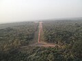
Obo is the capital of Haut-Mbomou, one of the 14 prefectures of the Central African Republic. It is close to the African Pole of Inaccessibility.

<span class="mw-page-title-main">Bouar</span> Place in Nana-Mambéré, Central African Republic

Bouar is a market town in the western Central African Republic, lying on the main road from Bangui (437 km) to the frontier with Cameroon (210 km). The city is the capital of Nana-Mambéré prefecture, has a population of 40,353, while the whole sous-préfecture has a population of 96,595. Bouar lies on a plateau almost 1000m above sea level and is known as the site of Camp Leclerc, a French military base.

<span class="mw-page-title-main">Alindao</span> Place in Basse-Kotto, Central African Republic

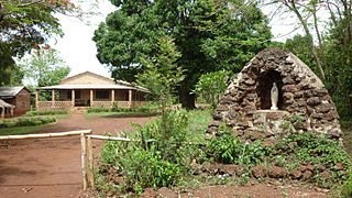
Alindao is a town and sub-prefecture located in the Central African Republic prefecture of Basse-Kotto. It lies at the junction of the National Route 2 and 22. Alindao had a population of 14,401 as of the 2003 census; and a calculated 2013 population of 15,213. The town is the seat of the Roman Catholic Diocese of Alindao. It has a small airport, Alindao Airport. A Catholic Mission was established at Alindao during French occupation under French Equatorial Africa.

Bimbo is located 25.5 kilometres (15.8 mi) by road southwest of the centre of the capital, Bangui. The country's second-largest city, Bimbo had a population of 124,176 as of the 2003 census and a calculated 2013 population of 267,859. Bimbo used to be the capital city of Ombella-M'Poko until December 2020. Since December 2020, Bimbo has been part of Bangui Prefecture.

<span class="mw-page-title-main">Boda, Lobaye</span> Place in Lobaye, Central African Republic

Boda is a town located in the Central African Republic prefecture of Lobaye.

Mongoumba is a town located in the Lobaye Prefecture, Central African Republic. From 1905-1933, Mongoumba was part of Moyen-Congo

Yalinga is a town and sub-prefecture in the Haute-Kotto prefecture of the central-eastern Central African Republic.

<span class="mw-page-title-main">Zemio</span> Sub-prefecture and town in Haut-Mbomou, Central African Republic

Zemio is a town and sub-prefecture in the Haut-Mbomou prefecture of the south-eastern Central African Republic. Zemio was the former capital of the Sultanate of Zemio before it was abolished in 1923 by France.

<span class="mw-page-title-main">Markounda</span> Sub-prefecture and town in Ouham, Central African Republic

Markounda, formerly Fort-Brusseaux, is a sub-prefecture and town in the Ouham Prefecture of the north-western Central African Republic. The sub-prefecture borders with Chad.

<span class="mw-page-title-main">Abakar Sabone</span>

Abakar Sabone was the leader of the Movement of Central African Liberators for Justice rebel group during the Central African Republic Bush War.

Sam Ouandja is a town located in the Central African Republic prefecture of Haute-Kotto near the border with Sudan. It has historically served as important arms trafficking hub for armed groups in Central African Republic. Artisanal diamond mining is also active in the commune.

<span class="mw-page-title-main">Mboki</span> Sub-prefecture in Haut-Mbomou, Central African Republic

Mboki is a town and sub-prefecture in the Haut-Mbomou prefecture of the south-eastern Central African Republic.

<span class="mw-page-title-main">Tiringoulou</span> Place in Vakaga, Central African Republic

Tiringoulou, also spelled Tirigoulou or Tiroungoulou, is a village in the Vakaga Prefecture in the northern Central African Republic.

Sikkikede , also spelled Sikikédé and Sikikede, is a town in Vakaga Prefecture, Central African Republic. It is the largest settlement in Vakaga, with a population of around 20.000 people. CPJP established the headquarter in Sikkikede.

Agoumar is a village located in Mbomou. It is situated near Rafai town in Central African Republic.

Kadjéma, also spelled Kadjemah, is a village located in Haut-Mbomou Prefecture, Central African Republic.

Fodé is a village located in Mbomou Prefecture, Central African Republic.

Koundé is a village located near Cameroon-Central African Republic border in Nana-Mambéré Prefecture.

Gouzé is a village situated in Lim-Pendé, Central African Republic. Until 2020, the village was part of Ouham-Pendé.

<span class="mw-page-title-main">Fidèle Gouandjika</span>

Fidèle Gouandjika, nicknamed The billionaire of Boy-Rabe, is a wealthy Central African businessman and politician. He held two different ministerial positions under the Bozize government. Gouandjika was the first person who introduced Qwan Ki Do in Romania by establishing the Qwan Ki Do club in Iași in 1980.

References

  1. Aymard Gilles Quentin, Mocki. "Dieudonné Zangbe-Nguilelo, sous-préfet de Djema est l'invité de la rédaction de Guira Fm". soundcloud.com. Radio Guira. Retrieved 12 February 2023.
  2. 1 2 Yongo, Judicael. "Centrafrique : La ville de Djéma à l'Extrême-est du pays manque d'infrastructures sanitaires". rjdhrca.org. RJDH-Centrafrique. Retrieved 19 July 2023.
  3. Bradshaw, Richard; Fandos-Rius, Juan (2016). Historical Dictionary of the Central African Republic (New ed.). Lanham, Maryland: Rowman & Littlefield. p. 224. ISBN   9780810879911.
  4. Rius, Juan Fandos; Bradshaw, Richard (2016). Historical Dictionary of the Central African Republic. Maryland: Rowman & Littlefield. p. 645. ISBN   9780810879928.
  5. Serre, Jacques; Fandos-Rius, Juan (2014). Répertoire de l'administration territoriale de la République centrafricaine. Paris: L’Harmattan. p. 223. ISBN   978-2-343-01298-8.
  6. Cakaj, Ledio (2016). When The Walking Defeats You: One Man's Journey as Joseph Kony's Bodyguard. London: Zed Books. p. 347. ISBN   9781783608126.
  7. Ndeke Luka, Ndeke Luka. "Centrafrique : la localité de Djema abandonnée par l'Etat ?". radiondekeluka.org. Radio Ndeke Luka. Retrieved 19 July 2023.
  8. World Health Organization (March 2017). Enquête rapide sur l'estimation des besoins de santé des populations affectées par la crise en République Centrafricaine en 2016 (PDF) (Report). p. TT. Retrieved 19 July 2023.