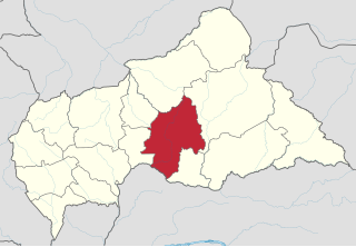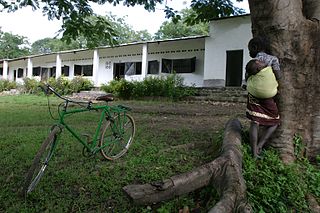
Ouaka is one of the 16 prefectures of the Central African Republic. It borders the Democratic Republic of the Congo, covers an area of 49,900 km2, and has a population of 224,076, giving a population density of under 5 inhabitants/km2. The capital is Bambari.

Bria is the capital of Haute-Kotto, one of the 14 prefectures of the Central African Republic. As of the 2003 census the town had a population of 35,204.
Bambari is a town in the Central African Republic, lying on the Ouaka River. It has a population of 41,356 and is the capital of Ouaka prefecture. Bambari is an important market town and is home to Bambari Airport, and the Roman Catholic Diocese of Bambari.
N'Délé or Ndele is a market town and sub prefecture in the north eastern Central African Republic, lying east of the Bamingui-Bangoran National Park. Ndélé is the capital of Bamingui-Bangoran, one of the 16 prefectures of the Central African Republic. N'Délé had a population of 10,850 as of the 2003 census; and a calculated 2013 population of 13,704.
Batangafo is a town located in the Central African Republic prefecture of Ouham-Fafa at the confluence of Ouham River and its affluent Fafa.
Baoro is a town located in the Central African Republic prefecture of Nana-Mambéré.

Rafaï is a town and sub-prefecture on the Chinko River, in the Central African Republic prefecture of Mbomou. Its estimated population is about 14,000 people.
Ouadda is a town located in the Central African Republic prefecture of Haute-Kotto.
Ippy is a town located in the Central African Republic prefecture of Ouaka, and is located near the geographic center of the country. It is 364 kilometers from the city of Bangui directly. Driving distance, however, is 496 kilometers.

Paoua is a town located in the Central African Republic prefecture of Lim-Pendé.
Grimari is a city located in the Ouaka prefecture in Central African Republic, approximately 222.7 kilometres (138.4 mi) away from the capital, Bangui. The politician Abel Goumba was born in Grimari.

The Central African Republic Civil War is an ongoing civil war in the Central African Republic (CAR) involving the government, rebels from the Séléka coalition, and Anti-balaka militias.

Séléka CPSK-CPJP-UFDR was an alliance of rebel militia groups that subjugated the Central African Republic (CAR) on 24 March 2013. After its official dissolution in September 2013, the remaining rebel groups became known as Ex-Séléka. Séléka leader Michel Djotodia became the nation's president from March 2013 until his resignation in January 2014. Members of Séléka were almost all Muslim.
Ndjoukou is a sub-prefecture of Kémo in the Central African Republic.
The following is a timeline of events during the Central African Republic Civil War.

Union for Peace in the Central African Republic is a rebel group in the Central African Republic which controls southern parts of the country.
Bokolobo is a village located in the Central African Republic prefecture of Ouaka.
Between 6 and 16 December 2021, a number of Muslim civilians were killed and injured by Anti-balaka fighters supported by government forces and Russian mercenaries in the Boyo commune, located in the Ouaka prefecture of the Central African Republic (CAR). These civilians were attacked for their alleged links with Union for Peace in the Central African Republic (UPC) rebels. The attacks are part of the larger CAR Civil War which has been ongoing since 2012.
Dimitri Placide Ayoloma – is an Anti-balaka commander from the Central African Republic, active in Ouaka and Kémo prefectures. He is responsible for multiple crimes including killing of peacekeeper, looting, arson, assault and kidnapping for ransom.


